Categories
Building Sustainable, Inclusive and Just Cities (Hons module)

Taking Control of the Energy Crisis – A community-owned solar panel system in Beirut, Lebanon as a way forward    

Introduction  

Beirut is home to diverse communities and has a rich and lively culture. The many summers I spent in Beirut as a child, gave me insights into the love the people have for the city, but also the daily struggles of Beirutis since the start of the 15-year civil war in 1975. More recently, Lebanon has been dealing with five crises simultaneously, which are heavily centred around governmental mismanagement (Moore, 2023). Three are Lebanon-specific crises: the influx of Syrian refugees into the country, the meltdown of the banking and economic system; and the aftermath of the August 2020 Beirut port explosion. Two are global crises from which Lebanon is not spared: the aftermath of the COVID pandemic and the continual effects of climate change. On the World Bank (2021) list of countries experiencing the most severe crises since the mid-1900s, Lebanon is in the top three. The lack of effective governance and severe economic crisis have resulted in an almost complete loss of government-supplied electricity in Beirut, forcing a whole alternative industry of privately owned generators and more recently solar panels. These crises combined, specifically, the lack of effective governance and severe economic crisis have resulted in an almost complete loss of electricity in the city. The extent to which communities in Beirut have been affected by the aforementioned crises cannot be encompassed in a single paper, however, my goal in this briefing is to provide a community-led alternative solution which moves away from the involvement of the government, a root cause of the current electricity crisis in Lebanon.   

The Community 

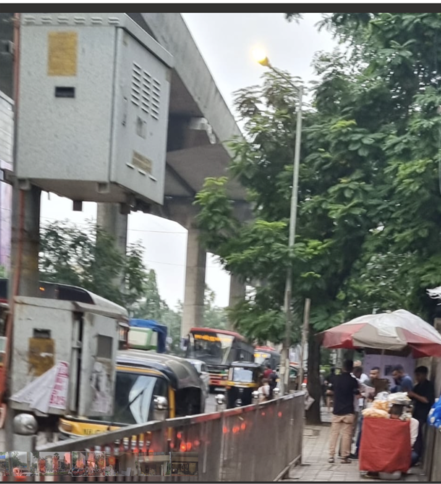
The Sabra neighbourhood, defined by the UN-Habitat (2019) as a ‘disadvantaged neighbourhood in Beirut’ is a diverse bubble of about 6,215 inhabitants. It is made up of about 50% Lebanese citizens and it also hosts Syrian and Palestinian refugees. Sabra acts as an extension of the Shatila refugee camp found in the neighbouring community (UN Habitat, 2019). The struggles faced by this community are deeply rooted in its horrifying historical context. In 1982, during the Lebanese civil war, the Shatila refugee camp and the neighbouring community of Sabra were attacked by a Christian militia group (the Phalange), who were aided by the Israeli army which was occupying Lebanon at the time (Al Jazeera, 2022). The Israeli army surrounded the district to allow the Phalange militia to enter and attack civilians for over 2 days. Around 3,500 lives were taken, and this massacre was deemed an “act of genocide” by the UN General Assembly; however, neither party was ever held accountable for the tragedy (Al Jazeera, 2022). To this day, the people of Sabra are still dealing with the effects of this massacre. Currently, most of the Sabra residents are in the low-income bracket and do not have access to adequate living conditions, most importantly a reliable source of energy.  

The Challenge

Environmental justice is heavily discussed in the literature tackling ‘sustainable cities’. According to Pearsall and Pierce (2010), environmental justice is a theoretical concept that focuses on (1) how environmental burdens are divided among groups of people, and (2) the rights of the citizens to take part in the environmental decision-making process. (1) is defined as distributional justice and (2) as procedural justice. Since Sabra’s residents face energy poverty, they are not insulated from the effects of climate change like those with readily accessible electricity. This is a typical example of distributional injustice. Dagher et al., 2023 show that there is a correlation between lower energy poverty and households with higher levels of education. Thus, this community, which is comprised primarily of low-income residents and refugees, have disproportionality less access to energy. Furthermore, only 10% of the residents have fully functional government-supplied electricity grids (UN-Habitat, 2019). After the 2020 port explosion, the technical problems with the electrical grid increased because its infrastructure was heavily damaged throughout the city (Tarnini et al., 2023). So, with an average household receiving only two hours of electricity a day, private diesel generator (DG) systems have become the new electricity market in Lebanon (Simet et al., 2023). The energy market transition was guided by higher-income households with access to DG systems. This demonstrates procedural injustice as the Sabra community did not have control over this DG energy transition (Simet et al., 2023).  

This energy crisis affecting all of Lebanon has roots in Moore’s (2023) ‘five crises’ discussed above. One of the most significant contributors to the energy crisis is the economic let-down that began in 2019, when the Lebanese Lira was hit by record inflation of 8,580%, a jump from 1 USD = LBP 1,515 to 130,000 in 2023 (Tarini et al., 2023). In addition, Lebanon has a low Human Capital Index because citizens have comparatively poor basic public services. This is further compounded by the increasingly apparent climate change crisis, especially in Beirut as it is a coastal low-lying city (Moore, 2023). The term ‘crisis’ acknowledges the different challenges faced by this community; however, Sirri (2021) indicates that this term crisis is typically associated with a short-term or recent problem. The corruption and mismanagement of the post-war Lebanese government is directly correlated with the collapse of public industries like the energy sector (Simet et al., 2023). Hence, the energy problem is complex and is a result of a long history of political turmoil that has led to deeply rooted social, environmental, and economic, inequalities. Therefore, any solution to the energy crisis in the Sabra neighbourhood must rely on multi-stakeholder involvement that does not involve the Lebanese government. This favours solutions like the long-term community-led energy strategy suggested below.  

Community Response So Far 

Most communities in Beirut have relied on DGs, which was a practical solution in the past when the government subsidised diesel. However, this led to smuggling and illegal activities, which then led to diesel shortage, and consequently, the elimination of diesel subsidies (Dagher et al., 2023). DGs heavily contribute to climate change, but more importantly, they have become increasingly expensive because of the subsidy removal. For households, the market value of DG systems is at 2 billion USD (Adbdelnour et al., 2023). For low-income households, this option puts an unsustainable financial burden on families attempting to gain access to basic public services. On a more positive note, Zahle, the third largest city in Lebanon, has implemented a hydropower solution, which resulted in a decrease in energy poverty and less reliance on DGs (Dagher et al., 2023). Considering that so many of the country’s problems are rooted in the instability and corruption of the government, it is not always possible for communities like Sabra to depend on the municipality for real change, as seen in Zahle. Thus, several higher-income households have opted to install their own photovoltaic (PV) systems. How can we make this more accessible to low-income communities like Sabra?  

Suggestion Moving Forward

Overview 

Lebanon receives about 300 days of sun per year and experiences 7 months of a dry season (Moore, 2023). As renewable energies become increasingly affordable, there has been a steep increase in solar panel usage (81%) in Lebanon from 2010-2020 (Adbdelnour et al., 2023). Diesel energy is about 45 cents per kWh versus solar energy at 9-10 cents per kWh. Hence, the PV systems are becoming more appealing to Lebanese communities. Other renewable energies like hydropower and wind energy could be successful but would likely require involvement from the municipalities and government. In the past, the idea of solar farms in Lebanon has generated excitement but has ultimately been unsuccessful (Moore, 2023). Solar panels are an ideal renewable energy source for Sabra because 85% of its buildings are mixed-use and/or residential making them suitable for PV system placement and community sharing (UN-Habitat, 2019). Thus, this community briefing suggests the implementation of a community-owned and shared de-centralised solar (PV) system.  

Most consumers in Lebanon with the financial means buy private PV grids that are used to supplement the few hours of government-provided energy per day. However, Adbdelnour et al. (2023) explain that these two systems are used in conjunction because the few solar panels purchased by each household do not supply enough reliable energy for the household’s daily requirements. Even if they can afford it, there are space limitations on the roofs of a congested city like Beirut to provide each apartment with its full need of PV panels. To resolve this limitation and as suggested by several other scholars in the literature, Adbdelnour et al. (2023) propose a Peer-to-Peer (P2P) energy trading system. Essentially, it is a bottom-up (community-led) energy exchange platform that makes the energy consumer a ‘prosumer’ and allows them to sell and buy energy based on their household needs (Trivedi et al., 2022). Therefore, excess energy will not be wasted and instead, it will beshared around the community. In this suggestion, Adbdelnour et al. (2023) propose that the initial significant investment to purchase solar panels will come from community members. Unfortunately, in the case of the Sabra, this is not an achievable option, requiring alternative funding solutions.  

A PV system for the size of the Sabra community can be defined as a micro-grid system due to its small size. The development of microgrids is becoming increasingly popular in Lebanon and all over the world as it localises and decentralises renewable energy sources. Two somewhat well-known microgrid set-ups in Lebanon have inspired the Sabra initiative, the Baaloul project and the Menjez project. Baaloul, a town in the Bekaa Valley of Lebanon received funding from USAID, and support from CARITAS (a catholic-relief organisation) to develop community-owned PV micro-grids (Social Impact Inc., 2020). This initiative was extremely successful and reduced household and municipal energy bills by 25% (National News Agency, 2018). However, Chaplain (2022) notes that although this was community-led in partnership with third-party organizations, the Syrian refugee population was not included in decision-making and consequently did not gain much from the initiative. This once again depicts procedural injustice as the refugee community now only receive energy when it is in excess, which is rare. The Menjez project, on the other hand, was not as successful. This project also received funding from USAID and is supported by the René Moawad Foundation (RMF). The RMF is a political relief organisation that unfortunately used this initiative to expand its political clout in the region. This initiative is owned by the local municipality, meaning that they take tariffs on the energy and the community does not receive any profits. To avoid such complications based on previous experiences in Lebanon, the suggested Sabra initiative will not involve the government or local municipalities and aims to find alternative approaches without involving any political actors.  

A Decentralised On-Grid System  

Based on the above discussion, a decentralised community-based microgrid (C-MG) solution is a viable solution to support the energy needs of the Sabra community. Trivedi et al. (2023) lays out various C-MG strategies based on the existing literature including centralised, distributed, and decentralised approaches. A decentralised structure is best suited for Sabra because it has comparatively higher levels of community engagement, a high possibility for scalability in the future, and is relatively less complex. Let us break this down further. The American University of Beirut (AUB) and SOAS University of London held a workshop in 2021, that analysed “models for tackling Lebanon’s electricity crisis”. They explained that the increased use of renewable energy in Lebanon has occurred out of necessity and has been particularly successful when the private or community sector is involved (either from an investment or managerial standpoint) (ACE, 2021). This urges the need for a decentralised approach. ACE (2021) agree with Trivedi et al. (2023) in that this system would make a consistent energy supply more accessible to different community members and would reduce the energy monopoly based on DGs. Gaining access to reliable energy sources for Sabra will positively impact daily life for its residents. Giving access to these basic human rights allows for stronger development of the community and an ‘urban citizen’ identity, thus giving ownership of the city to the people (Moore, pg. 170, 2023) (UCL, 2020).  

ACE (2021) do pose the challenge of the large initial investment for the PV systems. As discussed in more depth below, taking a loan could be a possible approach to alleviate the financial burden. However, this approach implies that the initial instalment of the solar panels in Sabra is used in combination with the existing DGs. The Beirut Arab University’s (BAU) transition to renewable energy inspired this mixed approach for the initial phase of the Sabra C-MG system (Tarnini et al., 2023). Before implementing any changes on the campus, BAU scholars used HOMER, a platform that runs simulations of various energy systems. They simulated off-grid solar, on-grid solar, and DG systems. Tarnini et al. (2023) found that the DG system was impractical from a financial standpoint in the long run and was environmentally unsafe. The off-grid system was the most sustainable and environmentally friendly; however, the high investment costs, lack of available land, and “system reliability” issues made it unsuitable for this institution. The on-grid PV system in combination with DG, when necessary (in winter months), had the best return on investment and allowed for the DG’s to be used less, also lowering their maintenance and operational costs. The on-grid PV system was successfully implemented at the BAU university campus. The strategy and implementation will be different in Sabra as this is a bottom-up approach compared to the institutionally driven project at BAU. However, this initiative provides concrete evidence that a C-MG strategy is a practical approach to reducing energy poverty at a localised level in Lebanon.  

Implementation 

Stakeholders 

This initiative would be a multi-stakeholder approach involving local and international actors. In both the Menjez and Baaloul projects, sustainable change was implemented with the involvement of various parties. The Sabra neighbourhood has worked with the UN before to improve the living conditions on El Jazzar Street in Sabra (United Nations, 2021). The organisers put community engagement at the forefront of the project, allowing women and men from various nationalities and ages to decide on infrastructural changes that would lead to a better quality of life. Although a small initiative, it gives an insight into the possibilities of collaborating with the Sabra community in achieving a sustainable and reliable energy system.  

Alongside an international organisation like the UN, it could be beneficial to include a solar NGO with a high level of expertise in setting up on-grid PV systems. Some possible NGOs that were investigated include but are not limited to SolarAid, Solar Village Project, and SELF (Solar Electric Light Fund). This is important to ensure that the goals of the Sabra community stay at the forefront of the stakeholders’ motivations, prioritizing environmental justice as a core value. These NGOs have not done work in the Levantine region in the past, but they could be incentivized to do so in the future. The choice of the specific NGO(s) will depend on the funding source as well.  

As BAU did with its academic scholars, it would be valuable to partner with a research group that can aid in running the technical aspects of this initiative (Tarnini et al., 2023). At BAU, the academics used the HOMER system to fully simulate the financial and environmental effects of different energy systems. This briefing advocates for a similar approach in Sabra. The Sabra community could partner with the Beirut Urban Lab, an urban studies research group, who would be well-suited for this project, considering they have previous experience in urban recovery projects and simulation mapping (Beirut Urban Lab, 2023)  

Funding 

Between the five crises Lebanon faces, it has one of the largest public debts in the world. From 1992-2017, $36 billion of this debt has come from the electricity sector (UCL, 2020). Poorer neighbourhoods like Sabra face significant energy poverty especially after the government ended its diesel subsidies (UCL, 2020). Thus, the initial hesitation to implement renewables has declined, and solar panels are becoming a necessity to achieve reliable energy. PV systems have a high initial capital, but they have a better return on investment in the long term compared to fossil fuels (Tarnini et al., 2023).  

Funding for PV panels in Sabra could come from various sources. The first source could be a grant from USAID like that of the Baaloul and Menjez projects. Another opportunity could be crowdfunding in combination with a loan that would be paid back over time from the trading (buying and selling) of energy. Lastly, several of the NGOs discussed above provide PV systems for disadvantaged areas at a significantly lower cost. Thus, a partnership with an NGO could be extremely appealing to this community. Regardless of how the funding source is secured, the community must have full ownership of the microgrid.  

Layout of the System 

The recommended structural design is a five ‘layer’ system, as outlined by Trivedi et al.’s (2022) thorough literature review of community-based microgrids. The five layers are: (1) physical, (2) information communication and transmission, (3) market and business, (4) regulation, and (5) control layer. The overarching goal of the structural design is to educate and collaborate with the community at each step. Discussions at the UCL (2020) energy workshop stressed the need for community awareness and engagement campaigns as a necessary factor, regardless of whether the municipalities were involved. For instance, the community in the Akkar region of Lebanon heavily resisted the construction of a wind farm because they assumed the turbines were unsafe and that they could fall off the motors and injure people (UCL, 2020). Once this issue was addressed, the community was eager to see the installations. Therefore, the social factor needs to be addressed for procedural and distributional environmental justice to be established in Sabra. Below is a brief description of each layer. 

Physical Layer 

The physical layer covers the actual equipment needed for the microgrids. Ideally, the PV systems will be purchased through grants and subsidies so that the low-income community of Sabra does not assume the financial burden while retaining community ownership.  

Market and business layer 

The market and business layer is separate from the implementation actors (such as NGOs, Beirut Urban Lab, and UN). Instead, the focus here is the Peer-to-Peer (P2P) energy trading system discussed above (Adbdelnour et al., 2023). This strategy is associated with a decentralised structure because the consumer can become the producer (making them a ‘prosumer’). Essentially, each building or household will have a smart meter and app system. This will then allow the prosumer to give/sell their excess energy to other households, ensuring that not only is energy not wasted, but also that households have a more reliable source of energy (Adbdelnour et al., 2023). Trivedi et al. (2022) support this suggestion and add that it leads to a micro-balanced market. 

Information, communication, and transmission layer 

Interoperability is key to understanding this layer. Interoperability is the ability of a computer or technical system to work in conjunction with other systems (Trivedi et al., 2022). The interoperability system plays an important role in ensuring that energy sharing between various households is possible. Thus, this briefing suggests the installation of a smart meter and app system that work together. The Brooklyn Micro Grid (BMG) (2019) is a clear example of a successful initiative. Essentially BMG is an energy marketplace managed by the prosumers at a local level (BMG, 2019). When energy is created in excess by a certain household, it is detected by a smart meter and can be sold to another household on the app through the smart meter (UCL, 2020, pg. 18).  

Regulation layer 

To ensure that such systems become a long-term solution and run smoothly, Trivedi et al. (2022) suggest that a policy document be put into place. This would include the rules and regulations for the system. Ideally, this is agreed upon by the community members who will benefit the most from this micro-grid solution. The Beirut Urban Lab would be the perfect collaborator on such a legal document because they have done similar work in the past (Al-Harithy & Yassine, 2023). 

Control layer  

The control layer ensures proper maintenance of the PV systems. Once again, this highlights the need for community and social awareness to run the system and deal with technical errors and long-term maintenance. The trading platform described above could also pay for the upkeep. Teaching the community these skills will also allow for independence in running the PV panels. However, if the initiative is operated by an NGO that provides the PV panels, it could also be involved in the control layer.  

Conclusion

The suggested solution aims to install a reliable, sustainable, community owned and managed energy solution for the Sabra community. This would provide hope and functionality to the Sabra community while simultaneously outlining several technical, organisational, and financial factors that need to be considered for implementation. It does not aim to suggest that this is a perfect solution for the Sabra community that has been faced with political corruption for years on end. It is however a plausible and implementable solution based on knowledge of the Lebanese situation and a review of the current literature and available opportunities building on successful examples in Lebanon. A possible limitation would be to ensure that the various stakeholders involved are able to collaborate smoothly as this would be integral to the success of this energy transition. The success of the proposed micro-grid solution will lead to environmental justice as argued by Boone and Fragkias (2013). Importantly though the success of the proposed community-owned micro-grid solution may have significant implications on energy equity in Lebanon: its success could have a domino effect with other communities wanting to emulate it.  

References 

ACE (2021) ‘Watch webinar: Models for tackling Lebanon’s electricity crisis’, ace, 4 February. Available at: https://ace.soas.ac.uk/webinar-models-for-tackling-lebanons-electricity-crisis/ (Accessed: 10 October 2023). 

Adbdelnour, V. et al. (2023) ‘Energy Management Model Suitable for the Lebanese Case’, in. 2023 6th International Conference on Renewable Energy for Developing Countries, REDEC 2023, pp. 157–162. Available at: https://doi.org/10.1109/REDEC58286.2023.10208196

Al Jazeera (2022) Sabra and Shatila massacre: What happened in Lebanon in 1982? Available at: https://www.aljazeera.com/news/2022/9/16/sabra-and-shatila-massacre-40-years-on-explainer (Accessed: 10 October 2023). 

Al-Harithy, H. and Yassine, B. (2023) Beirut Urban Lab – The Co-Production of a Shared Community Space in Al-Khodor, Karantina, Beirut Urban Lab. Available at: http://beiruturbanlab.com/en/Details/1945 (Accessed: 9 October 2023). 

Beirut Urban Lab (2023) Beirut Urban Lab – Three Years of Post-Blast Observations@BeirutUrbanLab. Available at: http://beiruturbanlab.com/en/Details/1926 (Accessed: 13 October 2023). 

BMG (2019) Brooklyn Microgrid | Community Powered EnergyBrooklyn Microgrid. Available at: https://www.brooklyn.energy (Accessed: 25 October 2023). 

Chaplain, A. (2022) ‘Strategies of Power and the Emergence of Hybrid Mini-Grids in Lebanon’. Available at: https://sciencespo.hal.science/hal-03608202/document

Dagher, L., Jamali, I. and Abi Younes, O. (2023) ‘Extreme energy poverty: The aftermath of Lebanon’s economic collapse’, Energy Policy, 183. Available at: https://doi.org/10.1016/j.enpol.2023.113783

Moore, H.L., Collins, H. and Makki, D. (2023) ‘Decentralised renewable energy: a pathway to prosperity for Lebanon?’, in H.L. Moore et al. (eds) Prosperity in the Twenty-First Century. UCL Press (Concepts, models and metrics), pp. 149–178. Available at: https://doi.org/10.2307/j.ctv33pb01p.14

National News Agency (2018) USAID and Baaloul Community celebrate the completion of a solar power generation project for Baaloul villageMTV Lebanon. Available at: https://www.mtv.com.lb/news/852654 (Accessed: 12 October 2023). 

Pearsall, H. and Pierce, J. (2010) ‘Urban sustainability and environmental justice: evaluating the linkages in public planning/policy discourse’, Local Environment, 15(6), pp. 569–580. Available at: https://doi.org/10.1080/13549839.2010.487528

Simet, L. et al. (2023) ‘“Cut Off From Life Itself”’, Human Rights Watch [Preprint]. Available at: https://www.hrw.org/report/2023/03/09/cut-life-itself/lebanons-failure-right-electricity (Accessed: 12 October 2023). 

Sirri, O. (2021) Beirut Urban Lab – Waiting for Urgency in Beirut@BeirutUrbanLab. Available at: http://beiruturbanlab.com/en/Details/781 (Accessed: 9 October 2023). 

Social Impact, Inc. (2020) Building Alliances for Local Advancement, Development, and Investment — Caritas Lebanon: Final Performance EvaluationResilienceLinks. Available at: https://www.resiliencelinks.org/resources/reports/building-alliances-local-advancement-development-and-investment-caritas-lebanon (Accessed: 12 October 2023). 

Tarnini, M. et al. (2023) Towards Energy Sustainability in University Campuses: A Case Study of Beirut Arab University. Available at: https://www.mdpi.com/2071-1050/15/9/7695 (Accessed: 10 October 2023). 

Trivedi, R. et al. (2022) Community-Based Microgrids: Literature Review and Pathways to Decarbonise the Local Electricity NetworkEnergies, 15(3), p. 918. Available at: https://doi.org/10.3390/en15030918

UCL (2020) Transitions to Renewable Energy and Sustainable Prosperity in LebanonUCL Institute for Global Prosperity. Available at: https://www.ucl.ac.uk/bartlett/igp/publications/2022/feb/transitions-renewable-energy-and-sustainable-prosperity-lebanon-0 (Accessed: 10 October 2023). 

UN-Habitat (2019) Story Map Series. Available at: https://un-habitat.maps.arcgis.com/apps/MapSeries/index.html?appid=0ed602c1e30a4b4c81957bbed75f894b (Accessed: 11 October 2023). 

United Nations (2021) Fostering hope in El Jazzar Street, Sabra, Beirut by improved living conditions | UN-Habitat. Available at: https://unhabitat.org/news/29-nov-2021/fostering-hope-in-el-jazzar-street-sabra-beirut-by-improved-living-conditions (Accessed: 3 October 2023). 

World Bank (2021) Lebanon Economic Monitor, Spring 2021: Lebanon Sinking (to the Top 3)World Bank. Available at: https://www.worldbank.org/en/country/lebanon/publication/lebanon-economic-monitor-spring-2021-lebanon-sinking-to-the-top-3 (Accessed: 25 October 2023). 

Categories
Building Sustainable, Inclusive and Just Cities (Hons module)

No more back pedalling: infrastructure changes to make cycling safer in central Oxford 

Introduction

Infrastructure is what makes a city a city, as opposed to a group of people simply coexisting in proximity with one another. It connects people, allows them access to resources and services and can play a significant role in the population’s experience of living and working. Oxford is an old city, known for its historical architecture and world-leading education and research outputs. However, the city’s infrastructure has struggled to keep pace with the demands of modern urban living. Nowhere is this as clear as on Oxford’s roads. Local residents will know of the traffic, constant road works and diversions, and frustration that these can cause. However, for a particular group of road users the unsuitability of Oxford’s roads can be dangerous or even deadly. Since 2000, there have been 3,345 cycle accidents reported in Oxford, with 468 occurring in the city centre ​(CycleStreets, 2023)​. Oxford City Council’s Local Plan 2040 sets out three aims in relation to transport: to reduce the number of car journeys in Oxford, to achieve net zero emissions from transport in Oxford, and to have zero fatalities on Oxford’s roads ​(Oxford City Council Scrutiny Committee, 2023)​. Vision Zero is a global campaign to eliminate road deaths as a result of traffic violence, and has been adopted in cities across the UK including Oxford to make cycling a less dangerous form of transport ​(Cyclox, 2022)​. From the perspective of the local council’s development plan, the benefits of cycling are twofold: the more cyclists there are the fewer journeys are made by car and subsequently the level of emissions from transport is reduced. Beyond this, there are numerous physical and mental health benefits that individuals reap from the exercise and time outdoors that cycling provides. It is the third goal, zero road deaths in Oxford, that is not possible to achieve through the act of cycling alone. It is also the most significant goal, because reducing risks and perceived risks to cyclists is imperative in its own right. Helping to reduce car journeys and emissions should be an advantageous by-product of improving cycle safety, rather than being the singular reason for doing so. 

I have a personal connection to cycling in Oxford. Growing up there, I remember having my route to or from school diverted because of clashes between vehicles and bikes. The roundabout in front of my high school is notorious for how dangerous it is to use on a bike. As I write this paragraph I receive a text message from a family member about an accident that they have cycled past on their way home from work, where an older woman was knocked off her bike by a coach. Cycling is embedded in my experience of oxford, and the community more generally. It is therefore the most appropriate level from which to examine where provisions for cyclists have historically gone wrong, as well as the avenues through which it can be tackled.  

This report will look at the problems facing cycling and cyclists in Oxford, focussing on how infrastructure can be reimagined at the community level to make cycling safer and more accessible. The audience is road-users in central Oxford and the local community who have the most to gain from safe and accessible cycling. It will set out reasons to support and facilitate the three types of infrastructure changes proposed. These are Low Traffic Networks, Bus Gates, and the 15 Minute City.   

The Problem 

In order to ensure that any recommendations made are relevant, possible to implement and will be effective, the specific problem they aim to tackle must be identified. This report is looking at cycle specific infrastructure, because of the high prevalence of serious and even fatal collisions that occur when bicycles share infrastructure that isn’t designed for them with motor vehicles. Cycling journalist and author Robert Penn says that the two key factors to increasing the safety of cycling are having a reasonable surface on which to cycle, and to be surrounded by other cyclists ​(Penn, 2010)​. Placing cyclists in close proximity with other road users is likely to discourage cycling before they gain the experience to learn safe cycling behaviours and feel confident adopting them.  

Cycling can be dangerous. Of the collisions that have occurred in Oxford since 2000, 10 have been fatal ​(CycleStreets, 2023)​. Traditional thinking around cycling assumed that the safest way to behave on a bike was to behave like a car. Placing bikes in amongst other road users and assuming they will act offensively and occupy space ​(Lusk, et al., 2011)​. However, this is not the case. Cyclists will instead act defensively, occupying pockets of space around cars rather than as if they were one. This is particularly the case among people commuting by bicycle, the primary use among female cyclists, as opposed to male cyclists who are more likely to be cycling for sport and leisure purposes ​(Prati, et al., 2019)​. While this is a generalisation, the different reasons for traveling by bicycle may result in different levels of cycle experience and different behaviours on a bike, and this is one of the theories in the literature as to why a disproportionately high number of cyclist fatalities are female ​(Barajas, 2020)​. Many cyclists choose to accept the risks of their chosen method of transport, and will mitigate the dangers through their own behaviours as far as they can ​(Lusk, et al., 2011)​. But relying on this is insufficient if cycling is to become a widespread, safe and practicable method of transport. It is also exhausting for cyclists, many of whom travel this way knowing the danger they are in in busy urban environments. The UK government has adopted an unusual stance in recent months towards cycling, despite the environmental and health benefits it offers. Prime Minister Rishi Sunak described a ‘war on motorists’ and criticised ‘anti-car’ traffic control schemes aiming to protect cyclists ​(Walker, 2023, p. n.p.)​. This is at odds with much of the research suggesting the importance of cycling as a tool to improve the lived experiences of those in urban environments.  

The problem is the lack of suitable infrastructure for cycling. The injuries, fatalities and (correct) perceptions of risk are symptoms of this.  

The Background to Cycling in Oxford 

A recent series of events surrounding the closure of the Marston cycle path providing a key access route into the centre of the city, illustrates the problems of lack of safe infrastructure and the problems with decision making regarding cycling by non-cyclists. However, before looking into this case study it is important to understand the background to cycling in Oxford, and the context in which community recommendations would be implemented.  

Oxford grew from a simple crossing point over the river Thames into a city famed for its university, and with a significant car manufacturing industry as well. William Morris made his fortune in bicycles before starting Morris Motors, who made some of the most well-known British cars over the years. The original Morris factory in Cowley, East Oxford, is the second largest employer in the county, after the University of Oxford, and supports other automotive businesses in the surrounding areas ​(Oxford City Council, 2023)​. However it has always been a city known for bicycles, both town and gown. Whether cycling to the Morris factory, to cook, clean or light fires at the university, or students to and from lectures, bicycles are everywhere in old images of Oxford ​(Johnson, 2015)​. Much of the travel into and out of central Oxford was dependent on where there were bridges, because of its location at the confluence of two rivers, where the Cherwell joins the Thames on a stretch known as the Isis. Many informal footpaths and bridges formed a network where people could travel to and from central oxford away from main roads, particularly as cars became more common place and people chose to avoid the pollution and risks that came from cycling on main roads. The University and Colleges own significant areas of land across Oxford, and as they began to make more of their land private in the 20th Century, this network of safe travel routes became increasingly restricted ​(Johnson, 2015)​. Bridges were removed and signs put up excluding the public from travelling on university land in order to maintain images of peace and civility. As Danny Dorling, a Professor of Social Geography who grew up in the city, says, ‘civility was to be enforced by edict’ ​(Dorling, 2023, p. 9)​. This forced many more people onto Oxford’s roads, significantly changing the safety and accessibility of cycling and resulted in many more journeys into and across the city centre being under taken by private cars. In the densely populated residential areas of East Oxford, such as Iffley and Cowley, the effects of this shift are particularly prevalent. Three main roads meet at The Plain, the notorious roundabout mentioned previously, with the Iffley Road, Cowley Road and St Clements converging to cross the river over one bridge to get to the High Street and centre of the city ​(Dorling, 2023)​. These residential areas are historically less affluent than other parts of the city, and provisions for safe cycling have been much less than neighbourhoods like Summertown and Marston ​(Johnson, 2015)​. The converging nature of the main roads from East Oxford also means that traffic is a problem as well making buses, the city’s dominant mode of public transport, relatively slow and ineffective and results in rat-running behaviour through narrow residential streets. However Oxford is a very compact city, with a densely built central area and limited scope for significant urban redesign. It has a high number of visitors and many people commute to jobs and schools in the very centre of the city from outside regions. It therefore the potential to benefit hugely from increasing the number of journeys made on a bicycle, and this would also be advantageous for the local population.  

A map of a city

Description automatically generatedText Box 7, TextboxA map of a river

Description automatically generatedText Box 7, Textbox

When the decision was taken to close a bridge on University land in June 2023 land that brought the Marston cycle path into Oxford, because of a routine inspection in 2021 highlighting minor repairs, cyclists were left with no choice but to take either a 2km diversion including a section along St Clements and the Plain or a 3.5km round trip through North Oxford to avoid this dangerous section of road, as seen in Figure 1. There was no consultation or warning of the closure, and when news came that the bureaucracy surrounding ownership and responsibility for the bridge would result in a lengthy delay to repairs, many people who used the route daily to schools and work faced a difficult choice. Either risk a journey over the Plain, despite many users of the Marston cycle path doing so to avoid this, or take a detour more than tripling the length of the original route ​(Dorling, 2023)​. Initially very little was done to remedy this, but with the start of the school year approaching and consequently numbers of young children cycling during rush hours increasing, Oxfordshire County Council put pressure on the University and City Council to act ​(Oxfordshire County Council, 2023)​. The solution was a diversion, shown in Figure 2, over another private bridge into the University Parks, university-owned land but open to the public although famously bicycles are prohibited ‘whether ridden or not’ ​(Dorling, 2023, p. 9)​. There were significant restrictions on how this diversion could be used however, bicycles would only be allowed to be walked over the bridge and through the park during a two hour window twice a day, and the route must be patrolled by volunteer cycle marshals to ensure no bicycles were ridden or taken outside the prescribed route. Volunteers signed up, and the compromise stood until the path reopened in early October 2023 ​(Oxfordshire County Council, 2023)​. 

With the backdrop of oxford’s cycling history, the closure of a high-use cycle path connecting East Oxford with the centre of the city is particularly shocking. The events of the Marston cycle path closure illustrate two problems. Firstly, the lack of suitable infrastructure to provide an alternative safe route into and across central Oxford. Secondly it demonstrates a mindset with limited understanding of the needs of cyclists.  Former City Councillor Roy Darke, quoted by Danny Dorling in his Oxford Magazine article, described the events as showing an ‘open neglect of public duty and a lack of spirit and imagination’ ​(Dorling, 2023, p. 14)​. Cycling can offer huge potential benefits for health and the environment and the development plans for the city are progressing towards cycling as a solution. However there is insufficient recognition of the barriers to cyclists. No progress towards meeting these goals will be made until risks to cycling are removed and public perceptions of safety improve.  

Recommendations 

The story of the Marston cycle path highlights the need for more investment in cycle-specific infrastructure such as cycle paths and segregated bike lanes, and roads should be less dangerous to cyclists should they need or choose to use them. However, not all of these changes are possible without collaboration between policy and people. This section of the report will look at three types of physical infrastructure changes that aim to reduce levels of traffic in areas where cyclists may be particularly at risk travelling through central Oxford, or encourage hyperproximity, meaning fewer journeys need to be made by car.  

The overarching recommendation of this report is for communities to engage with the proposed changes because of the benefits they offer. Designing infrastructure around users, rather than subjecting them to it, is only possible with community support and input. Oxford’s City and County Councils, although not perfect in their actions, have shown awareness of the benefits of cycling and intent to make the city safer as a result. This will have real time impacts on the injuries, fatalities and perceptions of risk.  

Low Traffic Neighbourhoods 

A Low Traffic Neighbourhood (LTN) can take many forms, but the central aim is to limit the amount of through traffic passing through an area. This is most often done through modal filters such as bollards or planters which allow pedestrians and cyclists, but not vehicles, to pass through. Filters have been put in place by residents’ organisations on some Oxford streets already, but without a unified approach the effect is to displace traffic onto surrounding roads ​(Sustrans, 2023)​. A formalised LTN approach would place filters on minor roads to ensure all journeys through the area are undertaken on main roads, leaving the rest to be quieter and safer. In East Oxford, three LTNs have been proposed by the County Council, as shown in the Figure 3. Four filters are currently in place, and a further 16 are proposed to create distinct areas and flows of traffic. Analysing the implementation of traffic filters in Austin Texas, policy makers found that the predictability from regular traffic flows was most the important factor for reducing accidents and making streets safer for cars, pedestrians and cyclists ​(Martin, 2016)​.  Recently LTN’s have appeared in (inter)national news alongside misleading claims about their purpose, and have become a contentious idea as a result of this coverage. Some arguments were genuine, such as concerns filters would limit passing footfall and therefore would be detrimental to local businesses. Others were less relevant, and popular theories that local authorities wanted to confine populations to particular areas were quickly dismissed ​(Quinn, 2023)​. The attention on the proposals slowed progress. However, a community can be effective at restarting dialogue with representatives to provoke change ​(Maton, 2008; Burk, 2017)​. An empowered show of support can play a significant role in the Council’s actions and confidence to follow through with the policy. The Marston cycle path closure showed the County Council to be receptive to the needs of the community when raised. If fully embraced and implemented, neighbourhoods could see a reduction in traffic, pollution and accidents, making streets safer and more desirable.  

Experimental Traffic Regulation Orders, or ‘Bus Gates’ 

Similar external criticisms have been levelled against Experimental Traffic Regulation Orders (ETROs), known as Bus Gates. Proposed ETRO’s will mimic the restrictions already in place on the High Street, where only buses, taxis and other commercial vehicles may pass ​(Allen, 2022)​. The effect of the High Street bus gate was to significantly reduce traffic in the very centre of Oxford, allowing for the pedestrianisation of key shopping street Cornmarket ​(Johnson, 2015)​. The restrictions would prevent through traffic in the city in order to reduce congestion by requiring through journeys to be made via the ring road ​(Dorling, 2023)​. Figure 4 shows the proposed locations. After consultation, a number of concessions were made to allow certain groups like carers and commercial vehicles free movement through the filters, which are to be monitored by Automatic Number Plate Recognition (ANPR) cameras and fines issued to unauthorised vehicles. Exemptions will be made for households within these areas, up to three cars per household. In February 2023, large protests took place in Oxford against the Bus Gates, and the issue has stalled ​(Dorling, 2023)​. Very little opposition occurred when the High Street restrictions were put in place in the 1980s, and the result was a safer, more pleasant urban environment ​(Johnson, 2015)​. Similarly to the LTNs, communities can speak up for what changes they would like to see in their area, and demonstrate the desire for safe and pleasant places to live and work. There are concerns about the capacity of Oxford’s ring road to handle more traffic as a result of fewer journeys through the city, but public transport and cycle-share provisions were included in the County Council’s original proposals, and would go a long way towards solving this. Local authorities can be held accountable to the wishes and needs of their communities to make sure that the proposed changes aren’t perfunctory and make a real difference. 

15 Minute Cities 

The 15 Minute City Project and proposes that everyone living in an urban setting should be able to access all of the essential services they may need within a 15 minute journey by bike or on foot. This includes community level healthcare and education, amenities, recreation facilities and more. It places blended land use and hyperproximity at the centre, and founder Dan Luscher described it as the urban planning equivalent of human centred design ​(Luscher, 2020)​ The are other aspects as well, such as widening pavements and implementing cycle lanes in order to facilitate more non-car travel. Equity is also key, the services should be equally accessible no matter where your live and your journey starts and will be established to rectify existing discrepancies in provision ​(Moreno, et al., 2021)​. The 15 Minute City would not make cycling safer directly, but instead imagines a world where more journeys are accessible by bike, and cars are needed less frequently and thus targeting both Net Zero and Vision Zero. It supports Robert Penn’s argument that being surrounded by other cyclists is key to increasing its prevalence. 15 Minute Cities are in contrast to historically dominant principles of urban design, which separate cities into zones for business, retail and residential areas etc. The major changes needed to create hyperlocal communities require input from those communities to be effective. When similar neighbourhoods were development in Portland, Oregon, policy makers were explicit about the need for participatory change, with significant consultation with and input from communities ​(Flanagan, et al., 2016)​. The 15 Minute City has not been implemented in any official capacity in Oxford and yet it is the infrastructure proposal from this report which the community can play the largest role in shaping. As with the previous examples of infrastructure change, communities are at the heart of the design decisions in 15 Minute Cities. An empowered community engaging with their authority to ensure infrastructure is designed for them, rather than existing within the confines of it, is a marked change in attitude and has the possibility to improve quality of life in terms of cycling and beyond.   

Conclusion 

Cycling has the potential to make huge strides towards environmental, physical and mental health. Historically bicycles have played important symbolic roles. The freedoms they enabled through reducing reliance on cars caused women’s rights activist Susan B Anthony in 1896 to say ‘Let me tell you what I think of bicycling. I think it has done more to emancipate women than anything else in the world’ ​(Hawken, 2017, p. 88)​. Cycling has the potential to make the same impact with regards to the climate crisis. Oxford is particularly well placed to take advantage of the opportunities cycling offers to meet the aims of reducing car journeys and reducing emissions. However, this can only be achieved if the dangers of cycling are significantly reduced. Community engagement with the three infrastructure changes presented in this report will go a long way towards ensuring that this is the case.  

​​

Reference List 

​​Allen, L., 2022. Traffic filters: pre-ETRO survey. DJS Field and Data Services for Oxfordshire County Council, Volume November, pp. 1-73. 

​Barajas, J. M., 2020. Supplemental infrastructure: how community networks and immigrant identity influence cycling. Transportation, Volume 47, pp. 1251-1274. 

​Burk, D., 2017. Infrastructure, Social Practice, and Environmentalism: The Case of Bicycle-Commuting. Social Forces, 95(3), pp. 1209-1236. 

​CycleStreets, 2023. Bikedata. [Online]  
Available at: https://bikedata.cyclestreets.net/collisions/#13.52/51.77378/-1.25066 
[Accessed 24 October 2023]. 

​Cyclox, 2022. Vision Zero Campaign. [Online]  
Available at: https://www.cyclox.org/index.php/2022/09/27/what-is-vision-zero/ 
[Accessed 25 October 2023]. 

​Dorling, D., 2011. Roads, Casualties and Public Health: the Open Sewers of the 21st Century. London, Parliamentary Advisory Council for Transport Safety’s 21st Westminster Leacture. 

​Dorling, D., 2023. The Oxford Bus Gates and Open Minds. Oxford Magazine, Volume 451, pp. 14-19.

​Dorling, D., 2023. The souls of the people of Oxford. Oxford Magazine, Volume 256, pp. 7-16. 

​Flanagan, E., Lachapelle, U. & El-Geneidy, A., 2016. Riding tandem: Does cycling infrastructure investment mirror gentrification and privilege in Portland, OR and Chicago, IL?. Research in Transportation Economics, Volume 60, pp. 14-24. 

​Hawken, P., ed., 2017. Drawdown; the most comprehensive plan ever proposed to reverse gloabl warming. New York: Penguin Books. 

​Johnson, R. W., 2015. Look Back in Laughter; Oxford’s Postwas Golden Age. 1st Edition ed. Newbury: Threshold Press. 

​Luscher, D., 2020. Introducing the 15-Minute City Project. Medium, 17 June.  

​Lusk, A. C. et al., 2011. Risk of injury for bicylcing on cycle tracks versus in the street. Injury Prevention, Volume 17, pp. 131-135. 

​Martin, E. R., 2016. Wheels of Justice: WIdespread confusion over the rules of the road for bicyclists leads to clashes. American Bar Association Journal, 102(8 (August 2016)), pp. 16-18. 

​Maton, K. J., 2008. Empowering Community Settings: Agents of Individual Development, Community Betterment, and Positive Social Change. American Journal of Community Psychology, Volume 41, pp. 4-21. 

​Moreno, C. et al., 2021. Introducing the “15-Minute City”: Sustainability, Resilience and Place Identity in Future Post-Pandemic Cities. Smart Cities, Volume 4, pp. 9-11. 

​Oxford City Council Scrutiny Committee, 2023. Oxford Local Plan 2040 Regulation 19 Consultation Document. [Online]  
Available at: https://mycouncil.oxford.gov.uk/documents/g8096/Agenda%20frontsheet%20Monday%2016-Oct-2023%2018.00%20Scrutiny%20Committee.pdf?T=0

​Oxford City Council, 2023. Oxford Major Employers. [Online]  
Available at: https://www.oxford.gov.uk/info/20238/oxfords_economy/946/major_employers 
[Accessed 25 October 2023]. 

​Oxfordshire County Council, 2023. Additional route made available for cyclists during Marston cycle path closure. [Online]  
Available at: https://news.oxfordshire.gov.uk/additional-route-made-available-for-cyclists-during-marston-cycle-path-closure/ 
[Accessed 25 October 2023]. 

​Oxfordshire County Council, 2023. East Oxford low traffic neighbourhoods (LTNs). [Online]  
Available at: https://www.oxfordshire.gov.uk/residents/roads-and-transport/connecting-oxfordshire/low-traffic-neighbourhoods/east-oxford-ltns 
[Accessed 26 October 2023]. 

​Penn, R., 2010. It’s All About the Bike: The Pursuit of Happiness on Two Wheels. New York: Bloomsbury. 

​Prati, G., Fraboni, F., De Angelis, M. & Pietrantoni, L., 2019. Gender differences in cyclists’ crashes: an analysis of routinely recorded crash data. International Journal of Injury Control and Safety Promotion, 26(4), pp. 391-398. 

​Quinn, B., 2023. Far right trying to infiltrate UK’s low-traffic protests, campaigners warn. The Guardian, 24 February.  

​Sustrans, 2023. Making the case for a low traffic neighbourhood. [Online]  
Available at: https://www.sustrans.org.uk/for-professionals/infrastructure/an-introductory-guide-to-low-traffic-neighbourhood-design/an-introductory-guide-to-low-traffic-neighbourhood-design-contents/design-guide/all/1-making-the-case-for-a-low-traffic-neighbourhood/ 
[Accessed 25 October 2023]. 

​Walker, P., 2023. Sunak ‘backs drivers’ with curbs on 20mph limits and bus lanes. The Guardian, 29 September.  

Categories
Building Sustainable, Inclusive and Just Cities (Hons module)

Infrastructure to combat the Affordable Housing Crisis in Fort Myers, Florida 

Introduction 

Coastal cities must prepare for more substantial and detrimental hurricanes due to worsening climate change. Southern Florida has experienced multiple hurricanes over the past two decades, leaving communities with millions of dollars in damages (FEMA, 2020; Lee Board of County Commissioners, 2023). Hurricane relief funding will only get more expensive as hurricanes will likely begin to “produce larger storm surge levels in more concentrated areas” (Guttman et al., 2018, p. 13). As climate change continues, these hurricanes will not be slowing down. Coastal communities need to recognize their vulnerability and begin long-term plans. 

Southwest Florida is particularly at risk for feeling the brunt of the worsening hurricane seasons. In 2022, Lee County was hit hard by Hurricane Ian. Specifically, Fort Myers, a coastal city located along the Caloosahatchee River.  Fort Myers has a population of 95,949, with an average household income of $51,682 (in 2021), with 16% of the city living in poverty (U.S. Census, 2022). For reference, the median household income in Florida was $59,730 in 2021 (FRED Economic Data, 2021). When Hurricane Ian struck Fort Myers, much of the city was unprepared for the storm’s intensity. Many low to medium-income households struggled to recover, specifically mobile home park owners (Lee Board of County Commissioners, 2023). Unlike higher-income residents, these families do not have the luxury of being able to move to a new place when their home gets flooded. Protecting mobile homes in Fort Myers and providing alternatives to those who do not have housing is essential to the success and longevity of the city.  

Providing infrastructure plans to protect the coastline, the city, and the residents is urgent, as the climate crisis will continue to damage Fort Myers. Additionally, Florida continues to gain popularity, and Lee County is America’s 9th fastest growing county (Lee Board of County Commissioners, 2023). The needs of the Fort Myers community will continue to grow with population increase and climate change. It is essential to spend time and money investing into the future of Fort Myers before it is too late.  

For a city to continue to thrive, residents need to feel safe and welcomed. Sustaining Fort Myers requires immediate action to protect infrastructure and provide safe, affordable housing for all current and future residents. There are large mobile home communities within the city that need help. The present community briefing primarily focuses on mobile home parks and recommends two infrastructure projects to protect the future of Fort Myers:  

(1) Implementing Nature-Based Solutions through protecting and promoting mangrove forests and (2) building affordable, hurricane-resistant apartment complexes to combat the current crisis.  

Positionality  

I am a fourth-year student at the University of St Andrews enrolled in a Joint Honours Degree studying Sustainable Development and Psychology. I am from the United States, and my work this past summer sparked my interest in Fort Myers, Florida. I was a research assistant for the Center for Contemporary Documentation, an organization dedicated to documenting climate injustice across the U.S.. I provided support to various photographers across the country who focused on documenting different instances of climate injustice. I became invested in one project in particular: the aftermath of Hurricane Ian in Southwest Florida. I was asked to research different counties’ homeless populations, mobile home communities, hurricane relief projects, and government funding. It quickly became clear to me that many low-income community members were at an increased risk of experiencing the adverse effects of natural disasters. Additionally, a limited number of infrastructure plans were in place to help protect these community members.  

As an outsider who has never visited Fort Myers, I cannot begin to understand the hardship and tragedy the people of Lee County experienced following Hurricane Ian. I also know that I lack any in-group experiences, so my recommendations may be missing key perspectives. Due to my extensive research over the past few months, I believe I will be able to propose various recommendations that will both recognize the current needs of community members while also preparing Fort Myers for the inevitable long-term climate-related disasters they will face as a coastal city.  

Fort Myers Background & Context 

Mobile Home Parks and the Affordable Housing Crisis  

Mobile homes began as “travel trailers” in the mid-1920s and were primarily used for vacations. These began evolving into more permanent affordable housing options from the 1950s to 1970s (Berger, 1993). As these mobile homes became more popular, the government started recognizing them as permanent homes, which led to more “standardization, categorization, and regulation” (Berger, 1993, p. 453).  These homes have gained popularity in Florida to avoid high real estate pricing while still living in desirable neighborhoods (Jacobsen Homes, n.d.).  

Now, mobile homes are mobile homes are found throughout Florida but are much less ‘mobile’, and are instead a more affordable housing option for many low-income familes. Florida is home to more than 1,600 mobile home parks, with 131 existing in Lee County alone (Home Nation, n.d.; MobileHome, 2023). Within Fort Myers, there are at least 400 individual mobile homes, most located in parks that are age 55+ (Lee Board of County Commissioners, 2023). This suggests the demographic is primarily retired community members who fall below the median household income. The report formed by the Lee County Commissioners found that “areas with more mobile homes may be an indication of underlying social vulnerability or greater recovery needs” (Lee Board of County Commissioners, 2023, p. 89). Outwith these socioecomic tensions, mobile home parks are located in areas at high risk for natural disasters, as these coastal communities are desirable locations. Additionally, mobile homeowners often do not own the ground below their homes, making it difficult for them to receive government funding in the event of a natural disaster (Levin, 2023). Mobile homeowners are thus placed at greater risk of hurricanes and flooding due to their homes’ immobility and coastal location.    

Hurricane Ian  

A map of a city

Description automatically generatedText Box 6, TextboxHurricane Ian made landfall in Fort Myers on 28 September 2022. This Category 4 hurricane was “the costliest hurricane in Florida’s history and the third-costliest in United States History”, causing $109.5 billion in damages in Florida (Bucci et al., 2023, p.1). The storm surges were 10 – 15 ft above ground at the storm’s peak (Lee Board of County Commissioners, 2023). The community in Fort Myers did not have ample time to prepare for the storm as it started as a tropical depression, then increased to a tropical storm, and finally, within 24 hours, strengthened to a Category 4 hurricane (Karimiziarani & Moradkhani, 2023). In the days and months after Hurricane Ian, 20,452 mobile home residents registered for the Federal Emergency Management Agency’s (FEMA) Individual Assistance, demonstrating the severity of the damage (Lee Board of County Commissioners, 2023).  

Figure 1 above show the area that flooded during Hurricane Ian and the location of some of the mobile home parks in Fort Myers. These images illustrate that many mobile home parks fell within the extreme flooding area.  

Hurricane Ian was not a ‘freak accident.’ Over the past two decades, Fort Myers has been hit with other costly hurricanes. Government funding from FEMA and HUD granted the whole state of Florida almost $3 billion after Hurricane Charley in 2004, and in 2018, after Hurricane Irma, Lee County alone received $1.9 million (FEMA, 2020; Office of the Press Secretary, 2004).  Additionally, there was considerable concern about Fort Myers being at risk for another detrimental storm before Hurricane Ian hit. An article published in 2021 argued that Fort Myers was disproportionately at risk for “storm surge damage from hurricanes,” as the city is located on the Eastern Seaboard of the Gulf of Mexico and is “home to nearly 322,000 residential structures” in a high-risk area (Stebbins, 2021). Stebbins estimated that the “total potential reconstruction cost value of these homes is $67.0 billion for storm surge damage and $72.2 billion for wind damage” (2021).  Other researchers have warned Florida that if they do not start to prioritize developing flood and hurricane-resistant infrastructure on the coasts, “damages could exceed $38 billion by 2070” (Majumder, Kelly, Garcia, 2021). Hurricane damage will not stop, and Florida must prepare for the future of climate change and long-term damages.  

The Effects of Worsening Climate Change on Hurricanes 

It is well known in the sustainable development field that climate change is getting worse, and with it, so are natural disasters. Julie Wraithmell, a member of Audubon Florida, an organization dedicated to conserving and restoring natural resources, explains that “as carbon accumulates in the atmosphere and the planet warms, we face more extreme storms, rising sea levels, drought, and intense heat” (Audubon Florida, 2021, p. 4). As climate change worsens, these events will only become more frequent and more harmful. Ballard discusses the hard truth about the worsening climate issue, recognizing that “sadly, storms of Ian’s magnitude and strength are becoming increasingly common, and our housing must be resilient and better able to weather the flooding and wind that devastated communities like Fort Myers” (Ballard, 2022). Despite this knowledge, there is a lack of action regarding climate change at the state level (Majumder, Kelly, Garcia, 2021). 

Fort Myers’ location, along the Gulf of Mexico, is a particularly vulnerable area. Hurricanes in the Gulf of Mexico often produce harsher than normal impacts on land due to the shallow water and shallow ocean floor (Jacobo, 2022). Additionally, the U-shape of the gulf traps storms inside so that no matter where they go, they will likely hit populated land (Jacobo, 2022). The Southwest coast of Florida is even more at risk for stronger storm surges because hurricanes often change direction before landfall. This change in direction slows the storm down and allows for waves to get bigger (Jacobo, 2022). All research demonstrates the urgent need for action to protect against the worsening state of the climate, but plans are short term and mostly reactionary rather than long-term proactive plans.  

Current Issue 

Government Funding

After Hurricane Ian, Lee County received $1.1 billion in government funding from the Department of Housing and Urban Development (HUD) to help them recover (Lee Board of County Commissioners, 2023). HUD outlines certain requirements for using the fund, which are limited to: “disaster relief, long-term recovery, restoration of infrastructure and housing, economic revitalization, mitigation” and planning (Lee Board of County Commissioners, 2023, p. 253). It is also required that at least 70% of the grant be used for projects that benefit low to moderate-income households, defined by HUD as families at or below 80% of the area’s Median Income (Lee Board of County Commissioners, 2023).  

Mangroves

Mangroves are an effective way to protect coasts when properly maintained. Investing in these coastal wetlands should be included in the long-term recovery aspect of Lee County’s plan for action. There was limited mention of mangroves, but they did include “restoration of mangroves, dunes, and sea grass” under the voluntary residential buyout section of their Action Plan (Lee Board of County Commissioners, 2023). However, there is no long-term monitoring of these mangroves to ensure they regenerate properly. Additionally, they have funds dedicated to restoring the shoreline but do not outline how they plan to restore mangroves. Without an explicit breakdown of an implementation strategy, it is difficult to ensure they will follow through with their proposed plan. Cities often include climate and sustainability projects in their outlines as a way to please the community and government entities; however, this does not guarantee they will follow through with implementation. There is currently no evidence of Lee County or Fort Myer’s efforts to restore local mangroves, but instead much of the focus seems to be on beach restoration. The only mangrove restoration projects that seem to be active are organized by local schools and sustainability groups. These community-led initiatives are important, but they cannot fund long-term maintenance or extensive regeneration of mangroves.   

Affordable Housing and Mobile Homes

Affordable housing is not a new issue in Fort Myers, but Hurricane Ian exacerbated the problem. Many mobile home parks were destroyed, and the county has limited plans for relocating or rebuilding houses for these community members. Additionally, developers see the destruction of mobile home parks as an opportunity to transform Fort Myers to a “playground for the rich” (Moore & James, 2023).  The lack of planning from the County and eager developers moving into the city is causing Fort Myers’ affordable housing crisis to increase drastically.  

The Lee Board of County Commissioners do not have a plan for assisting mobile homeowners within the budget provided from HUD. In the report outlining their plan for the $1.1 billion they received, they admitted that “specific solutions for mobile homeowners have not yet been identified” (Lee Board of County Commissioners, 2023, p. 260). Their general ideas include replacing or elevating mobile home units (Lee Board of County Commissioners, 2023). Additionally, FEMA has regulations requiring homes, being built or rebuilt in flood areas to elevate their bottom floor to at least one-foot above flood level to receive adequate flood insurance (FEMA, n.d.). Most homeowners cannot afford to elevate their homes in line with new regulations, and even so that is a temporary solution. Sea levels will continue to rise, and with that hurricanes will become more damaging. Although FEMA did provide some temporary trailer homes to those displaced by Hurricane Ian, this is not a suitable long-term solution (Lee Board of County Commissioners, 2023). More hurricanes will continue to come, and the same destruction will happen again. Investment in long-term affordable housing options must be considered, rather than temporarily attempting to ‘patch up’ the problem. As an affordable housing alternative, mobile homes require more attention than they currently receive.  

Without government funding many people will have to abandon their houses. Many Fort Myers residents do not have the “means to rebuild” and are watching as surrounding lots are being sold (Kaye, 2022). There is concern that these mobile home lots are being bought by developers who plan to implement unaffordable large luxury complexes (Kaye, 2022). Many developers have seen the destruction of mobile home parks as an opportunity, and many parks are being bought by corporations to be renovated, leaving long-term community members with limited housing options (Hartman, 2022). This increase in luxury buildings will also likely increase the value of the surrounding area, making much of Fort Myers unaffordable to longtime residents. The government needs to provide more adequate support and planning to those displaced and struggling to find housing. The current infrastructure plans active in Fort Myers primarily involve privately owned projects prioritizing luxury housing and tourism, showing no consideration for the needs of the present community.  

Recommendation   

There is no obvious long-term plan for preparing and protecting the city and the current and future population from natural disasters. The current proposal recommendation will provide possible solutions to prepare Fort Myers for the future of climate change, by providing long-term infrastructure that will not need to be rebuilt year after year. This will save costs for the majority of people in the city who fall below or at the median income level, and do not have the ability to rebuild houses year after year while also helping to prepare the city for the worsening climate crisis.   

Nature-Based Solutions  

Julie Wraithmell perfectly explains the importance of nature-based solutions, pointing to their “co-benefits that cannot be matched by traditional infrastructure” (Audubon Florida, 2021, p.1). Fort Myers sits on the Caloosahatchee River, home to various mangrove forests and salt marshes. These are two examples of wetlands that can be implemented as nature-based solutions that help protect Fort Myers’ coastline. Coastal wetlands, like these, “act as buffers against incoming storms and hurricanes… by slowing storm surge and absorbing stormwater” (Audubon Florida, 2021). Mangroves located along the Caloosahatchee River and by Sanibel Island can help protect Fort Myers from Hurricane damage, if properly maintained.  

These mangrove forests have deteriorated over the past few decades (SE CASC, 2022). J.N. Ding Darling, a National Wildlife Refuge located on the inner coast of Sanibel Island, is home to various mangrove forests and other wetlands. There has been growing concern over the health of these mangroves due to increased nutrients in the Caloosahatchee River causing algae blooms (SE CASC, 2022). Healthy mangroves are able to bounce back from hurricanes and other natural disasters quite easily and naturally adjust to rising sea levels. However, the mangroves located in Ding Darling have not been rebounding or adjusting as expected, since Hurricane Charley in 2004 ((Krauss et al, 2023). A study that monitored their growth over a 10-year period following the hurricane found that there was a lack of recovery (SE CASC, 2022). The deteriorating health of the mangroves has been credited to excess nutrients caused by “agriculture discharge into the Caloosahatchee River, which [elevates] soil phosphorus levels” (Krauss et al, 2023). The Caloosahatchee River is known for being ‘unregulated’ to some extent, which may be the cause of the excess nutrient flow (SE CASC, 2022).  

To help protect Fort Myers’ coastline, it is necessary to employ plans that prioritize managing and monitoring mangrove forests along the Caloosahatchee River and regulate runoff from farming. This requires government action effective enforcement of runoff regulations. Plans discussed for maintaining mangroves include monitoring their soil elevation, ecosystem metabolism, and “aboveground and belowground productivity” (SE CASC, 2022). Monitoring these indicators will help researchers understand what causes issues with mangrove regeneration and if regulating runoffs and nutrients in the Caloosahatchee River promotes mangrove health. Mangroves in J.N. Ding Darling can help lessen the impact of hurricanes on Fort Myers and neighboring areas, if appropriately maintained (Port Sanibel Marina, n.d.).  

Regeneration efforts should focus on areas where mangroves previously thrived, rather than implementing them in new areas, as they are more likely to be successful in habitats where they naturally occurred (Primavera & Esteban, 2008). The focus on regrowing mangroves will be most successful right after hurricane season, when they have a full year to regenerate before experiencing harsh weather conditions. Additionally, there needs to be a protection of these areas from illegal fishing and other harmful activities. All of this requires funding but will be beneficial to the long-term protection of Fort Myers vulnerable communities. This takes time and resources that should be set aside from the budget sent by HUD. Fort Myers will promote economic success in the future by using the funding for more long-term planning.  

Affordable Housing Recommendation 

The second recommendation is to provide affordable, hurricane-resistant housing in sturdy apartment complexes. These apartments would provide safe, affordable housing for those currently homeless or struggling to repair their homes after Hurricane Ian. Various plots around Fort Myers offer plenty of acreage to build affordable apartment complexes (Property Shark, n.d.). This project would be an investment in the future of Fort Myers.. The project should be far enough from the coast that it does not need to be elevated within the next two decades and allow local residents to vote on which location they prefer.  

There are various options for affordable building materials. Concrete, although not aesthetically preferred, is a cheap, sturdy, and hurricane-resistant material (Concrete Construction, 2015). Separately, the University of South Carolina has been experimenting with different natural disaster resistant materials that are more affordable than the typical materials used; researchers found a strong need for affordable “hazard resistant houses” after reviewing the 2020 HUD report (Woodley, 2021). After experimenting with different materials, they found that plastic-reinforced, compressed earth bricks are affordable and hurricane and tornado-resistant (Woodley, 2021). Another study by Mohamed & Mahmoud found that using plastic-reinforced compressed earth bricks cut the cost of walls by half the typical price, making them economically advantageous (2023). These are two possible affordable building materials that could be used to build a large-scale apartment building to combat the current housing situation in Fort Myers.  

Implementing affordable housing can be costly. CLEO Institute proposed a statewide fund for Florida to provide funding for “flood protection, resiliency and clean energy and transportation projects” (Majumder, Kelly, Garcia, 2021). Creating funds like this can collect donations and government grants while encouraging public and private infrastructure plans to think more long-term with the incentive of receiving monetary support. In addition to the obvious benefits of implementing stronger infrastructure in Fort Myers, these projects will positively impact the broader community by creating more jobs and providing a stronger sense of security and community (Majumder, Kelly, Garcia, 2021).  

Conclusion  

Fort Myers needs to prepare for the future by implementing infrastructure that is sustainable in the long term. The recommendations provided target the mobile home and affordable housing crisis. Mobile homes are at increased risk for hurricane damage, leading to worsening affordable housing crises when hurricanes hit. Government funding should be put towards the city’s longevity rather than temporary fixes that will continue to need repairing. The cost to implement these infrastructure recommendations will be paid off in the future by protecting and producing sturdier infrastructure that does not need to be replaced after each natural disaster. These recommendations will require funding and support from local and national government entities.  

Reference List  

Audubon Florida (2021). ‘Natural Climate Solutions: Audubon Works Towards a More Resilient Florida.” Audubon Florida. Available at: https://fl.audubon.org/sites/default/files/af-climate-solutions_web_spreads.pdf. (Accessed 20 October 2023).  

Ballard, D. (2022). ‘Affordable housing was already hard to find in Florida – and then came Hurricane Ian.’ Tampa Bay Times. Available at: https://www.tampabay.com/opinion/2022/10/22/affordable-housing-was-already-hard-find-florida-then-came-hurricane-ian-column/#:~:text=But%20the%20Tampa%2FSt.,2021%E2%80%B2s%20average%20of%20%241%2C550. (Accessed 20 October 2023).  

Bucci, L., Alaka, L., Delgado, S., & Beven, J.. (2023). ‘National Hurricane Center Tropical Cyclone Report.’ National Oceanic and Atmospheric Administration. Available at: https://www.nhc.noaa.gov/data/tcr/AL092022_Ian.pdf. (Accessed 15 October 2023).  

Berger, M. (1993). ‘Reviewed Work: Wheel Estate: The Rise and Decline of Mobile Homes by Allan D. Wallis.’ Technology and Culture, 34(2), pp. 452 – 453.  

Concrete Construction. (2015). A CONCRETE HOUSE THAT’S HURRICANE PROOF. Available at: https://www.concreteconstruction.net/business/technology/a-concrete-house-thats-hurricane-proof_s (Accessed 25 October 2023).  

FEMA. (n.d.). What flood map updates mean for you. Available at: https://www.floodsmart.gov/flood-map-updates. (Accessed 26 October 2023).  

FRED Economic Data. (2021). Median Household Income in Florida. Available at: https://fred.stlouisfed.org/series/MEHOINUSFLA646N. (Accessed 22 October 2023).  

Gamio, L., Wu, A., Sun, A., & Khurana, M. (2022). Map: Where Hurricane Ian Hit Florida Hardest. Available at:  https://www.nytimes.com/interactive/2022/09/29/us/hurricane-ian-flooding-fort-myers-florida.html (Accessed 12 October 2023).  

Hartman, M. (2022). Southwest Florida has an affordable housing shortage. Hurricane Ian made it worse. Available at: https://www.marketplace.org/2022/11/22/southwest-florida-had-an-affordable-housing-shortage-hurricane-ian-made-it-worse/ (Accessed 12 October 2023).  

Home Nation (n.d.). Top 10 Mobile Home Parks in Florida. Available at: https://homenation.com/blog/top-10-mobile-home-parks-in-florida. (Accessed 25 October 2023).  

Jacobsen Homes. (n.d.). A History of Manufactured Homes. Available at:  https://www.jachomes.com/resources/blog/history-manufactured-homes/. (Accessed 17 October 2023).  

Jacobo, J. (2022). Hurricane Ian: Why the Gulf Coast – Especially Florida – is so vulnerable to hurricanes, storm surges. Available at: https://abcnews.go.com/US/hurricane-ian-gulf-coast-florida-vulnerable-hurricanes-storm/story?id=90529952. (Accessed 26 October 2023).  

Karimiziarani, M. & Moradkhani, H.. (2023). ‘Social response and Disaster management: Insights from twitter data Assimilation on Hurricane Ian.’ International Journal of Disaster Risk Reduction, 95, pp. 1-8. Doi: https://doi.org/10.1016/j.ijdrr.2023.103865

Kaye, D. (2022). On Florida’s Gulf Coast, developers eye properties ravaged by Hurricane Ian. Available at: https://www.npr.org/2022/12/21/1143088346/on-floridas-gulf-coast-developers-eye-properties-ravaged-by-hurricane-ian. (Accessed 12 October 2023).  

Krauss, K., Conrad, J., Benscoter, B., & From, A.. (2023). ‘Soil surface elevation change data from rod surface elevation tables (rSET) from mangrove forests at Ding Darling National Wildlife Refuge, Sanibel Island, Florida.’ U.S. Geological Survey. Doi: https://doi.org/10.5066/P9UJFBX8

Levin, J. (2023). Idalia Shows Need to Protect Manufactured Homes. Available at: https://www.washingtonpost.com/business/2023/09/01/hurricane-idalia-shows-need-to-protect-manufactured-homes-from-storms/b9e64a16-48ad-11ee-b76b-0b6e5e92090d_story.html#:~:text=For%20all%20the%20threats%20posed%20by%20climate%20change%2C%20curbing%20manufactured,include%20negligent%20and%20unscrupulous%20operators. (Accessed 23 October 2023).  

Lee Board of County Commissioners. (2023). ‘Action Plan: Community Development Block Grant Disaster Recovery Funds.’ Equal Housing Opportunity. Available at: https://www.leegov.com/recovery/Documents/Lee%20County%20Final%20CDBG-DR%20Action%20Plan%20-%2010.18.2023.pdf.  

Majumder, B., Kelly, C., & Garcia, S.. (2021). Securing a Safe, Just, and Climate-Ready Future for Florida. Available at: https://www.americanprogress.org/article/securing-safe-just-climate-ready-future-florida/. (Accessed 25 October 2023).  

MobileHome (2023). 131 Mobile Home Parks in Lee County, FL. Available at: https://www.mobilehome.net/mobile-home-park-directory/florida/lee-county. (Accessed 25 October 2023).  

Mohamed, N. & Mahmoud, I. (2023). ‘Cost-effectiveness and affordability evaluation of a residential prototype built with compressed early bricks, hybrid roofs and palm midribs.’ Frontiers in Built Environment, 9. Doi: https://doi.org/10.3389/fbuil.2023.1058782.  

Moore, K. & James, P.. (2023). Developers see Fort Myers Beach as a “modern luxury flip-flop community”: Moore about Business. Available at: https://news.wgcu.org/section/business/2023-02-20/developers-see-fort-myers-beach-as-a-modern-luxury-flip-flop-community-moore-about-business. (Accessed 25 October 2023).  

Office of the Press Secretary. (2004). Responding to Hurricane Charley. Available at: https://georgewbush-whitehouse.archives.gov/news/releases/2004/09/20040914-14.html#:~:text=Responding%20to%20Hurricanes%20Charley%20and%20Frances&text=President%20Bush%20on%20September%2014,by%20Hurricanes%20Charley%20and%20Frances. (Accessed 25 October 2023).  

Peneva-Reed, E. & Zhiliang, Z..(2019). ‘Mangrove Data Collected from J.N. “Ding” Darling National Wildlife Refuge, Sanibel Island, Florida, United States.’ U.S. Geological Survey. Doi: https://doi.org/10.5066/P9P2PHU3.  

Port Sanibel Marina. (n.d.). How to Explore the Sanibel Mangrove Ecosystem. Available at: https://portsanibelmarina.com/things-to-do-around-sanibel/how-to-explore-the-sanibel-mangrove-ecosystem/#:~:text=Red%2C%20black%20and%20white%20mangroves,storm%20surge%2C%20pollution%20and%20erosion. (Accessed 23 October 2023).  

Primavera, J., & Esteban, J.. (2008). ‘A review of mangrove rehabilitation in the Philippines: successes, failures and future prospects.’ Wetland Ecology and Management, 16, pp. 345-358. Doi: https://doi.org/10.1007/s11273-008-9101-y.  

Property Shark. (n.d.). Land for Sale in Fort Myers, Florida. Available at: https://www.propertyshark.com/homes/US/Land-For-Sale/FL/Fort-Myers.html?location=Fort+Myers%2C+FL&PropertyType=Land&search_mode=location&LotSizeMin=1&LotSizeMax=10&page=1&SelectedView=listings&LocationGeoId=499453&location_changed=&ajax=1. (Accessed 25 October 2023).  

The Southeast Climate Adaptation Science Center (SE CASC). (2022). Science to Inform the Management of Mangrove Ecosystems at Ding Darling National Wildlife Refuge. Available at: https://www.youtube.com/watch?v=8XUrdaZV1V0. (Accessed 23 October 2023).  

United States Census. (2022). QuickFacts: Fort Myers city, Florida. Available at: https://www.census.gov/quickfacts/fact/table/fortmyerscityflorida/PST045222. (Accessed 23 October 2023).  

Categories
Building Sustainable, Inclusive and Just Cities (Hons module)

The Abandoned Building Crisis in Loíza, Puerto Rico: A Community Briefing 

Introduction

The history of Puerto Rico as a U.S territory is steeped in the violence of colonisation, resulting in a political landscape dependent on the desires of foreign stakeholders (Grosfoguel, 2003). This has led to a severe decline in the standard of living for Puerto Ricans residents, where their economy and welfare are risked for the economic gains of the US mainland (Backiel, 2015). For instance, the influx of abandoned buildings in Puerto Rico is one of the many consequences of this lasting colonial framework, as marginalised communities are not receiving the necessary aid for their rehabilitation (Hinojosa and Meléndez, 2018). This community briefing will explore how the abandoned building crisis manifests specifically in the municipality of Loíza and give recommendations to residents on what they should advocate for to rebuild their community. Prior to discussing my recommendations for this issue, this community briefly will first give context to the issue by discussing the colonial history of Puerto Rico on a macro scale, then focus on the community of Loíza and the multiple facets of this presented challenge. 

Colonialism in Puerto Rico  

Puerto Rico is an island understood as an unincorporated territory of the United States, a status often exploited by an ongoing colonial agenda. Puerto Ricans are US citizens yet lack the political representation in the US government constitutional to those in the US mainland, where decisions by congress are made without official votes from Puerto Rican elected representatives (Derieux, 2010). This has led to severe limitations on resources like federal tax provisions and welfare programs, thus ostracising Puerto Rico and their socio-political struggles (Derieux, 2010, pg. 800). The colonial legacy in Puerto Rico begins during its acquisition by Spain when the Taíno natives were enslaved and massacred in the early 1500s, followed by America’s seizing of the land after the Spanish-American war (Malavet, 2000). This history of exploitation demands for current socio-political issues like inadequate housing to be examined on an extended temporal scale, allowing for a recognition of these issues relative to colonialism and a weaponised dependence on the United States.  

Pharmaceuticals and manufacturing industries were the leading drivers of growth in Puerto Rico in the mid-twentieth century (Corser, 2022). These US Companies were attracted to the island’s generous tax incentives to foreign investors, such as section 936 of the Income Tax Act of 2007, which creates exemptions from corporate income tax on profits generated in Puerto Rico (Feliciano, 2018). Unfortunately, this prompted a lack of investment in local businesses and self-realised infrastructure, allowing for the large US corporations to gain market dominance (Corser, 2022). When the tax breaks and incentives were suddenly withheld by the US government in 1996, it led to sudden deindustrialisation as the industries moved out of Puerto Rico, inducing severe urban decay (Corser, 2022). This was made drastically worse by the tragedy of Hurricane Maria in 2017, beyond the tragic death of thousands of residents, crucial infrastructure used to deliver goods and services was devastated, forcing a waiting game on when or if supplies would be delivered from the US mainland (Meléndez and Venator-Santiago, 2018). Without US corporations and support, Puerto Rico was forced to deepen their debt at the cost of their own community and take austerity measures in infrastructure, housing, and other key facets of growth (Newkirk, 2018).  

Larger powers like the US mainland are continuing to fail in giving space to marginalised voices with the purpose of knowingly pursuing their own gain. This catered support for non-residents and rapid urban decay is leading to mass outmigration, significantly contributing to the current abandoned building crisis (Hinojosa, 2018). 

Positionality 

In regard to my present claim of prioritising the voices of Puerto Ricans, I feel it is crucial to address my own positionality within the issue, noting my own strengths and weaknesses for writing this report. My family are current residents of San Juan, Puerto Rico, where half of my lineage can be traced back to. However, most of my life has been spent in the US mainland, and I have limited experience with the consequences of neocolonialism and the racialised infrastructure I will be discussing in this briefing. However, I have spent time acting as a volunteer marketing coordinator for the non-profit Casa Taft 169, a non-profit working towards the sustainable transformation of abandoned buildings, bringing my attention to often-obscured issues like anti-Blackness in infrastructure (Moscoso, 2023). My work here has allowed me to develop a more acute understanding of the obstacles one must face in pursuing the sustainable and equitable transformation of a community in Puerto Rico. 

Additionally, I recognise how I myself have benefited from the colonial land relations as a person who has moved from the mainland to the island, but in this report, I hope to shed light on these persisting colonial structures, rather than participate in their concealment. 

The Community 

As previously stated, this report will focus on Loíza, a community described as an Afro-Caribbean enclave on the northeastern coast of the island. After hurricane Maria, the area was decimated and the recovery was slow, as represented by the federally distributed blue tarps meant to cover damaged roofs for 30 days remaining for many years after the tragedy (Garcia, 2019). Loíza has a high concentration of abandoned buildings, slowly deteriorating due to a lack of safeguards for environmental hazards and policies to rebuild the area (Pérez, 2002). However, this vulnerable position did not begin with the events of hurricane Maria, instead it can be traced back to the area’s history as a settlement for people who have escaped enslavement. 

In the nineteenth century, Loíza became a haven for people freed from or having escaped enslavement, as the abundant mangrove systems helped conceal this area from intruders (Declet-Barreto, 2022). The natural seclusion of this area in Puerto Rico helped foster this unique cultural enclave, where many African traditions manifested through music, food, dance, and other localised activities. However, Loíza became a community that was treated through a veil of ‘otherness,’ where there is a severe lack of investment in its socio-economic development due to the community being physically separated from other municipalities (Hiraldo, 2006). Until recently, there was only one road connecting Loíza to other parts of the archipelago, and this spatial distancing has inhibited the understanding of African culture in Puerto Rican heritage as one with the constructed national identity (Hiraldo, 2006, pg. 67). The racism and social exclusion embedded in Loíza’s infrastructure led to a slow rate of industrialisation which can be witnessed through the lack of hospitals and other crucial forms of infrastructure in Loíza (García and Hernandez, 2023). 

The recognition of structural racism in Puerto Rico is crucial when examining the abandoned building crisis in Loíza. These structures manifest on both the local and federal level, as on a local scale, afro descendant communities like Loíza are, as previously stated, subjected to a slow rate of industrialisation and other unjust concentrations of austerity measures. However, this manifestation of racialised infrastructure demonstrates how anti-blackness is not a byproduct of capitalist and colonialist societies, but rather a prerequisite (Bledsoe and Wright, 2019). This racialised hierarchy in Puerto Rico is what allows certain areas to prosper at the expense of others through the “systematic negation of black spatial agency” (Bledsoe and Wright, 2019, pg. 26). This spatial marginalisation can additionally cause federal agencies to fail in providing monetary aid on an equitable level, compounding the vulnerabilities of such Afro-Caribbean communities.  

As an example, the amount of aid distributed by organisations like the Federal Emergency Management Agency, FEMA, have been cited as unreflective of the community’s damage, as many Afro-Caribbean communities received far less funds than what was needed (Lloréns, 2021). The lack of necessary aid for Loíza after the hurricane is correlated to the influx of abandoned buildings as many households and schools were forced to be evacuated due to their hazardous conditions (Gomez, 2020). Additionally, this concentration of abandoned buildings has invited higher crime rates, as these abandoned sites became a popular site for drug exchanges and other illicit activities, due to the lack of supervision in these locations. (Jacobs et al., 2018). This contributed to the conceptualisation of Loíza as an abandoned site, creating determents for investments in the community. 

The Challenge 

In this section I will address how various sociopolitical factors like gentrification, property rights, and vulnerable infrastructure are impacting the abandoned building crisis in Loíza. By examining these external factors, I can take a systems approach in my recommendations and focus on sustaining the overall welfare of Loíza’s community while addressing the wickedness of the issue. 

Tax incentives in Puerto Rico are meant to encourage foreign investors to buy local property to ultimately circulate more funds in the regional economy. However, this influx of affluent investors has allowed prices to rise in the housing market, making it unsustainable for the locals to afford the cost of living in Puerto Rico’s rapidly changing economic landscape (Arrojado, 2022). This can create further obstacles for low-income residents to secure housing in urban areas, as these gentrified spaces can exclude marginalised groups like Afro-Carribean communities. Consequently, these marginalised residents are then pushed to areas in which lack federal investment like Loíza (Machicote, 2016, pg. 28). This then exasperates a feedback loop of people leaving the island because of the inaccessibility to resources and the lack of outlets to work towards rebuilding the community according to local needs. Thus, homes are continuing to become vacant, and Puerto Ricans continue to be displaced. 

FEMA formally recognises Loíza as a flood zone, where residents have increased exposure to coastal erosion and other natural hazards (García and Hernandez, 2023). Furthermore, the primary form of housing in Loíza are informal settlements outside of government regulation, leading to inappropriate land use and worsening conditions for flooding (García and Hernandez, 2023). This leads to coastal dunes and mangroves in Loíza being damaged from unprofessional constructions and the foot-traffic from unregulated beach access, inhibiting the natural environmental service of flood regulation (García and Hernandez, 2023). Homes which do not adhere to regulatory building codes often lead to issues like overcrowding or inadequate water sanitation, thus risking the health and safety of residents (Malik, et al., 2020). This serves as a crucial reminder that to ensure the welfare of Loíza residents, abandoned buildings must be rehabilitated according to governmental regulations and be officially incorporated in governmental databases. 

The reason for this disproportionate amount of informal housing can again be traced back to when Puerto Rico was under Spanish colonial rule. As stated, Loíza became an area concentrated with people who escaped enslavement due to a colonial decree (Garcia, 2019). Many families currently living in Loíza gained their property rights via this decree, and this land was then passed down generationally (Garcia, 2019). This type of property ownership differs from the wider Puerto Rican community, causing many residents of Loíza to not have formal titles to their land (Garcia, 2019). Additionally, without this proof of ownership many residents were unable to receive benefits like federal aid after Hurricane Maria as they were excluded from the provision of public services (Garcia, 2019). These lasting colonial structures make residents vulnerable and create unnecessary divisions between Loíza and the government. 

Recommendations 

From the context previously given, this abandoned building crisis requires collaboration between the public and third sector. With this approach, grassroots organisations and non-profits can cooperate with government agencies to ensure that rehabilitation programs are regulated to protect the health and welfare of Loíza residents. However, this briefing will maintain the prioritisation of a bottom-up approach to the crisis where the needs of the residents are regarded as paramount. The recommendations included in this community briefing will focus on creating a system for participatory urban design while enforcing regulations opposing the ongoing colonial agenda.  

Civic Centre for Receiving Input from Loíza Residents 

The first step in creating a system for participatory urban design is setting up formalised outlets for Loíza residents to voice their concerns and desires for their community. Through outlets like civic centres, it will be easier to decide how abandoned buildings should be transformed to best suit the needs of the community. The ability and right to transform abandoned buildings has already been secured by the non-profit Casa Taft 169, as their lobbying efforts resulted in the creation of Act 157, amending Puerto Rico’s 1930 Civil Code (Bernal, 2022). Through this act, nuisance properties can be assigned by the municipal government to be sold or rented to non-profit organisations, rather than having no formalised pathway to rehabilitate nuisance buildings. Casa Taft 169 has already used this opportunity to create civic centres out of abandoned buildings, where the community can gather to give their input into how they can redevelop their neighbourhood using sustainable infrastructure (Moscoso, 2017). This initiative has already proven successful in Machuchal, Puerto Rico, where Casa Taft 169 established the first self-run civic centre in Puerto Rico through the transformation of an abandoned building (Moscoso, 2017). This became a catalyst for the city’s sustainable transformation through enthusiastic and sustained civic engagement. By having a space like this in Loíza, most likely from one of the abandoned buildings already present, there will be a greater capacity for residents to speak to each other about the issues they are facing and to consider if the proposed changes risks further displacement for the community. These concerns can then be transcribed and used as qualitative data to be used as a crucial point of reference for the government and involved non-profits. 

“Casa Taft 169 aims to set a different standard by demonstrating that public nuisance houses are not exclusively disposable, but instead offering great opportunities for the sustainable reimagining and redesigning of spaces” (Bernal, 2022, pg.1)  To redesign spaces, Casa Taft 169 has formed a partnership with La Maraña, an organisation dedicated to participatory urban design in Puerto Rico, and as stated on their website, “to facilitate the insertion of communities in the decision-making, design and creation processes of the spaces they inhabit” (La Maraña , 2023). This is done by using the qualitative data gathered from residents, as can be achieved through the implementation of civic centres, and transforming it into construction documents. Through this initiative, the imagination of residents can be realised while being grounded in current housing laws and regulations. Moreover, it is my recommendation and hope that La Maraña collaborates with local artists and professionals in the facilitation of these constructions, as it will encourage long-term and creative engagement with the community’s redevelopment. 

Through this partnership with Casa Taft 169 and La Maraña, there will also be an opportunity to address the community’s vulnerabilities to coastal erosion and flooding. Casa Taft 169 has previously hosted workshops to educate on sustainable home repair, and this was done by getting the community involved in the physical reconstruction of the deteriorating sites. While Casa Taft 169 was being rebuilt into a civic centre the neighbourhood was invited to learn how the renewable energy systems were installed, ways to use recycled building materials, the installation process of the water harvesting systems, and much more (Moscoso, 2023). Through this initiative, abandoned buildings can also become a place for education, allowing the community of Loíza to learn how to create stronger infrastructure as a vulnerable flood zone.  

Official Inventory for Abandoned Buildings 

Currently, the Puerto Rican government relies on citizens to identify, and report abandoned buildings, as the public nuisance procedures in place are ineffective due to the excessive administration and high costs associated with it (García and Gallardo, 2021). Yet, self-reporting remains a long and overly bureaucratic process, often leading to people abandoning this pursuit according to anonymous Puerto Rican lawyers (García and Gallardo, 2021, pg. 69). This bureaucratic red tape is also associated with the slow provision of aid after hurricane Maria, especially in Loíza where many do not have formal titles to their land. This creates an inaccurate picture of the issue’s scale and allows for the further deterioration of buildings which can go beyond the reasonable capacity for repair. For instance, the “Inventory of Properties Declared as Public Nuisances” created in 2016 to address the inaction from the government in the abandoned property crisis, only reported 106 properties out of what is believed to be more than 40,000 (García and Gallardo, 2021, pg.64). It can be assumed that the government’s inefficiency in addressing this problem is made worse in Loíza, due to the isolated and informal nature of the housing in the municipality. The lack of awareness and recognition of the issue’s scale and the unique barrier in gaining titles to properties in Loíza exasperates the crisis, thus demanding full cooperation from the government in creating an efficient plan of action. To break this punitive cycle of Loíza being subjected to the slow provision of aid, a partnership between the Puerto Rican government and relevant NGOs could help streamline the process to create a reliable inventory of vacant properties. 

Due to this prioritisation of efficiency and speed in creating this updated property inventory, I am recommending partnerships with NGOs who have access to advanced mapping technologies. As a point of reference, the city of Baltimore in Maryland addressed their vacant building crisis through their Vacants to Value program, which used GIS technology to compile market data on housing demands with a vacant housing inventory updated monthly using various mapping resources (Kvit et al., 2022). This created a visual which private developers could refer to, thus driving up incentives for involved stakeholders to take action in allocating abandoned properties (Kvit et al., 2022). Regarding Loíza, I recommend that the community contact NGOs with access to GIS technology, such as Direct Relief, a humanitarian aid organisation who provides help using their extensive mapping technologies and request a governmental collaboration with them (Hensmans et al., 2023). Additionally, Direct Relief already has a relationship with Puerto Rico through the aid they provided after many natural disaster crises, allowing for a greater capacity to build this relationship further (Hensmans et al., 2023).  

Community Driven Home Repair  

The afterlife of colonialism has left Loíza in a continuous state of disrepair, and to resolve this proliferation of abandonment there needs to be an intensive repair program. As already stated, Loíza is made up of informal housing in environmentally hazardous areas and this has led to homes to be extensively damaged to the point where they are inhospitable for people to continue to live in. There is already a Hazard Mitigation Planning Process being put in place in Loíza, however this initiative maintains a focus on implementing preventative infrastructure rather than rebuilding what is already damaged (PR.gov, 2021).  

I recommend the implementation of funding programs which support the home repair costs of residents, rather than depending on external bodies to repair the issue. This will build up the autonomy of the Loíza community in creating unique and sustainable infrastructure as seen in the Casa Taft 169 initiative.  In addition, I want to emphasise a focus on creating programs specifically for Loíza’s senior population. There is a housing disparity for senior citizens in Puerto Rico, as many are struggling to afford Puerto Rico’s rapidly changing economy in their retirement (García and Rúa, 2018). Homes owned by the elderly can also be a significant cause of the proliferation of vacant housing, as once the owner of the property has passed, it can be difficult to find relatives to pursue the rehabilitation of the building. My recommended senior home repair program will be founded on building relationships with Loíza’s elderly population, where participants can help rebuild their homes sustainably and the elderly can communicate their concerns about land inheritance.  

Community participation programs as I am suggesting are said to be effective in building the strength of a community through the relationships it builds within a neighbourhood. This can create more channels for communication when addressing the abandoned building crisis and act as a preventative measure for unaccounted-for vacant buildings (Osterkamp, et al., 1995). However, there are studies which doubt the effectiveness of community participation programmes, as communities are often not homogenous and want to address the issue in contrasting ways (Rifkin, 1986). Yet, I believe by opening these avenues for people to share skills and resources, there will be a growing social consciousness in favour of helping vulnerable populations in Loíza. 

Conclusion 

This community briefing of Loíza has outlined how the colonial history of Puerto Rico has led to the ostracization of the Loíza community, leading to the spread of crumbling infrastructure and abandoned buildings. Through a discussion of Loíza as a community and its history, the abandoned building crisis could be understood as a wicked issue connected to other systems of oppression. In closing, my recommendation in addressing this issue requests for Loíza residents to advocate for a formal assessment of the crisis’s scale and to collaborate with various participatory non-profits to rebuild their community according to their own visions. 
 

Bibliography

Arrojado, J. (2022) Minding the Gap: Applying a Rent Gap Analysis for Short-Term Rentals in Puerto Rico. 

Backiel, L. (2015) Puerto Rico: The crisis is about colonialism, not debt. Monthly Review, 67(5), pp.11-18. 

Bledsoe, A., & Wright, W.J. (2019) The anti-Blackness of global capital. Environment and Planning D: Society and Space, 37(1), pp.8-26. 

Corser, M. (2022) Hedgepaper 76: Pharma’s failed promise: How big pharma hurts workers, dodges taxes, and extracts billions in Puerto RicoHedge Clippers. Available at: https://hedgeclippers.org/hedgepaper-67-pharmas-failed-promise-how-big-pharma-hurts-workers-dodges-taxes-and-extracts-billions-in-puerto-rico/#post-4930-footnote-89 (Accessed: 26 October 2023).  

Cui, L., & Walsh, R. (2015) Foreclosure, vacancy and crime. Journal of Urban Economics, 87, pp.72-84. 

Declet-Barreto, J. (2022) Building resilience in afro-puerto Rican community based on feminist practicesThe Equation. Available at: https://blog.ucsusa.org/juan-declet-barreto/building-resilience-in-afro-puerto-rican-community-based-on-feminist-practices/ (Accessed: 26 October 2023).  

Derieux, A.I.C. (2010) A most insular minority: Reconsidering judicial deference to unequal treatment in light of Puerto Rico’s political process failure. Columbia Law Review, pp.797-839. 

Flood Map: Elevation Map, Sea Level Rise Map. Available at: https://www.floodmap.net/ (Accessed: 27 October 2023).  

Feliciano, Z.M. (2018) IRS Section 936 and the Decline of Puerto Rico’s Manufacturing. Centro Journal, 30(3). 

Garcia, I. (2019) The lack of proof of ownership in Puerto Rico is crippling repairs in the aftermath of Hurricane Maria. Human Rights, 44(2), pp.20-23. 

García, I. and Gallardo, L. (2021) Tackling vacancy and abandonment – community progress. Available at: https://communityprogress.org/wp-content/uploads/2021/10/2021-09-Tackling-Vacancy-and-Abandonment-Book-Publication.pdf (Accessed: 27 October 2023).  

Garcia, I., & Hernandez, N. (2023) “They’re just trying to survive”: The relationship between social vulnerability, informal housing, and environmental risks in Loíza, Puerto Rico, USA. World Development Sustainability, 2, p.100062. 

Gomez, D. (2020) Long-Range Economic Development and Resilience Planning at Loíza, Puerto Rico. MUP Capstone. 

Grosfoguel, R. (2003) Colonial subjects: Puerto Ricans in a global perspective. Univ of California Press. 

Hensmans, M., Ballesteros-Sola, M., & Axelrod, D. (2023) Direct relief: a tradition of public service efficiency in global humanitarianism. The CASE Journal, 19(3), pp.348-380. 

Hinojosa, J., & Meléndez, E. (2018) The housing crisis in Puerto Rico and the impact of Hurricane Maria. Hunter College, NY: Centro de Estudios Puertorriqueños. 

Hinojosa, J. (2018) Two Sides of the Coin of Puerto Rican Migration: Depopulation in Puerto Rico and the Redefinition of the Diaspora. Centro Journal, 30(3). 

La Maraña. (2023) Available at: https://hedgeclippers.org/hedgepaper-67-pharmas-failed-promise-how-big-pharma-hurts-workers-dodges-taxes-and-extracts-billions-in-puerto-rico/#post-4930-footnote-89  (Accessed: 27 October 2023). 

Kvit, A., Corrigan, A.E., Locke, D.H., Curriero, F.C., & Mmari, K. (2022) Can restoring vacant lots help reduce crime? An examination of a program in Baltimore, MD. Urban Forestry & Urban Greening, 74, p.127630. 

Lloréns, H. (2021) Toxic Racism in Puerto Rico’s Sacrifice Zone: In Jobos Bay, Afro-Puerto Rican communities living in the shadow of two polluting power plants fight for the right to a safe environment. NACLA Report on the Americas, 53(3), pp.275-280. 

Malik, S., Roosli, R., & Tariq, F. (2020) Investigation of informal housing challenges and issues: experiences from slum and squatter of Lahore. Journal of Housing and the Built Environment, 35, pp.143-170. 

Meléndez, E., & Venator-Santiago, C.R. (2018) Puerto Rico Post-Hurricane Maria: Origins and Consequences of a Crisis. Centro Journal, 30(3), pp.2-10. 

Moscoso, por M., & Moscoso, M. (2023) CASA TAFT 169. Available at:https://casataft169.com/2016/10/ (Accessed: 26 October 2023). 

Natural hazard mitigation plan – PR (2021) Junta de Planificación. Available at: https://jp.pr.gov/wp-content/uploads/2022/04/Loiz-HMP-ExeSummary.pdf  (Accessed: 27 October 2023). 

Newkirk, V. (2018) Puerto Rico Enters a New Age of Austerity. The Atlantic. Available at: https://www.theatlantic.com/politics/archive/2018/05/puerto-rico-enters-a-new-age-of-austerity/559565/  

Osterkamp, L.B., & Chapin, R.K. (1995) Community-based volunteer home-repair and home-maintenance programs for elders: An effective service paradigm?. Journal of Gerontological Social Work, 24(1-2), pp.55-76. 

Pérez, M.A. (2002) The place of abandonment: Geography, race, and nature in Puerto Rico. University of California, Berkeley. 

Hiraldo, S.H. (2006) “If God Were Black and from Loíza” Managing Identities in a Puerto Rican Seaside Town. Latin American Perspectives, 33(1), pp.66-82. 

Categories
Building Sustainable, Inclusive and Just Cities (Hons module)

Opportunities for Revitalization: Exploring Minneapolis Brownfields 

Introduction  

As a resident of the Twin Cities Metropolitan Area (TCMA) and having grown up in a particularly disadvantaged neighbourhood in St Paul, I have seen the aesthetic effect of brownfields first hand. Although I have not experienced direct effects they can have on health and environmental indicators, I witnessed the conversion of brownfields in my own community and observed the effect they can have on community empowerment and coordination, as well as community members themselves.   

This paper outlines specific challenges associated with brownfields that are faced by multiple Minneapolis inner-city neighbourhoods, and discusses environmental, social, health, and economic implications of brownfield clean up and redevelopment. It will also propose several recommendations for the local community; suggesting ways in which neighbourhoods can be active participants and take initiative of redevelopment strategies. The scale of this challenge is unique in that the severity of its implications are inherently spatial, as the proximity of brownfields to low-income communities and communities of colour is a coincidence of specific development and settlement patterns.   

Historical Context  

The city of Minneapolis, Minnesota, situated within Hennepin County, is the larger of the two cities within the TCMA. Highly sought after because of its placement surrounding the Mississippi River, Minneapolis possessed access to the only major waterfall on the river, St Anthony Falls, making it an industrial focal point in Minnesota (MHS, 2023). During the early 1850s, the falls were harnessed as a power source for industrial production, including the commercial lumber and flour milling industries (MHS, 2023). This economic growth of early Minneapolis through the exploitation of natural resources stimulated other ancillary activities such as the building of railroads, resource processing, and agricultural tool manufacturing (Tikkanen, 2023). Due to the push of industrial and economic development outwards towards suburban and undeveloped parts of the state, thousands of these abandoned and contaminated property sites were left across Minneapolis. Bjelland (2004) describes the effect of this rapid industrialization and subsequent disinvestment, claiming ‘Within a dynamic, competitive capitalist economy, capital moves with relative speed and ease while its imprint on the landscape remains relatively fixed in space’ (p.652). The occurrence of this process in centrally located industrial properties in Minneapolis has led to the creation of many brownfield sites.   

As defined by the Minnesota Pollution Control Agency (MPCA), brownfields are ‘abandoned, idled, or underused industrial and commercial properties where financing or redevelopment is complicated by actual or suspected environmental contamination’ (MPCA, 2023). Brownfields can exist in various forms, ranging from abandoned industrial sites to landfills and gas stations, or ‘any commercial site where prior uses introduced contaminants into the environment’ (Cich, Blair, and Faust, 2019). There are more than 10,000 brownfield sites spanning across the state, 78% of these being concentrated within the Twin Cities Metro Area (MPCA, 2021). Inner city suburbs contain a disproportionate number of contaminated properties, which is simply reflective of the historic concentration of economic and population activity within their borders (Bjelland, 2004). The City of Minneapolis has identified several neighbourhoods within its boundaries as ‘green zones,’ which are groups of communities containing elevated levels of pollution, as well as social, political, and racial marginalization (Green zones, 2023). These include both a Southside Green Zone and Northside Green Zone, spanning multiple neighbourhoods from the greater Phillips community and Cedar-Riverside neighbourhood to the neighbourhoods of Hawthorne, Mckinley, and Near North (Young et al., 2023; Green zones map, 2022). These green zones are the focus of several environmental justice projects undertaken by the city. Many are place-based initiatives, aimed at the improvement of several factors, including health, economic factors, and other vulnerabilities these communities face. Despite efforts towards the creation of strategies towards mitigating these issues, community members of Minneapolis neighbourhoods have expressed concerns with the historic racism embedded in city planning. The Tangletown Neighbourhood Association has included several web pages detailing the purpose of the initiatives, as well as the impacts of environmental contaminants and pollutants from brownfields on health and their unequal exposure. Discussing discriminatory practices of housing and lending, they note: ‘low-income residents, Indigenous people and residents of colour in Minneapolis are disproportionately impacted by the cumulative effects of traffic, stationary sources of air pollution, brownfield sites, blight, substandard housing, lack of access to jobs, and the adverse effects of climate change’ (Young et al., 2023). The Northeast Midwest Institute states how historically unjust housing practices have contributed to these inequities, expressing that ‘African American neighbourhoods are disproportionately affected by vacancy and abandonment. This is not a coincidence, but an outcome explained by a history of explicit and implicit racially biased planning, development, and lending practices’ (Cain, 2016). Brownfields pose a multitude of environmental, social, and economic risks to communities in Minneapolis, as well as the inequalities driven by these factors.   

Challenges  

Brownfields have negative social, economic, and health implications for inner-city neighbourhoods, particularly those specified in the city’s green zone initiatives. The challenge of brownfields is a unique community issue in that it is quite widely recognized by the state as a problem affecting local neighbourhoods, but it falters in that it lacks initiatives that adequately address the issues in ways most effective to the communities themselves. The majority of focus on research and redevelopment of brownfields centres on economic, environmental, and community gain through the conversion of idle brownfields into compact development, whereas communities may benefit more from the formation of affordable housing, urban farms, and other environmental amenities.   

Health  

A previous study from Wang et al. has shown that one of the most powerful determining factors of health inequities is the physical environment; one that may be triggered by uneven spatial distribution of brownfield sites (2023). Contaminants present in brownfields due to past uses can migrate on and off site and can expose community members to harmful toxins through vapor or dust inhalation from the site, as well as drinking groundwater that has been contaminated (Berman et al., 2022). Common contaminants can have serious health effects, including decreased cognitive function due to lead poisoning in children and adults and lung diseases such as pleural disease, asbestosis, and lung cancers (Health effects of asbestos, 2016). Aside from health effects experienced due to environmental contaminants, studies also show that exposure to derelict or vacant land can have negative effects on wellbeing, including heart rate variability, stress-led inflammatory responses, and worsening mental health (South et al., 2015). Fears surrounding the impacts of environmental pollutants are felt by Minneapolis residents directly, one example being Kathryn Savage, a nonfiction writer from Shoreham Yard, Minneapolis. In her most recent publication, Ground Glass, Savage contemplates the loss of her father, and whether it was due to his living near a polluted industrial site in the Victory neighbourhood of the city (Manzella, 2022). The nonfiction piece confronts the offenses of brownfields against land, water, neighbourhoods, and people, drawing on her first-hand experiences of growing up surrounded by environmental risk factors. Without proper redevelopment and decontamination of these sites, they run the risk of continued deterioration and subsequent environmental problems, compounded with a weakened economic base of surrounding communities (Collaton and Bartsch, 1996).   

Economic  

Brownfield properties can be unattractive to investors and developers for several reasons spanning issues of inadequate infrastructure, high crime rates in areas of potential development, or lack of a skilled workforce (Coffin and Shepherd, 1998). Leigh and Coffin (2005) also examine the effect of brownfields on property values in surrounding areas, finding that the labelling of a site as a brownfield can have negative impacts for housing value in nearby or adjacent properties. As a result of this, neighbourhoods containing brownfields sit at a lower achievable income for land and rental units before redevelopment, highlighting inequities between communities. Another substantial issue for potential developers of brownfield sites is the elimination of liability through the remediation of environmental contamination. Developers who choose to take on brownfield sites must account for a much longer development process to include pre-development investigation and clean-up of the property, legal logistics and costs of demolition if needed (Cich, Blair, and Faust, 2019). This contributes to the avoidance and fear of risks associated with clean up. Another issue for developers with the logistics associated with brownfield redevelopment is the fact that many sites tend to be located within already existing property groupings with multiple landowners (Cich, Blair, and Faust, 2019). Fragmented ownership presents a difficulty through the need to discuss and negotiate with multiple stakeholders.  

Environmental Justice  

Green gentrification (Becerra, 2022) is a term defined as the increase of local property value due to environmental repair or green development in a previously polluted and disadvantaged neighbourhood, which subsequently attracts a wealthier class, poses a risk to environmental justice and redevelopment initiatives in Minneapolis communities. While the creation of green spaces in urban areas seeks to amend problems of environmental justice as well as making neighbourhoods more attractive and residents healthier, these ‘improvements’ can increase housing and property values (Becerra, 2022). This then can create an even further separation between disadvantaged groups and environmental amenities through the supersedence of wealthier classes. A multitude of environmental justice studies have examined the existence of environmental burdens that are felt at disproportionate rates in low-income and minority neighbourhoods (Mohai, Pellow, and Roberts, 2009). Explanations touch on the perception of these areas as efficient locations for industrial developments, and because of a lack of political resources, these neighbourhoods are often targeted for the placement of dangerous and polluting waste and industrial facilities, as well as other land uses unwanted by local communities (Lee and Mohai, 2012). Approximately 25% of all minorities in the US live within 1 mile of a brownfield site, as well as 29% of all households below the poverty level, and 31% of the black population in the US (US EPA, 2021). The Environmental Protection Agency briefly addresses this injustice, claiming ‘While there is no single way to characterize communities located near our sites, this population is more minority, low income, linguistically isolated, and less likely to have a high school education than the U.S. population as a whole’ (US EPA, 2021, p.2). The recognition and consideration of the ways in which brownfields have manifested spatially and are indicative of pre-existing residential segregation and class divisions in tandem with the processes of deindustrialization is key to understanding brownfield site creation in Minneapolis.   


What has been done?  

Much of the focus for brownfield redevelopment programs is placed on economic advancements, including tax base expansion, increasing property values, and market demand for compact developments. Few are dedicated to the incorporation of improved public health and sustainability, which may serve to lessen the social and environmental inequalities experienced in areas with brownfields (Berman et al., 2022).   

The United States Environmental Protection Agency (EPA) estimates that there are nearly 450,000 brownfield sites in the US (US EPA, 2023). The United States EPA Brownfields Program began in 1995 and provides funding for functionary levels of the brownfield redevelopment process, including environmental assessment, clean up, and job education (Berman et al., 2022). Other site remediation programs can be unique to regions or states, which causes problems with the complexity of a national approach to redevelopment of brownfields. Despite the EPA’s involvement with brownfield redevelopment, ‘less than 7% of the estimated brownfields in the U.S., however, have undergone assessment and only a fraction of these have been cleaned up with U.S. EPA funding’ (Berman et al., 2022).   

Currently, state agencies can provide funding assistance to facilitate various stages of brownfield development. The Minnesota Pollution Control Agency (MPCA) Brownfield Program, which includes both the Voluntary Investigation and Cleanup (VIC) Program as well as the Petroleum Brownfields (PB) Program, each of which aid towards investigations into contaminated sites and their clean up (Cich, Blair, and Faust, 2019). The 2001 Brownfield Revitalization and Environmental Restoration Act (BRERA) provides developers and brownfield site purchasers with federal liability exemptions once the state and local governments have set clean-up standards for sites (Lee and Mohai, 2010). Because of this, there has been a clear lowering of development standards in order to reduce costs for developers and has potentially jeopardized public health (Lee and Mohai, 2010). In light of environmental and class disparities also existing along racial lines with the proximity of these communities to brownfields, the standard for site remediation and clean up should be of great concern. In order to not further exacerbate environmental burdens that are spatially concentrated, clean-up standards should be reconsidered.   


Community Recommendations  

Brownfield redevelopment is unique in that multiple steps to achieve beneficial development of sites requires effective removal of potentially toxic or dangerous substances, ones that may put community members at risk if not properly remediated. Because of this, neighbourhood groups working in partnerships with corporate communities, environmental professionals, and potential developers of brownfield sites is the most realistic route of site repair. To ensure that brownfield redevelopment is within the best interests for the affected community, clear goals must be set, and economic, environmental, and social benefits considered. Before targeting local brownfield sites, being knowledgeable about the local regulatory environment and potential funding opportunities is essential, and determines which sites are potentially economically and environmentally viable. A process in which local sites are considered in tandem with social and environmental factors unique to their neighbourhood will be most effective in the process of revitalization.   

Before targeting local brownfield sites, being knowledgeable about the local regulatory environment and potential funding opportunities is essential, and determines which sites are potentially economically and environmentally viable. A process in which local sites are considered in tandem with social and environmental factors unique to their neighbourhood will be most effective in the process of revitalization. The recognition of structures of disinvestment, racism, and oppression that must be disassembled (by elected leaders and investors) is of extreme importance to the process of restoration and in order to understand local histories associated with brownfield development. This is also crucial in the prevention of creating further disparities through phenomena such as green gentrification.    

Reaching out to Developers, Environmental Professionals, and Corporate Communities  

Eckerd and Keeler (2012), maintain the notion that ‘realistically, few brownfield sites are remediated without at least some infusion of government funding’ (p.296). This confirms recommendations that propose leading with stakeholder development, as it is crucial in community-facilitated brownfield development. Private-led brownfield development, which would be most likely to occur in a location where there is significant development potential for the property, as well as a market demand that would warrant an acceptable return on their investment, necessitates the involvement of stakeholders such as private developers (US EPA, 2019). Communities can find success in reaching out to developers through encouraging consideration of positive impacts of brownfield site clean-up and reuse. Despite the negative perceptions that may be associated with a site, such as ‘the longer timeline associated with pre-development investigation and clean-up; upfront capital costs of demolition and remediation; legal protocol and communication with state and federal agencies’ (Cich, Blair, and Faust, 2019), realization of the health, financial, and environmental benefits for infill development on brownfield sites is a key argument in the subject of profitability for developers.  as many seek projects or sites that will maximize capital gain. In a survey of state regulatory and economic development agencies conducted by Wernstedt and Hersh (2006), they question relative importance of the reasoning for redevelopment in local contaminated properties, finding that ‘In general, respondents identified environmental and health rationales more frequently than they did economic impacts (tax revenues and jobs), but both were viewed as very important by significant minorities’ (Wernstedt and Hersh, 2006). This suggests that developers and other corporate communities hold significance to environmental and health factors, offering an applicable avenue for persuasion on the importance of redevelopment of environmentally hazardous brownfields within communities. The encouragement of environmental professionals to pursue further research and development of brownfields can also alleviate some burden of private developers in the process of risk minimization as well as safety during the redevelopment process. Knowledge surrounding economic, environmental, and social consequences of brownfield sites as well as benefits from their redevelopment could also be extremely beneficial to the broadening of redevelopment training and avenues to brownfield clean-up. Finally, the utilization of and collaboration with nonprofits such as The Minnesota Brownfields, an organization focused on the support and enhancement of brownfield reuse and development, will foster valuable connections through partnership with regulatory agencies, environmental consulting firms, as well as both the private and public redevelopment communities (MN Brownfields, 2023).   

Urban Farms and Greenspaces  

Urban greenspaces provide a range of environmental services in cities and are in some ways a determinant in the ‘liveability’ of cities. Carroll (2016) notes how the underused or vacant structures on brownfields where contamination is present offer opportunities for urban agricultural projects and developments (Carroll, 2016). Urban agricultural renewal projects, although they vary nationwide, offer an opportunity for community reuse of brownfield properties, which can be advantageous for several reasons. Brownfield land may be available at a lower cost to other properties, and therefore are more accessible for community redevelopment (Carroll, 2016). Brownfield sites are also more common in disadvantaged areas where few alternatives to urban agriculture exist, which may be targeted by public health and sustainability advocates, as well as the local food movement. In their search for the expansion of local production and improved access to fresh and healthy produce and foods, they may focus on neighbourhoods with brownfield properties. Urban farms are significant for this reason in the prevention of forms of gentrification associated with increased housing prices and contribute to improved environmental resources for residents (Carroll, 2016). Community familiarization with local or state brownfield programs, reviewing grants, and consulting educational materials for organizations and individuals is necessary for a thorough understanding of redevelopment organization.   

Community Partnership and Knowledge Exchange  

Community residents possess an understanding of environmental problems and social needs plaguing their neighbourhood, which are essential for just and inclusive sustainable development planning. Steps such as identifying the sites of most concern and defining clear goals for redevelopment are vital to processes of renovation. McCarthy (2002) argues that local participation in redevelopment processes of brownfields produces quicker and more community-oriented resolutions. In order to broaden the level of involvement and capacity of neighbourhood groups, it is beneficial to fully understand the process of redevelopment. Brownfield redevelopment training programs, which are generally designed for the private sector, offer the opportunity for local community members to engage directly with redevelopment projects. Although emphasis on these trainings is placed for developers, environmental engineering firms and financial institutions, they would allow for members to gain a more comprehensive understanding of brownfields and the realistic level of involvement community members can have in the redevelopment process. Community-based organizations can offer significant pathways for the process of predevelopment work on brownfield sites, which often inhibit private sector interest. This would include the assessment of environmental conditions, confirmation of site control or ownership, protection from liabilities, and the elicitation of support from the local community for the project (Brachman, 2003). Furthermore, community cooperation and collaboration with developers and corporate communities can facilitate the beginning of investment in local brownfield properties, as well as protect the inclusion of community-oriented uses for viable properties. McCarthy highlights the ways in which local participation in brownfield redevelopment is effective, maintaining that ‘early involvement of the community can help foster understanding and consensus, and prevent protests and litigation,’ highlighting the ways in which local participation in brownfield redevelopment is effective (2002, p.294). Community land trusts (CLTs), which are non-profit organizations made up of community members, are also a strategy to minimize displacement of local communities and maintain housing affordability (Strategies to minimize displacement, 2023). In their most basic form, community land trusts buy or are gifted land, and contract building facilitators and project managers in order to build outwards, providing homes and other assets that are and will remain affordable to rent and buy. CLTs can use grants and subsidies at the town, state, and federal levels for funding, and can also receive grant funding from private institutions, and living costs can be dramatically reduced and based upon what communities earn. This may ameliorate some risks related to gentrification through brownfield redevelopment and prevent the displacement of lower-income residents and small businesses (Strategies to minimize displacement, 2023).   
  

Conclusions  

The rectification of brownfield sites in the city of Minneapolis is a serious environmental and health issue; one that is most acutely experienced by communities of colour and low-income communities. Recommendations outlined in this briefing for community-led redevelopment focus on the involvement of multiple stakeholders, community capacity building through brownfield training programs, the transformation of urban farms and greenspaces, as well as community partnership and community-based organizations. It stresses the importance of strengthening action towards dismantling structural racism and working to reduce the disproportionate effects of brownfields through environmental justice initiatives and dialogue with community members. Finally, collaboration with environmental professionals, developers, non-profit organizations, and other corporate communities will greatly increase the accessibility of redevelopment projects as well as a favourable outcome that best serves the community.  


References

Berman, L. et al. (2022) ‘An Overview of Brownfields Redevelopment in the United States Through Regulatory, Public Health, and Sustainability Lenses’, J Environ Health, 84(9), pp. 8–14. Available at: https://www.ncbi.nlm.nih.gov/pmc/articles/PMC10191173/ (Accessed: 2023).  

Bjelland, M.D. (2004) ‘Brownfield Sites in Minneapolis-St. Paul: The Interwoven Geographies of Industrial Disinvestment and Environmental Contamination’, Urban Geography, 25(7), pp. 631–657. doi:10.2747/0272-3638.25.7.631.  

Brachman, L. (2003) Roles of community-based organizations in brownfields redevelopmentLILP. Available at: https://www.lincolninst.edu/publications/articles/roles-community-based-organizations-brownfields-redevelopment (Accessed: 20 October 2023).  

Cain, C. (2016) Fighting Blight in the Northeast-Midwest Region: Assessing the Federal Response to Vacant and Abandoned Properties. rep. Washington, DC: Northeast-Midwest Institute, pp. 1–27. Available at: https://www.nemw.org/wp-content/uploads/2016/05/2016-Fighting-Blight-in-NEMW.pdf (Accessed: 2023).  

Carroll, A. (2016) ‘Brownfields as Sites for Urban Farms’, in S. Brown, K. McIvor, and E. Hodges Snyder (eds.) Sowing Seeds in the City. Springer, Dordrecht, pp. 339–349.   

Cich, A., Blair, H. and Faust, M. (2019) Benefits of Brownfield Redevelopment in Minnesota. rep. Minnesota Legislative Reference Library. Available at: https://www.lrl.mn.gov/docs/2020/Other/201184.pdf (Accessed: 2023).  

Coffin, S. and Shepher, A. (1998) ‘Barriers to Brownfield Redevelopment: Lessons Learned from Two Great Lakes States’, Public Works Management & Policy, 2(3), pp. 258-266. Available at: https://doi.org/10.1177/1087724X9800200309 (Accessed: 2023).  

Collaton, E. and Bartsch, C. (1996) ‘Industrial Site Reuse and Urban Redevelopment—An Overview’, Cityscape – Issues in Urban Environmental Policy, 2(3), pp. 17–61. Available at: https://www.jstor.org/stable/20868420 (Accessed: 2023).   

Green zones (2023) Green Zones – City of Minneapolis. Available at: https://www2.minneapolismn.gov/government/departments/health/sustainability-homes-environment/sustainability/green-zones/ (Accessed: 20 October 2023).  

Green zones map (2022) Green zones map – City of Minneapolis. Available at: https://www2.minneapolismn.gov/government/departments/health/sustainability-homes-environment/sustainability/green-zones/map/ (Accessed: 20 October 2023).  

Health effects of asbestos (2016) Centers for Disease Control and Prevention. Available at: https://www.atsdr.cdc.gov/asbestos/health_effects_asbestos.html (Accessed: 25 October 2023).   

Leigh, N.G. and Coffin, S.L. (2010) ‘Modeling the relationship among brownfields, property values, and community revitalization’, Housing Policy Debate, 16(2), pp. 257–280. doi:10.1080/10511482.2005.9521543.  

Manzella, A. (2022) Review: ‘Groundglass,’ by Kathryn SavageStar Tribune. Available at: https://www.startribune.com/review-groundglass-by-kathryn-savage/600194036/?refresh=true (Accessed: 20 October 2023).  

McCarthy, L. (2002) ‘The brownfield dual land-use policy challenge: reducing barriers to private redevelopment while connecting reuse to broader community goals’, Land Use Policy, 19(4), pp. 287–296. doi:10.1016/S0264-8377(02)00023-6.  

MHS (2023) Minneapolis RiverfrontMinneapolis Riverfront | Minnesota Historical Society. Available at: https://www.mnhs.org/millcity/learn/history/minneapolis-riverfront (Accessed: 13 October 2023).  

MN Brownfields (2023) Remediating BrownfieldsMinnesota Brownfields. Available at: https://mnbrownfields.org/Public/Brownfields-Basics/Remediating_Brownfields/Public/Brownfields_Basics/Remediating_Brownfields.aspx?hkey=9df5e727-77b5-4f60-afaf-3b95cfe83976 (Accessed: 23 October 2023).  

Mohai, P., Pellow, D. and Roberts, J.T. (2009) ‘Environmental Justice’, Annual Review of Environment and Resources, 34, pp. 405–430. doi:10.1146/annurev-environ-082508-094348.  

MPCA and Crawford, A. (2021) MPCA Brownfield Program – 2021 Annual Report. MPCA. Available at: https://www.pca.state.mn.us/sites/default/files/c-brwnfld1-06c.pdf (Accessed: 2023).  

MPCA and Crawford, A. (2023) MPCA Brownfield Program – 2021 Annual Report. Minnesota Pollution Control Agency. Available at: https://www.pca.state.mn.us/business-with-us/brownfield-redevelopment (Accessed: 2023).  

South, E.C. et al. (2015) ‘Neighborhood Blight, Stress, and Health: A Walking Trial of Urban Greening and Ambulatory Heart Rate’, American Journal of Public Health, 105(5), pp. 909–913. doi:10.2105/AJPH.2014.302526.  

Strategies to minimize displacement: Community Land Trust (2023) Smart Growth America. Available at: https://smartgrowthamerica.org/resources/strategies-to-minimize-displacement-community-land-trust/ (Accessed: 20 October 2023).  

Tikkanen, A. (ed.) (2023) Plant and Animal LifeEncyclopædia Britannica. Available at: https://www.britannica.com/place/Minnesota/Plant-and-animal-life (Accessed: 14 October 2023).  

US EPA (2019) Anatomy of Brownfields Redevelopment. rep. United States Environmental Protection Agency, pp. 1–14. Available at: https://www.epa.gov/sites/default/files/2015-09/documents/anat_bf_redev_101106.pdf (Accessed: 2023)  

US EPA (2021) Population Surrounding 30,675 Brownfields Sites. rep. United States Environmental Protection Agency, pp. 1–3. Available at: https://www.epa.gov/system/files/documents/2021-10/brownfields.pdf (Accessed: 2023).  

US EPA (2023) Overview of EPA’s Brownfields Program | US EPAUnited States Environmental Protection Agency. Available at: https://www.epa.gov/brownfields/overview-epas-brownfields-program (Accessed: 25 October 2023).  

Wang, W. et al. (2023) ‘Brownfield land and health: A systematic review of the literature’, PLoS One. Edited by T.J. Wade, 18(8). doi:10.1371%2Fjournal.pone.0289470.  

Wernstedt, K. and Hersh, R. (2006) ‘Brownfields regulatory reform and policy innovation in practice’, Progress in Planning, 65(1), pp. 7–74. doi:10.1016/j.progress.2005.10.004.  

Young, W. et al. (2023) Minneapolis’ green zonesTangletown Neighborhood Association. Edited by P. Collins and K. Hanson. Available at: https://tangletown.org/minneapolis-green-zones/ (Accessed: 10 October 2023).  

Categories
Building Sustainable, Inclusive and Just Cities (Hons module)

The Effects of Extreme Heat on Low-Income Communities in Phoenix, Arizona, U.S.A. 

Introduction 

The southwestern area of the United States of America, or more commonly known as the ‘Southwest’, is a region which would be considered by many as incompatible to sustaining human life. The Environmental Protection Agency (2023) describes the region as one that has high temperatures, a minimal water supply, and an overall arid landscape. These qualities of the Southwest are antithetical to the functions of modern society that require consistent access to water and arable land. Despite these challenges however, the Southwest region of the U.S. has experienced considerable growth over the past few decades. One city in particular that has seen some of the highest growth in the region in recent years is Phoenix, Arizona. 

Located in the northeastern reaches of the Sonoran Desert, Phoenix is a quintessential desert city with its year-round hot temperatures and sunlight. As mentioned in the previous paragraph, Phoenix has also experienced significant growth which shows no indication of slowing down. Between July 2021 and July 2022, the city saw a population increase of 19053 people, making it the second fastest growing city in the United States and the largest city in the Southwest with a population close to 1.65 million people (United States Census Bureau, 2023). Phoenix’s ability to sustain and accommodate this growth in a harsh desert climate can be attributed to its proactive city planning. For example, one major issue which plagues the Southwest region is droughts and Phoenix has been able to mitigate this by planning its water supply many years into the future and through the diversification of its water sources, thereby ensuring a consistent water supply regardless of droughts (City of Phoenix, 2023). Even though the city has been able to adapt to the Southwest region’s major challenge of water supply, the city has yet to do the same for the equally significant desert issue of extreme heat.  

Cities across the world are struggling with the issue of extreme heat and its wide-ranging consequences that impact different groups of society in a multitude of ways. While Phoenix has always experienced high temperatures, factors such as climate change and the increased urbanisation spurred by population growth have worsened heat and its effects on the people of the city in recent years. In particular, the low-income communities of Phoenix are disproportionately impacted by the increasingly high temperatures which the city is facing. 

This community briefing seeks to address the unequal impacts of extreme heat in Phoenix, Arizona in regard to the city’s low-income communities and will provide potential solutions on how to narrow these inequalities. Firstly, this briefing will examine the effects of extreme heat on Phoenix as a whole and will describe the low-income communities of the city in conjunction with the disproportional effects which they face from extreme heat. Afterwards, this briefing will also summarise and analyse policy actions taken by the city of Phoenix that attempt to combat the effects of extreme heat. Finally, this briefing aims to provide recommendations which members of low-income communities can utilise in order to lessen the many impacts of extreme heat on their neighbourhoods. Overall, this paper seeks to provide advice on how the low-income communities can address this issue without wholly relying on the help of the city government of Phoenix. 

Statement of Positionality 

I believe that it is essential to state my positionality given that this is a complex and multi-faceted issue. To start, I am an outsider who comes from an upper-class background. I am not a resident of Phoenix, Arizona nor have I ever visited the city. As a result, I am not fully aware of or accustomed to what it is like to be a low-income resident of the city. Therefore, my recommendations are only a product of my analyses of primary and secondary sources. Given the fact that I am an outsider, I aim to base my recommendations as much as possible on community and policy actions that were already taken in the city of Phoenix and elsewhere in Arizona. By doing this, my recommendations could potentially be easier for members of the community to follow and ultimately be more realistic. Lastly, because my outsider perspective does not allow me to be fully attuned to the abilities and limitations of Phoenix’s low-income communities, I aim to make my recommendations as inclusive as possible by forming them as ones which all of the city’s residents could contribute to, therefore increasing the chances that these recommendations can be implemented successfully.  

The Challenge 

As the title of this briefing suggests, the challenge which the city of Phoenix is facing is heat. Being in the Sonoran Desert, Phoenix has always had to cope with heat and its effects. Yet in recent years this heat has become more extreme. In fact, during 2023, Phoenix had temperatures of over 110 Fahrenheit (43.3 Celsius) for 54 days, breaking a previous record set in 2020 (PBS, 2023). This extreme heat can have fatal consequences as evidenced by 425 people dying of heat-related causes in Maricopa County—which consists of Phoenix and its metropolitan area—in 2022 alone (Healy, 2023). Unfortunately, it is exceedingly difficult for the city of Phoenix to mitigate the issue of extreme heat because the city’s rapid growth is one major factor which is worsening it. 

As mentioned earlier, Phoenix is one of the fastest growing cities in the United States, but its explosive growth is exacerbating the issue of extreme heat through a concept known as the ‘urban heat island effect.’ In essence, the urban heat island effect is a phenomenon where the air temperature in an urban area is higher than the air temperature of the surrounding rural environment (Kleerekoper, Esch and Salcedo, 2012, p. 30). One way in which Phoenix’s increased urbanisation creates a heat island is due to the extensive presence of the materials which urban environments are made of: asphalt and concrete. According to NASA (2023), materials such as asphalt absorb up to 95% of solar radiation and have a high heat capacity, meaning that heat is easily stored during the day but is consequently released slowly at night. Due to the already extreme heat levels in Phoenix, the urban island effect is made more profound as the intense heat stored in the pavement releases so slowly that even temperatures at night hover around 33 Celsius (Partlow, 2023). The urban island effect essentially makes it so that the residents of Phoenix rarely receive any relief from the heat, even when the Sun is not out. 

While heat is an invisible force, its impacts on people are quite visible. In the city of Phoenix, extreme heat poses significant risks towards people’s health. Aside from the risk of fatality, extreme heat can cause issues such as heatstroke, dehydration, and even severe burns from pavement which reaches temperatures of up to 71 Celsius (Partlow, 2023). In other words, people in Phoenix can quite literally get cooked on the ground which they walk on. Furthermore, according to Arizona PBS (2023), heat can cause long-term health issues in people such as worsened mental health, sleep problems, and an increase in migraines. These serious health risks are compounded for vulnerable populations such as the elderly or those with pre-existing conditions like diabetes.  

With factors such as climate change and urbanisation working in tandem to increase heat levels in Phoenix, the major obstacle for the city is finding a way in which it can grow sustainably without worsening the effects of extreme heat. Most crucially, this challenge highlights the need for solutions to take into account all of the city’s residents, including vulnerable populations such as members of low-income communities, as these members of the city face the brunt of the consequences from extreme heat. 

The Community 

As emphasised throughout the briefing, extreme heat affects all the residents of Phoenix, yet there are a variety of elements which create disproportionalities. The most influential of these elements is socioeconomic status, as evidenced by the increased hardships which Phoenix’s low-income residents receive from extreme heat in comparison to the city’s wealthier residents. 

It is important first to define where Phoenix’s low-income residents live. Generally speaking, Phoenix’s low-income residents are concentrated in the urban core of the city while the wealthier residents tend to reside in the suburbs surrounding the peripheries of Phoenix. More specifically, as explained in a case study performed by the Economic Innovation Group (2023), the city’s low-income residents are concentrated in the southern part of the city in neighbourhoods adjacent to the airport such as Central City as well as in the neighbourhood of South Phoenix. However, the neighbourhood of South Phoenix contains the majority of the city’s low-income residents with a population of around 359,000 people or nearly one-fifth of Phoenix’s total population. The level of poverty in these neighbourhoods are significantly higher than the overall level of poverty within Phoenix’s metropolitan area. In South Phoenix for example, the poverty rate sits at 31.9 percent with a median household income of $36800; A stark contrast to Phoenix metropolitan area’s overall poverty rate and median household income of 12.7 percent and $67100 respectively (Economic Innovation Group, 2023). The element of low socioeconomic levels alone plays a massive role in making neighbourhoods such as South Phoenix disproportionately affected by extreme heat. In fact, there is a high correlation between socioeconomic status and heat levels in Phoenix as residents in low-income neighbourhoods on average show temperatures 3 to 5 degrees higher than wealthier neighbourhoods (James, 2023). 

Low-income communities in Phoenix are more vulnerable to extreme heat for a variety of reasons. The most noteworthy reason is the lack of heat-mitigating measures in low-income neighbourhoods. One of the most effective forms of heat-mitigation is through vegetation because it does not absorb heat as effectively as surfaces such as concrete or asphalt. In Phoenix, wealthier residents tend to reside in low-density areas where they have the space and money to grow ample vegetation, resulting in cooler temperatures than the urban heat islands of dense and industrial low-income neighbourhoods such as South Phoenix (Chow, Chuang and Gober, 2012, p. 289). Socioeconomic status plays a role in this because the low-income residents of Phoenix simply do not have the space or the income necessary to maintain the amount of vegetation required to cool an area. The lack of vegetation means that low-income residents are unable to receive relief such as shade from trees and are therefore highly exposed to extreme heat. This disparity also applies to other forms of cooling as evidenced by wealthy neighbourhoods having increased access to relief measures such as swimming pools and air-conditioning in comparison to low-income neighbourhoods (Chow, Chuang, and Gober, 2012, p. 288). For the poorest residents of low-income communities, their vulnerability to extreme heat is only magnified. In particular, homeless members of the community are the most disproportionately affected by extreme heat. Healy (2023) explains that of the 425 heat-related deaths in Maricopa County in 2022, a majority of the victims were homeless. This can be explained by the fact that homeless people tend to be outside for longer periods of time which increases their exposure to extreme heat. In combination with other risk factors such as drug use, the consequences can be severe as evidenced by incidents such as homeless drug users falling unconscious within urban heat islands and consequently receiving severe burns (Partlow, 2023). Even the low-income residents who have access to housing are just as vulnerable as those who are homeless as they tend to be employed in outdoor positions such as landscaping and are reliant on public transportation—which often requires them wait outdoors at unshaded bus stops—at a higher rate than Phoenix’s wealthier residents (Economic Innovation Group, 2023). Overall, the disproportional impacts which Phoenix’s low-income residents face highlight the crucial role which socioeconomic status plays in regard to resilience towards extreme heat. 

Policy Analysis 

For years, the city of Phoenix’s government had not implemented any meaningful policies which addressed the issue of extreme heat, simply treating it as an unavoidable reality of living in Phoenix. However in the recent decades as extreme heat has become more prevalent, the city has taken a variety of steps to deal with the effects of extreme heat on the city as a whole and for its low-income communities. For example, one of Phoenix’s most significant strides in addressing extreme heat was in 2021 with the creation of the first publicly funded Heat Response & Mitigation Office (Garza, 2023). The implementation of an office that exclusively concentrates on heat demonstrates a formal commitment from the Phoenix city government that it takes the issue of extreme heat seriously and that extreme heat poses a threat to the city’s sustainable growth. The city has also implemented specific policy plans in the past which have sought to address the issue of extreme heat in a variety of ways, yet these policy actions have had varying degrees of success. 

One of Phoenix’s most comprehensive policies relating to extreme heat is the ‘Tree and Shade Master Plan’ created in 2010. Essentially, this master plan aims to cool the city by lessening the urban heat island effect through the utilisation of shade provided by trees as well as by extensively growing native desert plants. According to the City of Phoenix (2010), the plan aims to achieve an average of 25 percent canopy coverage in Phoenix by 2030 with an added focus on planting trees in low-income neighbourhoods such as South Phoenix. If successful by 2030, the plan could reduce temperatures in neighbourhoods with little to no vegetation by as much as 7.9 degrees Fahrenheit (Lurie, 2014). Unfortunately, since the city’s last official tree cover measurement in 2014 which estimated the coverage to be at 10 to 11 percent (the same levels since the plan started implementation in 2010), the city has barely made any progress as current estimates put canopy coverage levels in 2023 at only 12 percent (Yurow, 2023). This indicates that Phoenix’s city government has made little progress with this master plan and still needs to essentially double the percentage of tree coverage that the city currently has. As Montanari (2020) explains, reaching the goal by 2030 would require the city to plant 10000 trees each year from 2020 until 2030, ultimately making the master plan unrealistic as the most trees that the Phoenix city government had ever managed to plant in a year was around 5000 trees. Based off the city government’s current progress with the Tree and Shade Master Plan in combination with an absence of any significant increases in funding to the program, it is unlikely that they will reach the goal of 25 percent coverage in 2030 and have therefore failed the city and its low-income residents on this ambitious policy.  

In regard to policies which provide immediate relief from extreme heat, Phoenix’s government once again falls short as evidenced by their implementation of ‘cooling centres’ placed around the city. Cooling centres are essentially air-conditioned buildings available to the public often used by low-income residents who cannot afford adequate cooling at home and are especially important for low-income residents who are homeless. According to Garcia (2023), during the summer of 2023, the city had 62 cooling centres yet only one is open 24 hours a day. This presents a major issue as the urban heat island effect causes night temperatures in low-income neighbourhoods to still be dangerously hot and this leaves low-income residents more vulnerable to heat-related injuries and illnesses. Moreover, the city government fails to adequately communicate the locations of these cooling centres and only lists them on an online map. As Healy (2023) explains, this causes issues for low-income residents as many of them do not have access to phones or the internet, therefore leaving them unaware that such centres exist and consequently increases their vulnerability to extreme heat.  

The examples of the two policy actions listed above demonstrate that Phoenix’s government has been largely ineffective at implementing long-term and short-term policies that combat extreme heat. The Phoenix city government’s inability to adequately implement such policies emphasise not only the need for solutions to be inclusive, but they also highlight the need for community action in order to help make the goals of such ambitious policies a reality. 

Community Recommendations 

Community Gardening Fund 

The first community recommendation is the creation of a ‘Community Gardening Fund’ which would tackle extreme heat by mitigating the urban heat island effect. This recommendation builds upon the city government’s Tree and Shade Master Plan and would make vegetation more accessible for low-income communities in Phoenix. One issue with the city’s Tree and Shade Program is that many of the trees have to be planted on private property in order to provide effective shade and this also means that residents are in charge of maintaining them, leading many low-income residents to be hesitant towards trees on their property as they feared that they would be unable to afford the maintenance (Lurie, 2014). However, Lurie (2014) emphasises that low-income residents in Phoenix still desire to have trees as it helps reduce heat and they believe it beautifies their neighbourhoods. The Community Gardening Fund would help alleviate the issue of affordability by acting as a general fund which could be utilised for covering the costs of planting and maintaining the trees. With the Community Gardening Fund, anyone outside low-income communities could also donate to the fund in order to widen the potential donation sources and increase funds available for utilisation. This means that low-income residents could contribute little to no money and be able split the costs of planting and maintenance between the entire community. In other words, low-income residents would have access to heat-mitigating trees for a fraction of the cost. With the combination of this Community Gardening Fund and the Phoenix city government’s existing policies, the urban heat island effect could more realistically be lessened and most importantly, the members of the city’s low-income communities could see relief from extreme heat. 

Community Heat Action Plan 

The next recommendation to mitigate the effects of extreme heat towards low-income communities in Phoenix is for the low-income communities of the city to create a ‘Community Heat Action Plan.’ A Community Heat Action Plan is highly comprehensive and encompass all aspects of heat mitigation, making it the strongest community-based solution to addressing extreme heat. Furthermore, Community Heat Action Plans have already been utilised in different towns and neighbourhoods in Arizona with successful results (Guardaro, et al., 2020). The main benefit of a Community Heat Action Plan is that it encourages inclusivity and community bonding because it requires multiple workshops in order to create a comprehensive plan. The workshops which create the Community Heat Action Plan are also significantly helpful as they make residents more aware of the problems and inequalities which they are facing compared to other neighbourhoods (Guardaro, et al., 2020). Such a workshop would be useful for low-income communities such as South Phoenix as it would likely make residents more motivated to take action as they become fully aware that they are being disproportionately impacted by extreme heat. Furthermore, these workshops can utilise academic volunteers who are experts in the field of sustainability and heat-mitigation from places such as Arizona State University in order to aid the residents in the workshops. According to Guardaro, et al. (2020), in workshops done elsewhere in Arizona, the academic volunteers helped to guide the members of the community and they also helped make information more understandable. Given the wide range of people who live in Phoenix’s low-income neighbourhoods, these academic volunteers can help to make the process towards a Community Heat Action Plan more inclusive and unambiguous. The last benefit of a Community Heat Action Plan is that they are designed to be tailored towards specific neighbourhoods based off the feedback from residents in each community. In Phoenix, this means that low-income neighbourhoods like Central City and South Phoenix could have more realistic plans for addressing extreme heat because it is based on the unique wants and needs of the residents in their respective neighbourhoods rather than having both neighbourhoods rely on a generic plan provided by the city government. Overall, a Community Heat Action Plan gives low-income residents the power to make specific policies that adequately address extreme heat in their neighbourhoods in a comprehensive and inclusive manner.  

Conclusion 

This briefing has made clear that the issue of extreme heat in Phoenix, Arizona effects everyone in a myriad of ways, yet it is the members of Phoenix’s low-income neighbourhoods who are disproportionately affected by extreme heat. Factors such as the urban heat island effect and ineffective implementation of policies by the city government foster these inequalities. Most crucially, the unequal effects faced by Phoenix’s low-income residents stress the need for community-based solutions which are comprehensive, inclusive, and realistic. 

Reference List 

Arizona PBS (2023) Heat-related health problems. Available at: https://azpbs.org/horizon/2023/08/heat-related-health-problems/ (Accessed: 22 October 2023). 

Chow, W. T. L., Chuang, W. C. and Gober, P. (2012) ‘Vulnerability to extreme heat in Metropolitan Phoenix: Spatial, temporal, and demographic dimensions’, Professional Geographer, 64 (2), pp. 286-302. doi: 10.1080/00330124.2011.600225. 

City of Phoenix (2010) Tree and Shade Master Plan. Available at: https://www.phoenix.gov/oepsite/Documents/Tree%20and%20Shade%20Master%20Plan.pdf (Accessed: 26 October 2023). 

City of Phoenix (2023) Water Supply Q & A. Available at: https://www.phoenix.gov/waterservices/resourcesconservation/drought-information/climatechange/water-supply-q-a#:~:text=The%20city%20of%20Phoenix%20’s,which%20transports%20Colorado%20River%20water. (Accessed: 22 October 2023). 

Economic Innovation Group (2023) Advancing Economic Development in Persistent-Poverty Communities. Available at: https://eig.org/persistent-poverty-in-communities/case-studies/south-phoenix/#:~:text=Geography%20and%20background&text=The%20persistent%2Dpoverty%20tract%20group,adjacent%20to%20the%20city’s%20airport. (Accessed: 24 October 2023). 

Environmental Protection Agency (2023) A Closer Look: Temperature and Drought in the Southwest. Available at: https://www.epa.gov/climate-indicators/southwest#:~:text=see%20Figure%203).-,Background,to%20its%20characteristic%20desert%20climate. (Accessed: 22 October 2023). 

Garcia, N. (2023) This is the only 24-hour cooling center in Phoenix. Available at: https://www.fox10phoenix.com/news/this-is-the-only-24-hour-cooling-center-in-phoenix (Accessed: 26 October 2023).  

Garza, A. D. L. (2023) The Mayor of America’s Hottest City Learned a Lot From July’s Heat Wave. Available at: https://time.com/6303354/phoenix-mayor-kate-gallego-interview-heat-wave/ (Accessed: 26 October 2023).  

Guardaro, M., Messerschmidt, M., Hondula, D. M., Grimm, N. B. and Redman, C. L. (2020) ‘Building community heat action plans story by story: A three neighborhood case study’, Cities, 107. doi: 10.1016/j.cities.2020.102886. 

Healy, J. (2023) In Phoenix, Heat Becomes a Brutal Test of Endurance. Available at: https://www.nytimes.com/2023/07/11/us/phoenix-heat-wave.html (Accessed: 22 October 2023). 

James, I. (2023) Low-income and Latino neighborhoods endure more extreme heat in the Southwest, study shows. Available at: https://eu.azcentral.com/story/news/local/arizona-environment/2021/03/15/poor-and-latino-neighborhoods-endure-hotter-temperatures-study-finds/6920826002/ (Accessed: 25 October 2023). 

Kleerekoper, L., Esch, M. V. and Salcedo, T. B. (2012) ‘How to make a city climate-proof, addressing the urban heat island effect’, Resources Conservation and Recycling, 64, pp. 30-38. doi: 10.1016/j.resconrec.2011.06.004. 

Lurie, B. T. (2014) Growing Phoenix’s urban forest offers cooling potential. Available at: https://news.asu.edu/content/growing-phoenixs-urban-forest-offers-cooling-potential (Accessed: 26 October 2023). 

Montanari, S. (2020) Will Phoenix Be Able to Plant 100,000 Shade Trees in the Next 10 Years. Available at: https://www.phoenixmag.com/2020/10/26/will-phoenix-be-able-to-plant-100000-shade-trees-in-the-next-10-years/ (Accessed: 26 October 2023).  

NASA (2023) NASA Data Shows Fierce Surface Temperatures During Phoenix Heat Wave. Available at: https://www.nasa.gov/centers-and-facilities/jpl/nasa-data-shows-fierce-surface-temperatures-during-phoenix-heat-wave/ (Accessed: 22 October 2023). 

Partlow, J. (2023) Burning pavement, scalding water hoses: Perils of a Phoenix heat wave. Available at: https://www.washingtonpost.com/climate-environment/2023/07/13/phoenix-heat-wave-conditions/ (Accessed: 22 October 2023). 

PBS (2023) Phoenix hit 110 degrees on 54 days in 2023, setting another heat record. Available at: https://www.pbs.org/newshour/nation/phoenix-hit-110-degrees-on-54-days-in-2023-setting-another-heat-record#:~:text=It%20was%20the%2054th%20day,streak%20could%20reach%2055%20days. (Accessed: 22 October 2023). 

United States Census Bureau (2023) Large Southern Cities Lead Nation in Population Growth. Available at: https://www.census.gov/newsroom/press-releases/2023/subcounty-metro-micro-estimates.html#:~:text=Fort%20Worth%2C%20Texas%2C%20had%20the,five%20cities%20by%20numeric%20growth. (Accessed: 22 October 2023). 

Yurow, J. (2023) As heat-related deaths soar in Arizona, cities and other local activists launch tree-planting initiatives. Available at: https://ktar.com/story/5482168/as-heat-related-deaths-soar-in-arizona-cities-launch-tree-planting-initiatives/ (Accessed: 26 October 2023). 

Categories
Building Sustainable, Inclusive and Just Cities (Hons module)

AGBOGBLOSHIE THE TOWN THAT WAS NEVER MEANT TO BE: An Analysis of the Waste Management Conditions of the Largest Slum Settlement in Ghana, and the Way Forward.  

Glossary of Acronyms

AMA  –  Accra Metropolitan Assembly    

BAN  – Basel Action Network   

COHRE –  Centre on Housing Rights and Evictions    

KLERP  –  Korle Lagoon Environmental Restorative Project    

IPEN  –  International Pollutants Elimination Network    

PCB  –  Polychlorinated Biphenyls   

UN  –  United Nations    

UNICEF  –  United Nations International Children’s Emergency Fund    

Introduction 

Current data shows that more than 50% of the global population lives in urban areas (Dodman et al, 2013. The 2010 Census Population Report of Ghana highlighted that 50.9% of the country’s population lived in urban countries (Ghana Statistical Service, 2014). This move, according to the report, was fueled by the perception that urban areas and cities receive better attention with regard to resource allocation and policy implementation as compared to rural areas (Ghana Statistical Service, 2014). While urbanization itself presents great opportunities for development in growing economies like Ghana, the lack of critical fundamentals has created more urban-related challenges than benefits (Cobbinah and Erdiaw-Kwasie, 2018). The country’s rapid urbanization does not align with its development or planning capacity and has created a great imbalance between existing resources and the influx of rural inhabitants (Yankson and Bertrand, 2012). Most urban cities in Ghana grapple with crowded cities, unemployment, poverty, and other environmental problems such as air pollution, shortage of water, and access to social amenities (Yankson and Bertrand, 2012; Ghana Statistical Service, 2014). As urbanization has become a characteristic feature of the 20th and 21st centuries, it has drawn the attention of researchers and other stakeholders, championing the course, ‘sustainable urbanization’, which aims to push for the reduction of inequalities, promoting the well-being of inhabitants, and ensuring environmental protection. (Hannah and Roser, 2018; UN-Habitat, 2019).  

Environmental protection is particularly central to the theme of sustainability as it aligns with the idea of preserving resources for future generation use (Vij, 2012; UN- Habitat, 2019; Lissah, et al., 2021). Empirical evidence has established that urbanization directly leads to increased environmental challenges (Anarfi, Hill and Shiel, 2020; (Vij, 2012; Chen, 2018; Opara et al., 2016) such as waste generation. Therefore, it can be concluded that without proper waste management structures, countries like Ghana face exacerbated waste management challenges (Lissah, et al., 2021). Ghana’s waste challenges are mostly associated with its urban areas (Owusu and Yankson, 2017). Sustainable urban development is central to the development of effective strategies that can enhance urban waste management and lead to enhanced well-being of the inhabitants (UN- Habitat, 2019). Focusing on the case of Agbogbloshie, a major slum town in Accra- the country’s capital city; this briefing undertakes a critical review of the existing waste management structures and proposes sustainable strategies to manage waste effectively to enhance the well-being of the Agbogbloshie community.   

Positionality

I grew up in Western Ghana always admiring the capital city of Accra as the hub of urbanization and development. It was therefore a surprise when I moved to Accra  and discovered a formerly luscious lagoon, now a dump site, emanating a strong stench, right in the middle of the city. Though I am not a resident of this community and I have not personally experienced these issues firsthand, I have encountered flooding – caused by blocked drainage systems, before, and I made it my resolve to contribute to better systems and structures that prevent such unfortunate incidents from happening. With this commitment to building sustainable cities, my positionality is shaped by a combination of personal experiences, extensive travel, and professional expertise. Having visited various countries, I have witnessed firsthand the successful implementation of waste management practices, such as waste segregation systems and incentivizing recycling. Despite facing other sustainability challenges, these cities have prioritized effective waste management, demonstrating the crucial role it plays in preserving the environment and biodiversity. Unfortunately, this is not the case in Agbogbloshie, where inadequate waste management has led to devastating consequences.    

As an expert in Sustainability and urban planning, I possess the necessary knowledge and skills acquired through my education, volunteer work, and field experience to address sustainability issues critically and analytically in different contexts. This community briefing has been tailored specifically to the context of Agbogbloshie, taking into consideration the town’s history, cultures, and capacity of its residents. Urgent action and a shift in attitudes towards sustainability are needed to effectively address the pressing issue of waste management and secure a better future for its residents.   

The Community: History and Context

Agbogbloshie is a town in the capital city of Accra, Ghana. The Centre on Housing Rights and Evictions COHRE (2004) describes the town as an “informal settlement” located along the bank of the Odaw River and the Korle Lagoon in Accra. The Korle Lagoon, pre-independence of Ghana, was said to be a lively attraction, with aquaculture that provided a source of livelihood and income to settlers near the banks (Biney, 1982). The Odaw River flows into the Korle Lagoon, which then flows into the Gulf of Guinea. These two water bodies were originally created to be a source of drainage for the city of Accra but have failed to achieve this purpose due to the congestion of sediment and waste flowing into and blocking the waterway (Biney, 1982).   

The settlement, now known as Agbogbloshie, began around the 1980s when people relocated from slums in other parts of Accra to make a home along the river/lagoon’s bank. Soon after, immigrants from rural areas in the Northern part of Ghana also trooped down to Accra in search of security and better living conditions, fleeing the civil war that was ongoing at the time. The town grew gradually and now has a population of about 40,000 people (Adusei et al., 2020). The e-waste dumping site earned the town an unpleasant reputation as one of the “most toxic places in the world” (Scientific American. (n.d.). An article by Kwan (2020) revealed that about 215,000 tonnes of e-waste were imported into Ghana as of 2009. Most of these, from personal encounter, are barely reusable even though they are imported under the guise of being reusable. The rest of the imports, and those generated internally in the country, are the main sources that feed the scrap industry in Agbogbloshie. The dumping site was a budding commercial ground that saw the recycling of scraps on a commercial basis. Scraps that were dumped there underwent a process of dismantling and separation, extraction of minerals such as aluminium (Citi TV, 2019), copper, and others, burnt and used for steel (Learn Something New, 2022). Some parts of the original materials after dismantling were also sold as parts or scraps, and plastics that contained the wires were burnt and dumped along the bank of the Korle Lagoon (Citi TV, 2019).  

The fact that this settlement was unplanned may explain why adequate structures and systems were not put in place to support human interaction. In May 2002, the government of Ghana took steps to restore the Korle Lagoon and salvage the situation. The Korle Lagoon Environmental Restorative Project (KLERP) was initiated to undertake this mission, and one of its methods was to demolish the Agbogbloshie settlement to achieve this (COHRE 2004). A drastic attempt was made by the Accra Metropolitan Assembly (AMA) to evacuate all residents of Agbogbloshie as a solution to this issue. The residents, however, filed a case at the Court of Appeal, which was denied. Still, the eviction never happened, and residents occupy the area today and even operate one of the largest open food markets in Ghana – the Agbogbloshie Food Market. The AMA gave three reasons for this eviction. The first was illegal occupation because the settlement of Agbogbloshie was unplanned. Second, the physical location- explained that the proximity of the settlement was responsible for the pollution of both the Odaw River and Korle Lagoon. The third and final reason was the health risk residents were likely to face in an unplanned settlement from poor environmental health conditions. (COHRE, 2004).   

In July 2021, the e-waste site was suddenly closed down by the government, which simply relocated the trade from the former e-waste site to a nearby settlement known as Old Fadama. Therefore, though the site was demolished, it did not achieve the desired results. Rather, it exacerbated the problem as it moved the toxic activities closer to the human settlement and farther away from the former commercial site.    

The Community Challenges

1. Flooding caused by pollution of the Korle Lagoon.   

      Even though COHRE (2004) argued that the higher fraction of the waste that pollutes the Korle  

      Lagoon does not emerge from the surrounding community, findings from Biney (1982) and Mensah (1976) suggest otherwise.  According to them, the waste found in the Lagoon is mainly from human waste in the form of glass, plastics, tins, textiles and even excreta.  All these elements, mainly from the township, are directly deposited into the Lagoon or flow into the water body through smaller channels, choking the lagoon and preventing it from flowing into the sea. As a result of this, the area is prone to flooding, especially during the rainy season, as there is no well-constructed drainage system. Those that exist and are expected to flow into the lagoon and subsequently into the sea have also been choked due to irresponsible waste disposal practices.   

      2. Air and Land Pollution   

      With most of the unregulated recycling practices that took place at the former e-waste dumping site in Agbogbloshie, the air and land experience high levels of pollution. Scrap dealers who burn scraps or wire metals for copper, aluminum, and other materials to sell expose the soil to these strong fires and harsh chemicals, polluting it and rendering it infertile for cultivation. While this is happening on the ground, fumes emitted from these burning sessions also contain high levels of carbon monoxide, dioxins, and other toxic substances. (Learn Something New, 2022). Residents also contribute to air pollution through backyard burning of domestic waste. This poses health risks not only to the workers on the site but to residents and other workers in nearby cities and towns. With this direct impact on the land, not only is the land affected, but also the quality of food produced. This is corroborated by a 2019 report by The International Pollutants Elimination Network (IPEN) and Basel Action Network (BAN) which described eggs that were laid by free range hens in the area as the “most toxic eggs” as they contained high levels of chemicals such as dioxins and polychlorinated biphenyls (PCBs).   

      3. Health and life implications

      A study on the health implications of e-waste processing in Agbogbloshie by Adusei et al. (2020) revealed that the on-site workers suffered from skin issues such as burns, scars, abrasions, and lacerations. However, in addition to these relatively minor conditions, the poor sanitation state of the environment leaves residents at risk of diseases like malaria, cholera, and exposure to other harmful bacteria. Lives are sometimes lost during heavy rains and floods, with children especially at risk of drowning in stagnant water that is unable to flow away through the right channels. Dr. Carl Steven Osei of the Occupational and Environmental Health Unit of Ghana, in an interview with Citi TV, (2019), declares that respiratory and cardiovascular diseases may be developed or aggravated with continuous exposure to toxic pollutants.  The impact of pollution on the health of residents is a matter worthy of concern that requires urgent attention and addressing.    

      The insufficient amenities that are available for the effective management of waste in this town have created pollution on several levels that put the lives of residents at risk and continue to contribute to the high levels of inequality and poor health conditions. In addition to the pollution, drainage ways that are meant to carry water are full of filth, and this situation leads to flooding that causes loss of life and property during heavy rains.   


      Recommendations

      1. Limited use of rubber and plastics   

      Limiting the use of single-use plastics and rubber in Ghana may seem impossible, but it is one of the best practices that can be adopted to take effective steps in saving the environment. There is a high reliance on the use of rubber, as most food items, groceries and even water are packaged and transported in these products. Admittedly, it will be difficult to ban rubber from the system entirely, so a gradual shift by first limiting the rate at which it is handed out and or used for processing will be a commendable first step to take.   

      Fabrics made out of fabric or paper can be given out in place of rubbers and plastics. Stores in the community should encourage this practice and urge buyers to bring along their own non-plastic bags to pack their items. As a way of providing an incentive for this, business owners can consider adding a free gift to buyers who adhere to this initiative and diligently carry it out.   

      2. Reuse/ Reduce/ Recycle/ Upcycle   

        The slogan “Reduce, Reuse, Recycle” is one that is popular on television screens as it has been the headline for numerous sanitation-centered campaigns in the last decade. The concept of reusing is not foreign to residents, as they are well known for their ability to reuse plastics domestically as storage bowls for food and water. However, it is about time urgent attention is given to the other parts of this phrase. Consumerism is an issue prevalent in the Global North and South. It refers to the practice of acquiring more than one needs to survive. With affordable second-hand clothing and accessories markets, residents are fond of purchasing more items, especially for new seasons or events. To take active and effective steps towards restoring the environment, residents are encouraged to limit the purchasing of new items and work to preserve belongings to last only. New purchases should be resorted to only when necessary.   

        Where plastic must be purchased, there should be an investment in environmentally safe products or reusable rubbers or plastics. Most of these can be recycled after multiple sessions of use, but even if they cannot be recycled, they will limit the rate at which we use and dispose of single-use products. There should also be a shift toward upcycling. Upcycling is neither the same as recycling nor reusing which is more common here. The  usual  practice of collecting  plastic  bottles, washing them and using them to sell other products is merely reusing them and does not effectively help to manage plastic waste. In upcycling, the product is creatively transformed into another item for use.  Plastics are generally considered a nuisance because of ineffective management practices.  However, when upcycling is adopted, the potential and versatility of plastics will be harnessed, and they will be transformed from weapons of destruction into creative tools and resources. The range of products that can be made from upcycling is – making backpacks and shopping bags from plastic bottles, converting plastic bottles into seedling jars or flowerpots, and designing old cans into storage jars for stationery or even coin jars, among many others.  An ideal starting point for this recommendation will be to introduce this in schools as extracurricular activities, which will, in turn, promote creative and critical problem-solving skills in students. The capacity of teachers must also be enhanced to lead on such projects. Thankfully, there are a lot of resources on the internet, which is just a click away, but internal training can also be organized with local experts who have experience in upcycling and recycling.   

        3. Community Initiatives – Friends of the Environment Clubs/ Societies   

          Kosoe & Ahmed (2023) point out that factors such as poor planning, low knowledge of sanitation by personnel, lack of political will and lack of capacity are to account for the failed sanitation byelaws/ government interventions over the years. Examples of the byelaws resulted in the establishment of Agencies such as Town Councils in Sekondi – Takoradi and Cape Coast Kosoe & Ahmed (2023), and the declaration of monthly National Sanitation Days (Arku, 2014). The latter was initially quite effective, but it eventually lost its efficacy. It is crucial to approach community involvement from another angle, one that goes beyond a monthly intervention to a daily one. The community can consider the formation of sanitation-centered clubs and societies that implement activities daily to check filth and indiscriminate littering. These clubs and societies can ensure the daily picking up of waste on the main roads and public spaces. Members of such clubs can take turns daily to go around the community and pick up plastic and other forms of waste. Any member of the community caught littering by a member of a club on duty will be fined and made to render community service in the form of taking over the picking of litter.   

          4. Investment in an Effective Waste Management System   

            As a community, residents can come together to invest in an effective waste collection and disposing system that does not harm the environment. Residents must mobilize resources internally to ensure bins are situated at vantage points in neighborhoods. An option will be to consider the revenue generated from the environmental clubs, such as from member dues or from fines to be invested in purchasing dustbins and situating them at vantage points in the community. There should be further investments in the management of such bins- such as ensuring a timely collection of full dustbins and paying people to ensure their timely emptying. This will help reduce the likelihood of waste slipping into drainage holes and gutters meant to be passageways for water. Next, the community elders must ensure that all homes have bins to manage internally generated waste effectively to reduce the risks of diseases such as cholera and malaria, which are directly and indirectly caused by filthy environments. The most crucial step in this recommendation is for the entire community to decide on some waste management solutions that aim to remove waste from society, so it does not cause any negative impacts. Some options to consider include landfills or incinerators, which are commonly used in high schools across the country. When this is done, there must also be a system to ensure the regular collection of waste from collection points and homes to these landfills to avoid people reverting to their old ways of dumping waste in the lagoon or resorting to backyard open burning or dumping.   

            5. Education Campaigns to educate residents   

              Education is a vital part of any great transformational process and is critical to any agenda of change. Residents must be educated on the environment (Boadi and Kuitunen, 2022) and the impacts their actions have on it. Regular campaigns to educate the residents on effective waste management practices are also equally important. Other topics, such as the effects of air and land pollution, can also be covered to expose the residents to the harsh realities of the consequences of their activities. It must not be taken for granted that some of these things are “common sense,” so everyone ought to know. Rather, efforts must be made to shift the minds and change the mentalities of the residents through conscious, impactful, and informative sessions that will be bound to influence their actions positively. When such fundamental changes are made, soon, though it may be gradual, the agenda to save the Agbogbloshie environment and restore it to its former glory will be achieved.   

              6. Dynamic Formal Education for Youth   

                It was observed in the Citi TV documentary (2019) that most of the youth who migrate to the town in search of better living conditions resorted to working on the scrap site because they believed that formal education was not for them. A 2020 UNICEF report on Education in Ghana documents the attrition rate of school children, showing an alarming 90% of non-transitions- i.e., those who “finish one level but do not go on to the next” at the secondary school level. It is highly likely, then, that some school-going children are still working in the new scrap centres. Schools in the area are encouraged to introduce new curricula that incorporate both vocational skills and theoretical knowledge to encourage all children to go to school irrespective of their individual strengths and weaknesses. Ensuring that children are enrolled will expose them to responsible living through the impartation of knowledge, in addition to preparing them to be responsible global citizens. Education for Sustainable Development-SGD 4.7 (United Nations, 2015) must also be structured within the curriculum, changing society, one individual at a time.   

                Conclusion

                Concentrating urbanization in Accra has created a rural-urban migration situation with devastating effects. More people continue to leave their homes in rural areas in search of greener pastures in Accra, hoping to secure better opportunities and living conditions.  Usually, the government or benevolent NGOs are implored to come to the aid of communities and assist with the necessary financial or infrastructural interventions.  This time, however, it is imperative to rely on internal strength, capacity and initiative to address the problems that are faced within the community. Recommendations given along this line of interventions include community initiatives, investment in effective waste management systems and investment in education.    

                Bibliography

                Abraham E.M., Drechsel p., and Cofie O. (2015). The Challenge of urban flood control: The case of Accra’s Korle Lagoon    

                Adusei, A., Arko-Mensah, J., Dzodzomenyo, M., Stephens, J., Amoabeng, A., Waldschmidt, S., Löhndorf, K., Agbeko, K., Takyi, S., Kwarteng, L., Acquah, A., Botwe, P., Tettey, P., Kaifie, A., Felten, M., Kraus, T., Küpper, T. and Fobil, J. (2020). Spatiality in Health: The Distribution of Health Conditions Associated with Electronic Waste Processing Activities at Agbogbloshie, Accra. Annals of Global Health, 86(1). doi:https://doi.org/10.5334/aogh.2630.   

                Anarfi, K., Hill, R.A. and Shiel, C. (2020). Highlighting the Sustainability Implications of Urbanisation: A Comparative Analysis of Two Urban Areas in Ghana. Land, [online] 9(9), p.300. doi:https://doi.org/10.3390/land9090300.   

                Arku J, 2015. Saturdays to be compulsory clean up days. Graphic Online, https://www.graphic.com.gh/news/generalnews/saturdaystobecompulsorycleanuphttps://www.graphic.com.gh/news/general-news/saturdays-to-be-compulsory-clean-up-days.htmldays.html [Accessed 22 Oct. 2023].   

                Biney, C.A. (1982) Preliminary survey of the state of pollution of the coastal environment of Ghana. Oceanologia Acta No. SP, 39–43.   

                Chen, C. Y., 2018. Effects of urbanization on municipal solid waste composition. Waste management, Volume 79, pp. 828-836.   

                Cobbinah, P. B. and Erdiaw-Kwasie, M. O., 2018. Urbanization in Ghana: Insights and implications for urban governance. In: E-planning and collaboration: Concepts, methodologies, tools, and applications. s.l.:IGI Global, pp. 256-278.   

                Dodman, D., Brown, D., Francis, K., Hardoy, J., Johnson, C. and Satterthwaite, D. (2013). Human Settlements Discussion Paper Series Climate Change And Cities.  Understanding the nature and scale of urban risk in low-and middle- income countries and its implications for humanitarian preparedness, planning and response. International Institute For Environment And Development Human Settlements Group. [Online] Available at: https://www.iied.org/sites/default/files/pdfs/migrate/10624IIED.pdf.   

                Ghana Statistical Service, 2014. 2010 Population & Housing Report: Urbanisation, Accra: Ghana Statistical Service.   

                Hannah, R. and Roser, M., 2018. Urbanization. [Online]  Available at: https://ourworldindata.org/urbanization  [Online Resource] [Accessed 20 October 2023].  Hogarh, J., DiGang , J., Petrlik, J., Adu-Kumi, S., Akortia, E., Kuepouo, G., Behnisch, P. and Lee Bell (2019). Persistent Organic Pollutants (POPs) in Eggs: Report from Africa. Research Gate.   

                Kosoe A.E, and Ahmed A. , Drivers of ineffective Environmental Sanitation Bye-laws in Ghana:  

                Implications  for  environmental  governance,  Urban  Governance  (2023),  doi: https://doi.org/10.1016/j.ugj.2023.09.004   

                Kwan, J. (2020). Your old electronics are poisoning people at this toxic dump in Ghana. Wired UK. [online] 26 Nov. Available at: https://www.wired.co.uk/article/ghanaewastedumphttps://www.wired.co.uk/article/ghana-ewaste-dump-electronicselectronics. [Accessed 21 Oct. 2023].   

                Lissah, S. et al., 2021. Managing urban solid waste in Ghana: Perspectives and experiences of municipal waste company managers and supervisors in an urban municipality. PloS one, 16(3), p.e0248392.   

                Mensah, G.G. (1976) Water Quality and Pollution Survey of Inland and Coastal Waters in Ghana. Accra, Ghana: Water Resource Research Institute.    

                Opara, J. A., John, A. K. and Sempewo, J., 2016. Environmental health efficiency and urbanization: The case solid waste management in Bor municipality of South Sudan. International Journal of Bioinformatics and Biological Sciences, 4(1), p. 19.   

                Owusu, G. and Yankson, P. W. K., 2017. Urbanization in Ghana. In: The Economy of Ghana Sixty Years After Independence. Oxford: Oxford University Press, pp. 208-220.   

                Owusu-Boadi I. K and Kuitunen M., 2002. Urban waste pollution in the Korle Lagoon, Accra, Ghana.  The Environmentalist. [Accessed 10 Oct. 2023].   

                Qureshi, A. H. and Alaloul, W. S., 2023. Sustainable Development and Urban Design. In:  

                Reference Module in Earth Systems and Environmental Sciences. s.l.:Elsevier.Scientific American. (n.d.). The World’s 10 Most Polluted Places [Slide Show]. [online] Available at: https://www.scientificamerican.com/slideshow/10mostpollutedplacesintheworld/.   

                The Centre on Housing Rights and Evictions (COHRE) 2004. A Precarious Future: The Informal  

                Settlement  of  Agbogbloshie  Accra,  Ghana.  [Online]  Available  at  

                https://www.mypsup.org/library_files/downloads/Report%20on%20the%20Informal%20Settl ement%20of%20Agbogbloshie,%20Ghana.pdf [Accessed 04 Oct. 2023].   

                UN- Habitat, 2019. Sustainable Urbanization & Sustainable Developmental Goals, New York: United Nations.   

                UN-Habitat, 2020. World Social Report 2020 Inequality in a rapidly changing world, New York: United Nations.   

                UNICEF-Ghana Education Fact Sheets, 2020. [Accessed 26 Oct. 2023].    

                United Nations (2015). Transforming Our World: The 2030 Agenda for Sustainable Development. [online] United Nations. Available at: https://sdgs.un.org/2030agenda. [Accessed 26 Oct. 2023].   

                Vij, D., 2012. Urbanization and solid waste management in India: present practices and future challenges. Procedia-Social and Behavioral Sciences, Volume 37, pp. 437-447.   

                Yankson, P. W. K. and Bertrand, M., 2012. Challenges of urbanization in Ghana. In: The mobile city of Accra. Dakar: CODESRIA, pp. 25-46.  

                Categories
                Building Sustainable, Inclusive and Just Cities (Hons module)

                The potential of community-level recommendations in tackling traffic congestion on LBS Marg

                Introduction 

                Mumbai is a symphony of beauty and chaos, with vibrant colours, sounds and smells evoking a visceral experience. Its bustling streets portray the pursuit of ambitions in the ‘city of dreams’, whose allures have helped mould it into the financial capital of India. The result of this is an ever-growing urban population, with the Mumbai Metropolitan Region (MMR) being home to approximately 22 million people, at a per km² density of 20,000 (Bharadwaj et al., 2017). The city’s roads are a mix of “cars, trucks, pedestrians, animal-driven carts, two-wheelers, cycles…auto-rickshaws” and cattle (Verma and Kulshrestha, 2018). This has resulted in Mumbai being one of the most congested cities in the world, with road trips in the MMR taking 51% more time than they would under “free flow conditions” (Bharadwaj et al., 2017). Congestion contributes to an economic loss equivalent to “17% of the GDP of Maharashtra”, as the average Mumbaikar spends “11 days a year stuck in traffic” (Jain et al., 2021). This congestion causes and exposes citizens to higher emissions and air and noise pollution, while “[decreasing] productivity and [imposing] costs on society” (Bharadwaj et al., 2017). Traffic problems continue to grow as a significant middle-class population resides in “the periphery of Mumbai” (Shirgaokar, 2014), and primarily uses road transport for travel to commercial districts (Das and Mandal, 2021). Traffic troubles are aggravated by largely unchanged road infrastructure in a time of increasing car ownership (Jain et al., 2021). Between 2005-2017, Mumbai’s “vehicular population” increased by 60%, while vehicular speeds in the last decade decreased by 50% (Bharadwaj et al., 2017). This trend is set to continue as growing incomes, inconvenient public transport, successful car marketing and the ease of auto loans incentivize private car ownership (Das and Mandal, 2021; Shirgaokar, 2014). In addition, sociocultural tendencies and the comfort of private transport means that a growing middle class continues using their cars despite increasing levels of traffic congestion (Lesteven, 2014).


                Context  

                Lal Bahadur Shastri Marg, hereon referred to as LBS Marg or LBS is a 21km, four-lane arterial road that traverses through areas of high population density in the Eastern Suburbs, where 400,000 vehicles use the road everyday (Kulkarni and Pancras, 2015; Sen, 2018). This report examines traffic congestion on the stretch of LBS that passes through Ghatkopar West (Appendix 1 and 2), with the specified geographic area highlighted in Appendix 2. This area is notorious for traffic jams, with near complete halts in traffic and vehicle speeds regularly going down to 3km/h (Sen, 2018; Soni and Chandel, 2020). Here, wrong-side driving (Appendix 3), illegal parking (Appendix 4), metro line construction (Appendix 5), street vendors occupying footpaths (Appendix 6) and insufficient traffic rule enforcement, exacerbate traffic congestion. I am a resident of a large residential apartment complex located on this stretch of LBS, called Kalpataru Aura, referred to hereon as Kalpataru. This report will focus on the experience of Kalpataru residents with traffic congestion. Kalpataru’s entry and exit points (named ‘A’ and ‘B’), open directly onto LBS Marg, making this the only way to enter or exit the compound (Appendix 7,8 and 9). Consequently, unpredictable traffic conditions on LBS hold direct repercussions for Kalpataru residents, who face uncertain travel times, reduced leisure hours, increased fuel usage, increased car maintenance, and added stress (Metropolitan Council, 2020). Alongside residents, the report’s target audience is the residential complex’s administrative body, Kalpataru Management. Recommendations made will be directed at Kalpataru Management, who have the executive power to undertake initiatives. 

                Problems within Kalpataru  

                The Kalpataru Aura residential complex is a bustling community, home to over 1200 families living in 17 buildings (Kalpataru Limited, 2014), who regularly host social and religious events. Kalpataru is visited by guests, alongside hundreds of drivers who enter the compound every day for taxi and delivery purposes. This means that along with navigating traffic on LBS, residents must also deal with congestion caused by vehicles within the compound. The consequences of Kalpataru’s congestion are especially significant given the risks to children and the elderly, who are most vulnerable. Cars pose a safety risk for children who use the open space between apartments for recreation. When I was younger, I remember callously batting an eye at the risks, as my friends and I played around moving cars and commotion. However, retrospectively the risks this poses are alarming. Today, a simple walk around the compound requires one to navigate around the numerous cars, autorickshaws and two-wheelers that drive through. The often chaotic crowd of cars in Kalpataru contrast the image of a well-maintained residential area. Given that Kalpataru residents pay a monthly maintenance fee of ₹10,000 (£100), it is no surprise that this disorder is cause for frustration. Given this context and the significance of congestion within Kalpataru, solutions that focus only on congestion on LBS and not within the compound would be tunnel-visioned. 

                The nature of problem-solving efforts  

                Past policy failure complicates efficient traffic management in Mumbai, with the Brihanmumbai Municipal Corporation (BMC), often placing significant focus on “public transport improvement”, while disregarding “traffic demand management” (Alam and Ahmed, 2013). Here, it is valid to criticize the BMC for inadequate road infrastructure improvements, metro construction misplanning, failure to establish targeted fuel subsidies or the neglection of efforts in “driver education” on “road safety” (Alam and Ahmed, 2013). Even efforts by the traffic department of the Mumbai Police have not yielded sufficient action from the BMC (Kulkarni and Pancras, 2015). There is no question that bigger-picture solutions from the BMC would reduce congestion. However, in their absence, it is imperative to seek local, community-level solutions, which, albeit on a smaller scale, seek to make meaningful change. This report believes that such community-level solutions hold the potential to alleviate traffic congestion on LBS and within Kalpataru. Thus, this report aims to provide community-level recommendations that seek to find local activities that exacerbate congestion and tackle them in an intertwined manner, whereby solutions build upon each other. Recommendations try implementing a two-pronged approach to traffic congestion in the relationship between Kalpataru and LBS Marg. First, congestion within the apartment complex will be addressed, followed by efforts to reduce congestion on the adjacent stretch of LBS. 

                Recommendation 1: Parking Management using a mobile application 

                Let us begin by addressing the congestion within Kalpataru that stems from parking mismanagement. Kalpataru is frequented by visitors, guests, autorickshaws, taxi and delivery drivers, who face challenges in navigating the unfamiliar compound and finding a parking spot. The inability to reserve parking spaces means that even drivers familiar with the compound cannot know if spaces are occupied or free to park. This leads to cars chasing the same space or roaming around the compound, exacerbating localized congestion. The solution here is inspired by a proposition from Kazi et al. (2018), who suggests the implementation of a ‘Reservation-based Smart Parking System’. I recommend the implementation of a similar system within Kalpataru, with a mobile application that functions through user reporting. Let us tentatively refer to this app as ‘Kalpataru Smart Parking’. A map feature in the app will mark unoccupied slots in green, whilst occupied/reserved slots will be red. Before starting this system, a Kalpataru management team member will visit all parking sites and check which slots are free. Given that Kalpataru has security guards in the parking lot and around the compound, these guards can be tasked with checking the app once a day to ensure that slots marked available (green) on the app are indeed unoccupied. This allows a layer of verification on top of user reporting.    

                The app will require users to create profiles and input the following information: their name, contact details (phone and email) and specifics of their vehicle such as its type and registration number. This information is stored on the app’s server and does not need to be re-entered and is used to validate reservations. After a user’s reservation expires, they can choose to extend their stay or vacate the slot. Upon vacation, the slot is listed as unoccupied for other drivers. Given information on the slot’s availability comes directly from the driver who last used it, we can ensure that the information is “the most up to date” (Zargayouna, Balbo and Ndiye, 2016). The recommendation is for 2 hours of free parking, followed by an hourly charge of ₹50, which falls under the guidance of the BMC (Baliga, 2013). Payment options here will be cashless, with the app accepting credit/debit cards or the popular GPAY and/or UPI payment options. A timer feature on the app enforces this, tracking the parking time and calculating the parking fees that goes beyond 2-hours. This feature also sends a notification 30 minutes before the end of the parking time, acting as an alert for drivers. User reporting allows drivers to flag parking slots that are marked as available but are occupied. If this is due to an error, the flagging helps Kalpataru Management with quick troubleshooting. If the flagged parking slot is being occupied without the occupant paying, then the vehicle will be fined ₹2000, which disincentivizes this practice.       

                This recommendation helps facilitate a remote search for parking space, devoid of ticket machines, sensors, or any additional physical infrastructure. Through user reporting from residents and frequent visitors, this solution seeks to tackle parking mismanagement and problems stemming from it. Having targeted congestion within Kalpataru, we can now look at recommendations that primarily focus on alleviating congestion on LBS Marg.  

                Recommendation 2: Relocation of street vendors  

                The stalls of street vendors are a familiar sight on LBS Marg, dotting the footpath adjacent to Kalpataru (Appendix 10). A by-product of this is reduced footpath space for pedestrians, who opt to walk on the road itself, in process worsening traffic congestion and posing safety risks. While acknowledging the role they play in aggravating congestion, we must also recognize the effects roadside vending has on the vendors. These individuals spend a significant time on the hectic LBS, which exposes them and their products (notably fresh food and vegetables) to vehicle emissions such as “carbon monoxide, carbon dioxide…hydrocarbons, nitrogen oxides [and] particulate matter” (Bharadwaj et al., 2017).    

                The recommendation here asks management to approach vendors who primarily cater to Kalpataru residents and offer to relocate their shops within the Kalpataru compound. Alongside relocation, management will assist vendors in adding their stall on the popular InstaMart platform, an online chain of convenience stores. Here vendors can list the products they sell and set prices. This will expand vendors’ digital presence, allowing them to appeal to Kalpataru residents and non-residents, who can make physical or online purchases. By assisting with relocation and the move online, we not only empower vendors but also improve the physical conditions they work in, reducing their exposure to negative externalities of traffic on LBS Marg. Kulkarni and Pancras (2015) interviewed vegetable vendors on the Kurla stretch of LBS, learning that potholes, noise and air pollution had become a daily nuisance for them. This is why the relocation benefits vendors, who are placed in a privately maintained apartment complex that provides a better work environment and gets them off the footpaths. Importantly, for this report, the relocation means that LBS’s footpath can now accommodate more pedestrians, who are less encouraged to walk on the road. Part of this move involves charging vendors a small weekly rental fee for being based in the thriving residential community, which increases their exposure to a large customer base and expands their reach beyond a temporary structure on LBS.   

                The feasibility of this recommendation is high as the solution falls in line with current trends of digitization and online delivery in Mumbai. Cashless transactions are at an all-time high in India, with banknote demonetization and COVID-19 contributing to a 30% “growth rate” (Panda and Sahoo, 2022) in digital payments. Furthermore, this recommendation is logistically feasible for Kalpataru Management, given the compound has space to host these vendors. The vacant space under several buildings is used to store miscellaneous construction waste, such as cement sacks (Appendix 11). I recommend the decluttering of these spaces, followed by their use in hosting the street vendors. There is precedent for this, as Kalpataru’s main parking lot hosts a fresh fruit and vegetable vendor (Appendix 12), who is in high demand. The accommodation of this vendor shows that similar, smaller street vendors can set shop within the compound.       

                Alongside vendors, residents benefit from being able to purchase products within the comfort of the compound, avoiding the crowd, noise and pollution of LBS. The convenience of purchase is greater for children, who avoid safety concerns of the busy LBS footpath. Furthermore, InstaMart’s delivery option allows online orders and home deliveries, which is an upside for vendors and residents. Both parties benefit from established product availability and prices, while also avoiding the traditional bargaining that is a common shopping practice in India (Dawra, Katyal and Gupta, 2016). This recommendation provides benefits for residents and vendors while reducing congestion on LBS. On top of this, the collected rental revenue allows the funding of the app in the next solution, a carpooling initiative. 

                Recommendation 3: A carpooling initiative  

                As the peripheries of Mumbai expand, more people commute to business districts such as Nariman Point, Bandra-Kurla Complex, Lower Parel and Worli. In Kalpataru, the daily work commute means that during rush hours, the influx of drivers leaving Kalpataru worsens traffic congestion on LBS Marg. A recommendation here is a planned carpooling system, whereby groups of officegoers travel together. Currently, several cars leaving Kalpataru during rush hour are occupied by only the driver. Carpooling remedies this, maximizing the movement of people by increasing the number of passengers per car, hence reducing “the number of vehicles on the road and the travel times” (Sandaruwan et al., 2019). Carpooling’s success depends on Kalpataru management taking leadership in the early stages. Before implementation efforts must be taken in promoting and advertising this initiative (Dewan and Ahmad, 2007). At the heart of this recommendation is an app that facilitates carpooling, focusing on morning and evening office commuters. The rental revenue from the previous solutions can be used to outsource the creation of this app, tentatively called “Kalpataru Kommuters”. Through real-time matching and facilitating the “on-the-spot arrangement of rides”, this initiative makes last-minute commuting easier and minimizes “irregular trips” (Massaro et al., 2009), providing residents with an alternative to driving on their own. 

                Management must emphasise the advantages of carpooling to residents, especially individual benefits such as reduced “fuel, maintenance and parking” (Dewan and Ahmad, 2007) costs for those who drive alone to work. In an example from New Delhi, Dewan and Ahmad (2007) calculate that a group of four carpooling 40km a day would save “Rs.4044 per month” by travelling together. Conveying this cost saving is important in kickstarting carpooling culture. There is promising carpooling potential in Kalpataru, especially given that commuters have the same pick-up and drop-off location. Compared to other carpooling initiatives in the city, residents have the added comfort of travelling with those who live in Kalpataru and work in a similar area. Plus, carpooling provides the opportunity to build a wider social network. If not new social opportunities, the option to carpool with known individuals allows greater ease in accepting the initiative.   

                The app requires users to create profiles and request a ride. From here, a sophisticated route-matching algorithm will bring users together based on the time of day and destination. The server will use registered phone numbers to connect users. If all parties accept the ride, they will receive a notification confirming the match. From here, users can discuss their means of commuting (if one of them drives or if they share a taxi service). An app feature allows users to either “request for a ride” or offer to drive (Massaro et al., 2009). Here, with the novelty of carpooling in Kalpataru, individuals might have concerns of “security and safety” (Das and Mandal, 2021). Therefore, privacy protection and safety are high priorities. After consent from users, a GPS feature will assist tracking and user safety. The safety aspect can be strengthened through users needing to verify their status as Kalpataru residents. Trust is further reinforced through the app allowing users to link their professional pages, such as LinkedIn, to their profile. Furthermore, as suggested by Massaro et al. (2009), the app will allow users to “block” or “favourite” others, a feature that would then “give preference” to or eliminate options when deciding a match. Another point of resistance to carpooling is the discomfort of “negotiating finances” (Massaro et al., 2009). To remedy this, an app feature will automatically calculate the fares, helping split the bill if the group uses a taxi service or helping reimburse the group member who opted to drive. By implementing these features, we streamline carpooling, reducing barriers to its acceptance and, in the process encouraging consistent app use.    

                This recommendation seeks to reduce the number of vehicles entering LBS from Kalpataru during rush hours. This is done through an initiative that seeks to maximize individual benefits for users and fulfil the social benefit of maximizing the movement of people, consequently reducing congestion on LBS.   

                Conclusion 

                This report addressed community-level solutions implemented by Kalpataru Management to reduce traffic congestion within the Kalpataru Aura complex and on the adjacent stretch of LBS Marg. We began by acknowledging the extent of congestion, its growing trends, and the absence of adequate action by the municipal corporation. Then, three recommendations provided direction in resolving this issue. The first addressed parking mismanagement in Kalpataru using an app that guided drivers to unoccupied parking spaces. The aim here is to make parking easier and to reduce the time drivers spent in search of unoccupied spaces. This allows a reduction in the flow of traffic and alleviates the safety risks that roaming vehicles pose, especially to children. The second recommendation suggested the relocation of street vendors from the LBS footpath to the Kalpataru compound. I further suggested assisting these vendors with setting up their shop on InstaMart. The goal here is to incentivize relocation by giving vendors a better work environment, a digital presence and greater exposure to their customer base. These moves also benefit residents by making the process of product purchase more convenient. Most importantly, by reducing the number of vendors on the footpath, this recommendation allows for greater room for pedestrians, who have less reason to walk on the road. This reduces safety concerns and congestion on the road. The revenue earned from these two solutions helps fund the third recommendation, a carpooling initiative. Here, an app helps connect individuals commuting during morning and evening rush hours. Motivated by economic benefits and considerate app features, commuters are urged to travel together. This helps reduce the number of vehicles leaving Kalpataru, while increasing their occupancy, in the process, maximizing the movement of people on LBS.   

                While prioritizing the needs of community members, these recommendations provide feasible solutions that seek to minimize maintenance costs and avoid building new infrastructure. This is done through the cascading, intertwined nature of solutions. For example, parking management reduces the flow of traffic in the compound, making it easier for vendors to set up shop. The revenue earned here then helps fund the carpooling app. While the reduction of congestion directly helps Kalpataru residents, the community also benefits through what these recommendations bring to the table. To a resident, the parking management solution reduces congestion, chaos and disorder in the compound, while also making it safer for their child to play. The relocation of street vendors opens the LBS footpath for more pedestrians, while making it easier and more convenient for residents to make purchases. The carpooling initiative reduces the number of cars leaving Kalpataru while holding economic benefits and allowing the expansion of social networks.   

                With Kalpataru Management taking a leadership role, there is potential for these solutions. As the administrative body, this group holds the ability to influence actions and usher in meaningful change. It is high time for action. Management needs to show enthusiasm and openness in actively disseminating information and answering questions that residents might have. Given inadequate action from the BMC, we cannot be dependent on local government. In the absence of bigger-picture action, it is the responsibility of communities like Kalpataru to act, rather than sitting idle and being victims to worsening traffic conditions. I believe that the recommendations presented in this report do just that, providing a viable and practical course of action in reducing traffic congestion in Kalpataru and on LBS Marg. 

                Reference List  

                Alam , M.A. and Ahmed, F. (2013). URBAN TRANSPORT SYSTEMS AND CONGESTION: A CASE STUDY OF INDIAN CITIES. Transport and Communications Bulletin for Asia and the Pacific, (82).  

                Baliga, L. (2013). Area-wise parking rates approved in Mumbai. The Times of India. [online] 12 Dec. Available at: https://timesofindia.indiatimes.com/city/mumbai/area-wise-parking-rates-approved-in-mumbai/articleshow/27231126.cms [Accessed 27 Oct. 2023].  

                Bharadwaj, S., Ballare, S., Rohit and Chandel, M.K. (2017). Impact of congestion on greenhouse gas emissions for road transport in Mumbai metropolitan region. Transportation Research Procedia, [online] 25, pp.3538–3551. doi:https://doi.org/10.1016/j.trpro.2017.05.282.  


                Das, D. and Mandal, P. (2021). Comparative evaluation of commuters’ preferences and expectations for sharing auto-rickshaw. Case Studies on Transport Policy. doi:https://doi.org/10.1016/j.cstp.2021.08.006.  

                Dawra, J., Katyal, K. and Gupta , V. (2016). ‘Can You Do Something About the Price?’—Exploring the Indian Deal, Store-Brand and Haggling-Prone Consumer. In: ‘Can You Do Something About the Price?’—Exploring the Indian Deal, Store-Brand and Haggling-Prone Consumer. Developments in Marketing Science: Proceedings of the Academy of Marketing Science. Springer, pp.43–44.  

                Google Maps (2021). Google Street View. Available at: https://www.google.com/maps/@19.0978183,72.9164231,3a,75y,292.89h,83.33t/data=!3m6!1e1!3m4!1s6smzBOaeoXJTcRuKcWmSIA!2e0!7i13312!8i6656?entry=ttu.  

                Jain, I., Sharma, D., Pasari, E., Kimtee, G. and Singh, G. (2021). Application of Operations Research for traffic management in Mumbai. International Research Journal of Modernization in Engineering Technology and Science, 3(10).  

                Kalpataru Limited (2014). Life at Kalpataru Aura, Ghatkopar. [online] www.youtube.com. Available at: https://www.youtube.com/watch?v=lTni1YObeZk [Accessed 27 Oct. 2023].  

                Kazi, S., Nuzhat, S., Nashrah, A. and Rameeza, Q. (2018). Smart Parking System to Reduce Traffic Congestion. International Conference on Smart City and Emerging Technology (ICSCET), pp.1–4. doi:https://doi.org/10.1109/ICSCET.2018.8537367.  


                Kulkarni , N. and Pancras, K. (2015). LBS Marg: Road that slows the city. [online] The Indian Express. Available at: https://indianexpress.com/article/cities/mumbai/lbs-marg-road-that-slows-the-city/ [Accessed 27 Oct. 2023].  

                Lesteven, G. (2014). Behavioral responses to traffic congestion. Findings from Paris, São Paulo and Mumbai. Transport Research Arena 2014. Université Paris Cité.  

                Massaro, D.W., Chaney, B., Bigler, S., Lancaster, J., Iyer, S., Gawade, M., Eccleston, M., Gurrola, E. and Lopez, A. (2009). CARPOOLNOW – Just-in-Time Carpooling without Elaborate Preplanning. [online] WEBIST 2009 – Proceedings of the Fifth International Conference on Web Information Systems and Technologies. University of California, Santa Cruz: SciTePress – SCIENCE AND TECHNOLOGY PUBLICATIONS, pp.219–224. doi:https://doi.org/10.5220/0001808902190224.  

                Metropolitan Council.(2020).White Paper #1: The Negative Effects of Traffic Congestion on the Twin Cities and the State of Minnesota. Minnesota Legislative Reference Library.   

                Panda, S. and Sahoo, A. (2022). Impact of Digital Payment on Business Performance: A Study of Street Vendors in Odisha. SEDME (Small Enterprises Development, Management & Extension Journal): A worldwide window on MSME Studies, 49(2), pp.181–191. doi:https://doi.org/10.1177/09708464221103310.  

                Raj, K. (2018). wrong side driving. [Online Image] The Times of India.  

                Sandaruwan, A., Karunarathne, T., Edirisinghe, J. and Wickramasinghe, V. (2019). Carpooling: A Step to Reduce Traffic Congestion in Sri Lanka. 13th International Conference of Eastern Asia Society for Transportation Studies (EASTS). University of Peradeniya.  

                Sen, S. (2018). LBS Marg traffic goes from a crawl to virtual standstill. The Times of India. [online] 28 Nov. Available at: https://timesofindia.indiatimes.com/city/mumbai/lbs-marg-traffic-goes-from-a-crawl-to-virtual-standstill/articleshow/66836723.cms [Accessed 27 Oct. 2023].  

                Shirgaokar, M. (2014). Employment centers and travel behavior: exploring the work commute of Mumbai’s rapidly motorizing middle class. Journal of Transport Geography, 41, pp.249–258. doi:https://doi.org/10.1016/j.jtrangeo.2014.10.003.   

                Soni, A.R. and Chandel, M.K. (2020). Impact of rainfall on travel time and fuel usage for Greater Mumbai city. Transportation Research Procedia, 48, pp.2096–2107. doi:https://doi.org/10.1016/j.trpro.2020.08.269.  

                Verma, K. and Kulshrestha, U. (2018). Feasible Mitigation Options for Air Pollution and Traffic Congestion in Metro Cities. The Journal of Indian Geophysical Union, 22(2), pp.212–218.  

                Zargayouna, M., Balbo, F. and Ndiaye, K. (2016). Generic model for resource allocation in transportation. Application to urban parking management. Transportation Research Part C: Emerging Technologies, 71, pp.538–554. doi:https://doi.org/10.1016/j.trc.2016.09.002.  

                Appendix  

                Appendix 1: Location of Ghatkopar West in Mumbai (Google Maps, 2021)  

                Appendix 2: The geographic area that this report focuses on (Google Maps, 2021)  


                Appendix 3: Wrong side driving and illegal parking on LBS Marg (Raj, 2018). This is a common sight on LBS. An illegally parked heavy goods truck and wrong-side driving, with the two-wheeler and autorickshaws driving in opposite directions.  

                Appendix 4: Illegal two-wheeler and van parking (Srivastava, 2019)  

                Appendix 5: Metro construction in front of Kalpataru Aura Entry and Exit Point A (Google Maps, 2023)  

                Appendix 6: A street vendor occupying the footpath on LBS Marg (Self Captured, 2023)  


                Appendix 7: Kalpataru Aura Entry and Exit Point A (Google Maps, 2021) 

                Appendix 8: Kalpataru Aura Entry and Exit Point B (Google Maps, 2021)  

                Appendix 9: Entry and exit points A and B, marked on the map (Google Maps, 2021)  


                Appendix 10: Vegetable vendor located right outside Kalpataru (Self Captured, 2023).  Several vendors set up shop in front of the compound. Here, Kalpataru Aura’s entrance sign can be seen in the background. 


                Appendix 11: Miscellaneous construction waste stored under a building in Kalpataru Aura (Self Captured, 2023)  


                Appendix 12: Fruits and vegetables vendor set up in the Kalpataru parking lot (Self Captured, 2023).  Note, unfortunately, Monsoon conditions and dim lighting posed challenges in acquiring a clearer image.   

                Categories
                Building Sustainable, Inclusive and Just Cities (Hons module) Uncategorised

                The Impact of Housing Affordability on Los Angeles Communities: Socially, Educationally and Developmentally

                Los Angeles, a city known for its uber-wealthy and A-list celebrities, all a facade to the decreasing affordability of housing which has had unamendable impacts on countless individuals. With the cost of living on a continuous rise, many Los Angeles residents, also called Angelenos, have been burdened by an increase in rent and pricing of homes. This strain on the community has led to mass displacement and homelessness which has impacted the economic stability of the city, while simultaneously increasing social inequality in a once vibrant and diverse community. These financial strains within the community have led to gentrification of once cultural paradises within the city, impacting the social fabric of neighborhoods. This grapple to find affordable housing within Los Angeles is further embattled due to wage stagnancy, economic inequality and lack of housing availability. This leads to even middle-class families spending a majority of their income on a home and in turn not being able to afford essentials such as healthcare, education and means of transport. Oftentimes these families are forced to move which increases stress levels, uproots children from educational institutions and impacts the customer base for local businesses. This prevents Los Angeles from being able to create a sustainable and inclusive city which provides stable and safe housing options alongside a thriving community base. With nonprofit and government involvement on the issue increasing, it is important, for them and the community, to create solutions which inspire tenacity and justice for all, allowing for Los Angeles to return to its former, diverse glory.

                As a native of Los Angeles, I have gotten to experience the culture and diversity of the city however from a unique standpoint. I grew up in an affluent portion of the city which allowed me access to quality education, extracurricular opportunities and a bubble of safety. As I grew older and was able to drive, I unlocked a different part of Los Angeles that was vastly different from what I had ever known it to be. These areas, just miles from me, were filled with such diversity and an abundance of heritage that I had not known existed. However in these supercenters of culture I also discovered the underlying challenges that they were facing. The most prominent issue that I began to notice driving through these different areas of LA was housing, opening my eyes to the issue of affordability and accessibility within the city. Growing up I heard of rising property values and investment opportunities, which to me seemed to be a positive thing, not knowing what this meant for a majority of Angelenos. Hearing stories from new friends and various families about how they were affected by these skyrocketing prices upset me, oblivious to these hardships occurring in my backyard. Through my majoring in Sustainable Development, I have learned about the greater impact of housing affordability on a community, both socially and economically. With this growth in knowledge, it upsets me when I return home as I now am aware of the general challenges that many around me are facing. From financial decisions between paying rent or for food to healthcare access, this issue of affordability within the city is much more noticeable and its impacts on communities rapidly expanding.

                The pushing out of individuals from their neighborhoods to low-income areas have caused an increase in violent behaviors and gang activity. With people struggling to pay their bills as a result of rising living costs they often become more susceptible to engaging in illegal activities as a means of income. From selling illegal substances to committing money related crimes, individuals feel hopeless in their current way of life and resort to criminal activities that can help support their financial needs. This feeling of desperation due to displacement also increases gang activity as a way to feel safe and included within a community that they feel has wronged them. Gang activity also increases in areas of these increased housing prices as individuals don’t feel that they are heard or supported by local law enforcement which causes them to act out. Involvement in gangs and criminal groups also serves as a means of security in times of unknowing, feeling that they are heard and protected by others that have been outcast from their way of life. Many are unable to access extracurricular activities and outlets as they don’t have the means to do so which further pushes them towards gangs. This not only hurts those that are involved as they are surrounded by violence but also hurts the surrounding economy as these illegal activities impact the community well-being. By becoming so prevalent within an area, gangs are often monitored closely by law enforcement and stereotyping becomes more common within those areas which in turn causes those being stereotyped to join a gang as a retaliation. Many don’t want to join these groups however feel a need to as they are now surrounded by them. When being forced to move into a new area due to skyrocketing housing costs, many are exposed to situations in which they have never seen before and in turn begin to feel obligated to join in order to fit into their new surroundings. Efforts to reduce this increase in gang activity within Los Angeles have been made, hoping to deter youth from engaging in criminal activity. Volunteers of America Los Angeles is a non-profit within the city that works to help both gang-involved youth as well as those that are at high risk for becoming involved (Office of Juvenile Justice and Delinquency Prevention, 2021). They hope to inspire other forms for outlet rather than falling into the cycle of violence, something seen far too commonly within LA. Though efforts are being made to reduce such cycles from recurring, it is difficult to manage with more and more being pushed into these areas of high risk due to increasing housing prices.

                The increase in violent behaviors and gang-related activities with neighborhoods has a detrimental impact on education levels within the city. Due to individuals having to uproot their children from previous schools because of housing issues, their access to education, as well as quality of it, are changed significantly. From overcrowding within schools to negative environments for learning, many children’s ability to learn is impacted negatively. Even with gifted students, oftentimes this move to a lower-income area means the curriculum they are being taught is not to the standard at which they need to excel. Unable to afford outside institutions which can stimulate their minds, they often find themselves looking for an outlet that is detrimental to their personal wellbeing. The 21st Century California School Leadership Academy is a program designed to teach leaders how to create an environment which meets the needs of all students and inspires positive outcomes (Los Angeles County Office of Education). This program allows for previously uniformed leaders and teachers to promote change within their schools that help students of all backgrounds succeed. This includes implementing new curriculum into classrooms as well as offering advancement opportunities for gifted students.

                On the other hand, it also provides leaders within schools the knowledge as to ways that help kids that do not want to work nor gain an education, which, sadly, is a majority of youth in low-income areas. Within LA, “57% of Los Angeles Unified students do not meet standards in English; 67.2% do not meet standards in math and 76% in science”
                (Sequeira, 2024), which unfortunately limits opportunities for success in their futures. This is due to many youth in Los Angeles not being native English speakers which impacts their learning abilities and blocks them from gaining an education to the highest level. This lack of native english speakers within Los Angeles comes from a large Latinx community that have immigrated to the United States with no prior language experience. Though trying hard to emerge themselves within the American culture, many are forced to work low paying jobs just to make ends meet, preventing them from education opportunities that could help them better adjust.

                Due to rising housing prices, oftentimes multiple jobs are needed in order to survive, many parents unable to keep track of their children’s education and attendance. This further harms the testing scores within the Los Angeles Unified School District as teachers can only do so much, needing the assistance of parents at home to aid their children’s education. This can also occur if a student were to stay in their old school following housing displacement, longer commute times resulting in lower student attendance as well as engagement when in class. While a majority of issues within the education system come from student population and teaching techniques, funding also plays a massive role. With housing becoming more unaffordable, property values can also see a stagnation or decline, resulting in less property taxes to support surrounding public schools. This lowering in public funding can reduce resources and programs available within these areas as schools are no longer able to support them. These programs differ between schools and oftentimes result in specialty classes and extracurriculars within the institution, leaving solely basic level classes as they serve a majority of the student class. In turn, class sizes are increased significantly which limits one on one interactions between teacher and student as well as educators being unable to provide the best possible teaching due to becoming overworked and under supported. This has inspired new corporations to arise within Los Angeles, providing educational opportunities for students in these underserved areas. Youth Champions is an example of a program that works to provide students from low-income areas with educational internships. Not only are thesestudents getting real world educational experiences, but also get paid for it as a way to inspire them to learn and participate. In 2022-23 Youth Champions, “Establish[ed] an internship model paying 258 students more than $178,000 to learn and enhance their potential” (Youth Champions) which has seen an increase in applicants and individuals working for a better future. The program operates through professional led workshops with focuses stemming from financial literacy to exploring potential career paths. These offer educational opportunities that are not found within typical public schools however that are needed to enter the real world. This program is just one example of many that are working to improve the lives of low-income students and provide them with a chance to enter a university, if they see fit, or even simply find a job that is beyond that of minimum wage. With rising housing prices, educational institutions have been faced with new challenges that require an adaption in order to best set students up for success in their future.

                With housing affordability impacting so many across the city, health and well-being concerns are also on the rise, many unable to access institutions that provide them with medical and personal help. Health care access is one of the largest issues that Los Angeles residents in low-income areas have been faced with, a majority of them unable to pay the hefty fines and in turn leaving them susceptible to high out of pocket payments in times of need. From an accident to needing medical care due to disease, many are unable to pay for it which in turn causes debt to incur. While these payments can be reduced through healthcare insurance, many do not have access to money to pay those premiums. This is a very dangerous situation as many avoid seeking professional care due to the fear of facing increased financial strain on top of that already caused by housing prices. Many put themselves in dangerous situations and use unregulated medical practices as they are accessible and can provide the service for a fraction of the price. While this can be acceptable in very few situations, many times individuals in need find themselves in unsanitary locations which can, in turn, result in more health issues or even death. AltaMed is a non-profit organization that seeks to limit these disparities in healthcare access within Los Angeles, providing a multilingual network aimed at servicing low-income individuals with medical care (AltaMed). This allows individuals with access to not only general medical care but also specialties such as dental, women’s health, senior care and LGBTQ+ service, access to these rarely seen accessible to low-income communities. By providing these services, AltaMed gives the underserved of Los Angeles an opportunity to live a long, healthy life, something every individual should be awarded without the fear of additional financial pressure. The mental health crisis within the city is another crucial problem that has seen significant increase due to the rising housing costs. “Housing unaffordability, residential instability, and poor living conditions have all been linked to serious mental and physical health problems among adult residents, as well as developmental problems in children” (Clark, 2017). These issues spread from stress-related conditions to major depression, seriously impacting the well-being of communities.

                Oftentimes these issues are overlooked in low-income areas as residents must continue working to survive and in turn hide what is going on inside them. They are oftentimes also unable to seek treatment to help them in bettering their mental state, programs inaccessible due to cost. Even in cases where individuals have medical insurance many times their coverage will not pay for issues surrounding mental health. This has led to a rise in controversy as many feel that insurance companies should provide assistance in care revolving around mental health as it impacts personal well-being, the thing insurance companies claim to be assisting in. Questions circling what one can do in this situation have been discussed with one article claiming that, “You can file an appeal that might lead your health insurer to reverse its decision, and if that fails, you can ask a government agency to review your case and potentially overrule the insurer” (Weiner 2024) , providing an option for individuals in this difficult situation. The overall medical well-being of an individual being the most important aspect of anyone’s life, regardless of financial situation. While I have been focused on well-being in terms of physical, medical health, nutritional health should be discussed as well. Many faced with these financial hardships due to the lack of housing affordability oftentimes are forced to choose between eating and paying rent. In many cases individuals choose not eating as they are more fearful of losing their home than providing themselves with nutrition. Though the sad truth, food prices in Los Angeles are also on the rise alongside housing with the price of food, “up 2.8 percent from a year ago” (U.S. Bureau of Labor Statistics, 2024), for both at home food as well as fast food. This raise in price for a necessity needed to survive harms the well-being of individuals, especially those already in times of need as they have a significantly reduced opportunity to purchase nutritious meals. Due to this prohibitive cost of food programs have been introduced that allow for individuals below a certain financial level to access nourishment. CalFresh is an example of a program that is aimed to help those in need with opportunities to eat daily. It provides individuals with an Electronic Benefit Transfer (EBT) card that allows them to shop at participating stores and restaurants in some cases, all paid for by the government. This relieves families, especially those in newly difficult situations, to access nutrition and feed themselves without the stress of choosing to eat over paying for accommodation. The overall well-being of individuals is crucial when examining the growing inequality in housing affordability as it goes beyond that of the environment and to the personal health of a living, breathing person.

                While the effects of housing unaffordability have been discussed, the actual accessibility of new housing has not, the state providing, minimal, options to those in need. With the cost of living constantly on the rise within Los Angeles, the city and corporations have been forced into building and creating spaces where those displaced can move into. A majority of these housing units however are in areas of economic despair and known for violent behaviors as seen on the affordable housing map (California Housing Partnership, 2020). Though these properties are on the rise rehousing thousands, there is still inequality present, with many on the cusp unable to access these properties due to not fitting within the desired focus group.A Just like everything, there is a gray area that is hard to act on as they fail to fit within either side. This places individuals in falling conditions to face even more extreme hardships as they are unable to access these benefits, many times the lower middle class. This group of individuals make up a large portion of those facing hardship due to the housing crisis as they make more money than the homeless and jobless, however not enough to afford a home in current conditions. Due to this they are unable to directly access these new developments until they are on the streets, increasing the homeless population. Everyone In is an organization that works to prevent situations such as these happening stating that, “decades of policies [have] eviscerated our affordable housing supply and defunded the social safety nets which keep our most vulnerable neighbors in their homes” (Everyone In). They call out leaders for policies which have increased the pricing of homes within the city and forced many into homelessness, a situation that has irreparable damages on communities, families and individuals. Through the use of public funds, both government and state, grants have been created which are used to promote the welfare and safety of the growing homeless population as well as those on the cusp. The CDC Economic and Housing Development Division is one of the programs that has been developed that provides trusts and funds to those in need. The Affordable Housing Trust Fund is a prime example of their efforts as it focuses on using state and government funds to develop and rehabilitate multifamily rental housing within Los Angeles (LA County Housing, 2018). Through the growth in housing opportunities and programs such as these, the housing crisis can be combated which allows for overall city sustainability.

                While affordable housing opportunities have been discussed alongside the overall wellbeing of individuals in these high-risk citations, further recommendations should be discussed revolving around how the community can work to help these initiatives as well.

                To begin, the stereotyping around low-income individuals and communities should be discussed. Many within Los Angeles, especially in wealthier areas, have been raised with the misconception that these areas are filled with drug-addicts and immigrants, when in reality a growing majority of this population consists of previously middle-class citizens that have been heavily impacted by the increasing home prices. These individuals are now looked down upon and in turn face heavy inequality and bias which harms their way of life. Through community efforts to raise awareness about these changing neighborhoods, misconceptions of individuals in these situations can be alleviated. A majority of these individuals that are being displaced are peoples of color which raises the question as to why they cannot afford the rising housing costs. Even though Los Angeles has far surpassed the minority majority threshold, “the discrepancy in earnings between whites and people of color makes its income inequality even greater than the national average” (Szabo, 2019), which has resulted in wide displacement and homelessness due to the rising cost of housing. The community has the opportunity to change how people are viewed within low-income communities with local business owners implementing strategies that provide equal pay for staff, regardless of ethnic background. By eliminating the stereotypes within Los Angeles, one community at a time, wage equality and access to housing can be achieved.

                The implementation of mutual aid within Los Angeles is an additional way in which community-based efforts can help alleviate issues surrounding housing affordability. Mutual aid refers to the collective effort within a community to share resources, give financial contributions and exchange skill sets to help better their surroundings. Through the use of this model, communities are able to provide those in need with assistance to help lower their pain in times of hardship. This can be anything from finding short-term housing for the displaced to buying goods as a community to provide those in need with. While helping on a physical standpoint, this also creates a feeling of solidarity within a community, strengthening their ability to work together in times of uncertainty. This mutual aid can also transfer into local businesses and communities coming together to provide housing options for those in dire need. From the conversion of abandoned lots and warehouses into temporary housing to using ADUs to house the displaced, communities are able to get more people off the street and into a safe environment. While many will combat this as a viable option, it is possible if the individuals helping have prior knowledge of the person in need, lowering the risk of something negative happening. While this has traces back to the inequality within housing availability, it still helps some which has a positive effect on the community. All in all, the participation of the entire community to help those in despair can help amend the growing complications caused by the lack of housing affordability.

                Similar to programs discussed previously, the implementation of non-profit programs within the city can have significant, positive, impacts on low-income communities. Programs such as Youth Champions and AltaMed are examples of how community-based startups can increase the livelihoods of many in distress. Through community efforts, new programs are able to be born which can assist in providing services and opportunities for low-income neighborhoods. Things such as food banks, educational experiences and community stores can have a significant influence on the wellbeing of the displaced and homeless. By alleviating the financial stress of food, clothing and extracurriculars, the community is able to help others focus on finding housing and living a healthy lifestyle. By coming together and providing a service or access to products communities can better the day to day life of those facing times of hardship and in turn boost morality in uncharted times.

                While community efforts can be made to help those in need as a result of housing unaffordability, the only real way to alleviate the issue is by providing affordable housing options and lower property prices in gray areas. The L.A. County Affordable Housing Solutions Agency is an example of an organization that is working to provide affordable housing and alleviate the growing homelessness issue. They focus their efforts on developing in areas often seen as ‘nicer’ rather than where crime is rampant and property costs are lowered. This allows individuals to live comfortably within an affordable house or apartment unit while also presiding in an area that has lower violence and better education than the majority of other units. The company also provides emergency rent assistance while continuing to build affordable housing options to meet what is needed for the region (LACAHSA). This is an example of how powerful corporations can have a positive impact on the community rather than developing for wealth. By utilizing resources to provide for the masses, organizations such as these can change the landscape of affordable housing in Los Angeles.

                Conclusion

                All in all, the housing issue within Los Angeles has had detrimental impacts on communities socially, educationally and developmentally. The impact of housing affordability has been seen throughout various communities of the city with homelessness and displacement on the rise. This hurts not only local economies but also the development of the city towards equality. Through the inclusion of community-led programs helping the underserved in hand with offering short-term housing options, the complications surrounding skyrocketing housing costs can be alleviated. While not perfect, the local population can make a difference within Los Angeles, even without the help of the government. By recognizing that everyone is a person and limiting violence due to inequality, a major difference can be initiated, bettering the lives of the majority and returning Los Angeles to its previous glory, diverse and inclusive.

                References

                AltaMed (2019). Home | AltaMed. [online] Altamed.org. Available at: https://www.altamed.org/.

                California Housing Partnership (2020). California Affordable Housing Map . [online] CA Affordable Housing Map. Available at: https://affordablehomes.chpc.net/?view=33.817346 [Accessed 25 Oct. 2024].

                Clark, C. (2017). Housing and Health in Los Angeles. [online] SAJE. Available at: https://www.saje.net/housing-health-los-angeles/.

                Department of Public Social Services (n.d.). CalFresh. [online] dpss.lacounty.gov. Available at: https://dpss.lacounty.gov/en/food/calfresh.html.

                Gomez, D. (2021). OJJDP News @ a Glance, September/October 2021 | Stakeholder’s Corner: Los Angeles Nonprofit Helps Deter Youth Gang Participation. [online] Office of Juvenile Justice and Delinquency Prevention. Available at: https://ojjdp.ojp.gov/newsletter/ojjdp-news-glance-septemberoctober-2021/stakeholders-corner-los-angele s-nonprofit-helps-deter-youth-gang-participation.

                LA County (2018). ADMINISTRATIVE OFFICES Community Development Commission / Housing Authority of the County of Los Angeles. [online] Available at: https://housing.lacounty.gov/pdfs/CDCHOUSINGMAPBACK4-18-2018.pdf [Accessed 25 Oct. 2024].

                LACAHSA (n.d.). LACAHSA. [online] LACAHSA. Available at: https://lacahsa.gov/.

                Lacoe.edu. (2024). Curriculum & Instruction. [online] Available at:
                https://www.lacoe.edu/services/curriculum-instruction [Accessed 24 Oct. 2024].

                Sequeira, K. (2024). LAUSD shows strong standardized testing gains, but proficiency still low. [online] Los Angeles Times. Available at:
                https://www.latimes.com/california/story/2024-10-11/lausd-math-english-test-scores-show-overall-improv ement-but-most-still-not-proficient [Accessed 23 Oct. 2024].

                Szabo, A. (2019). The Negative Implications of Los Angeles’ Increasing Inequality. [online] USC Economics Review. Available at:
                https://usceconreview.com/2019/04/03/the-negative-implications-of-los-angeles-increasing-inequality/.

                United Way (n.d.). Everyone In – United Way. [online] Everyone In. Available at: https://everyoneinla.org/.

                Weiner , J. (2024). Denied coverage. [online] LAist. Available at:
                https://laist.com/brief/news/health/denied-coverage-for-mental-health-treatment-heres-what-you-can-do [Accessed 22 Oct. 2024].

                Western Information Office (2019). Consumer Price Index, Los Angeles area – November 2019 : Western Information Office : U.S. Bureau of Labor Statistics. [online] Bls.gov. Available at: https://www.bls.gov/regions/west/news-release/ConsumerPriceIndex_LosAngeles.htm.

                Youth Champions (2023). About YC – Youth Champions. [online] Youth-champions.org. Available at: https://youth-champions.org/about-yc/ [Accessed 24 Oct. 2024].

                Categories
                Building Sustainable, Inclusive and Just Cities (Hons module) Uncategorised

                Mitigating the Health Effects of the Urban Heat Island in Central Harlem, NYC

                Author’s positionality

                Before continuing to the briefing, I would like to recognize the privilege I have of being able to have access to the resources that enable me to write a piece of work such as this one. This briefing is focused on being for the people and them only. I believe that even though communities must sometimes rely on governmental bodies and NGOs to reach sustainability goals, social inclusion is a crucial aspect that is overlooked during processes. Communities, both rural and urban, have the potential to be localized routes to sustainability. Hopefully with a substantial amount of participation in practices and policy, at the personal level that is, others will take notice leading to a larger social change at the regional, domestic, and national level. It must be recognized that this paper does not aim to direct state-run actions but merely plant the seeds of change where it is so desperately needed.  

                I recognize Central Harlem as being one of these areas, one that suffers from the extreme effects of climate change. Climate change is in most cases a silent but deadly characteristic of the world we live in. Rising sea levels and changing weather patterns pose threats to the natural environment and the livelihoods of billions. It should be prefaced that I do not intend to state that climate change can be solved by the community of Central Harlem. I would like to avoid creating a feeling of extreme pressure on my chosen community by stating this is simply not the case and remains true for any group of people. It must be approached by billions around the world, a nod back to how communities could be paths to localized and large-scale transformation. A prime example of such a tactic were the community reliant initiatives to combat Covid-19 in the past 4 years.  

                Nineteen years of my life I spent growing up just a short walk away from Central Harlem and by frequenting the area for sport, I feel that I must give back to the community. By juxtaposing my former neighborhood, the Upper West Side, with it, I notice the major differences in the area economically and resource wise. Creating cool neighborhoods is a function of these two things. How could two areas that are so close to each other be so different? This is my main question and one that led me to share my thoughts on a personal level about how to mitigate the health effects of rising temperatures. This inequality is emphasized even more so where I currently live in a rural setting which experiences coastal breezes allowing homes and people to remain at lower temperatures even during heat events. Being a student allows me to approach this problem in as simple terms as possible backed by academia. Despite this I am still speaking from a privileged point of view. There may be a stark difference in knowledge and experience between me and those who reside in Central Harlem. Therefore, I acknowledge that my suggestions may be limited by this lack of familiarity. I wish to help those struggling with health effects and underlying diagnoses to ensure that heat does not affect their daily lives. I believe that neighborhoods of New York City have a strong willingness to come together and help each other no matter who they might be. Central Harlem and other communities can unlock a potential of civic participation which is subdued by a lack of power, education, greed, fear, and mistrust (Chatterton, 2019). I have full confidence in the abilities of Central Harlem’s population to create a healthier environment for all. Additionally, my suggestions are not solely for one demographic. I wish that every gender, age, race, and ethnicity may consider what I say in the following paragraphs with no third-party intervention.  

                Community

                Considering meeting global sustainability goals, new ways to face the obstacles of mass urbanism using urban justice must be considered, while remembering that a city is a space with history and people should have the right to remain in the spot they currently reside in. Cities have been able to outlive multiple governing bodies and radical social transformation (Sassen, 2018). New York City is deeply rooted in its own history with ties back to the native populations that roamed prior to the colonization of European powers. Just like its fellow colonial cities of Philadelphia, Boston, and Charlotte, it began to form into an area that revolved around capital, trade, and dense living.  Today it offers to many a deep sense of home, culture, diversity, and opportunity. The almost 8.9 million people (United States Census, 2020) are crammed into Manhattan, Queens, Brooklyn, The Bronx, and Staten Island. Manhattan is home to roughly 1.7 million residents in the metropolitan area, making it the third most populous borough (United States Census, 2020). Through the perception of media, most may assume the heart of Manhattan lies near Times Square or Soho. Although these areas may be significant in that they experience elevated levels of foot traffic and economic prosperity, Manhattan and its neighboring boroughs are filled with tucked away communities that pose their own charm.  

                Central Harlem is one of many that offers attractions, good food, good people, and an overarching sense of community, spanning from Harlem River to the north, Central Park to the south, Fordham Cliffs to the west, and Fifth Avenue to the east (NYC Department of SBS, 2019). It is a product of a mass immigration pre–World War I, both domestically from other parts of New York City as well as abroad from the Caribbean into newly built tenements predominantly owned by white people (Columbia University, 2024). By the 20’s, the Harlem Renaissance’s artistic expression took over as the beating heart of the area (Grunwald, 1999). The people of Harlem were hit hard by the crash of 1929 leading to a cascading disparity both economically and socially leading to later riots in the 60’s and 70’s combined with the crack and AIDS epidemics in the 80’s (Foster, 2003). The effects of these historical events have been rooted in the space of Central Harlem and are being felt by the population today. Central Harlem is home to 138,953 people, 45.8% of which identified as Black, 28.2% as Latino, 14.4% as White, and 4.5% as Asian (NYU Furman Center, 2022). Diversity offers an inclusive neighborhood that prospers of the concept of community building. As of a community health survey conducted in 2018, 82% of adults reported that they were willing to help each other compared to a citywide percentage of 78% (NYC Health, 2024). Despite this Central Harlem seems to continue to struggle both economically and socially. 21% of residents live in poverty and 9% are unemployed compared to the 13% and 5% averages in the Manhattan as of 2019 (NYC Health, 2024). The median household income as of 2022 was $51,990, about $25000 less than the citywide average (NYU Furman Center, 2022). These imbalances are why I want to address this community specifically. They have the right social makeup but lack the economic fortitude to move forward with action to mitigate the health effects that the urban heat island may have on them. By catering my suggestions to a level that is attainable, the chances of them being adapted are higher and possibly looked at as being friendly to the population of Central Harlem. I would like to resonate to my community Chattertron’s (2019) statement that we must break down larger concepts and challenges into “manageable chunks and simply try things out on a small scale” as there is “no workable blueprint for unlocking sustainable urban futures” (p.115).

                Health Effects of the Urban Heat Island Effect

                As global temperatures rise, many metropolises are faced with harsh heat conditions that can lead to serious health effects or loss of life. The urban heart island effect (UHI) is when urban areas, like Manhattan, become ‘islands’ of higher temperatures relative to surrounding rural areas (EPA, 2024). Although the acceleration of the UHI has become more relevant given the state of our world, the concept has been termed for much longer than expected. It was first observed and recorded in 1833 in London and has since been measured in cities around the world (Heavside et al., 2017). This ‘heat accumulation phenomenon’ is caused by a multitude of factors especially human activity (Yang et al., 2016). Decisions on building geometry and surface materials can increase temperatures in cities (Heaviside et al., 2017), most of which are filled with high rises and buildings that lack the proper facets to remain cool. If the physical space remains at a tolerable temperature, then its inhabitants will be less susceptible to the threats of heat. Air pollution emitted from vehicles like cars, buses, and taxis also contributes to the UHI as well as using cooling systems like air conditioners (Nuruzzaman, 2015). These devices pump hot air out when in use. The built environment also affects the amount of heat in cities retain mainly in a passive manner. A lack of wind caused by large structures causes hot air to linger and short-wave radiation to constantly bounce around (Kleerkoper et al., 2012). Again, we can see how places like Manhattan or London, with their many glass skyscrapers create perfect conditions for an anomaly such as the urban canopy where multiple layers of buildings trap heat (Nurruzzaman, 2015). While most of the effects are experienced during the day, heat release can happen at night. The nature of concrete, the material most notably used in cities to build sidewalks, allows for solar heat to remain trapped for longer than soil, causing an extended release overnight (Parker, 2010). It is important to point out the way in which anthropogenic heat release only emphasizes the effects. In addition to the causes above, certain industries like construction require for energy to power machinery and construction vehicles that can lead to an immense rush of heat release throughout the year. In 2023 it was predicted that $83 billion was spent on building projects with an estimated 66 million gross square feet added to the metropolitan area of New York City (New York Building Foundation, 2023) making it the most constructed region in the entire United States (New York Post, 2024). Manhattan alone is set to have almost 3000 new apartment units available in 2024 (ibid). The community of Central Harlem is being setup for failure from a health standpoint. Expanding on how members are being affected it by from this point of view is crucial to why it has been chosen for this briefing.  

                The heat vulnerability index for both north and south-Central Harlem was ranked a 5 (Figure 1), the highest number on the scale (NYC Environment and Health, 2023). The ranking shows the risk of community level impacts such as deaths caused by extreme heat and is constituted by data like surface temperature, green space, accessibility to air conditioning, and median income (ibid). In 2018 community members had to battle the average daytime surface temperature of 98.35 degrees Fahrenheit during the summer in Central Harlem (NYC Health and Environment, 2018). Before proceeding it should be noted that this briefing does not intend to substitute people with numbers when presenting statistical values. Numerical values are important to the fact that this paper is trying to capture how severe the health effects of the UHI have been and will continue to be without proper intervention. With that being said, the human body is a complex organism that in extreme exterior circumstances will begin to deteriorate. During the UHI effect as the air and ground temperatures increase, heat begins to rise causing the human body to exert more energy to stay cool. The amount of heat stored in the body is affected in different ways which include lack of ability to rid oneself of heat generated from metabolic processes, clothing, and excess heat stress from environmental conditions (WHO, 2024). If the body reaches over 41 degrees Celsius, heat stroke will most likely ensue along with ‘fever, hot and dry skin, rapid pulse and sometimes progresses to delirium and coma’ (Shahmohamadi et al., 2012, 67).  

                Central Harlem has a higher concentration of ethnic minorities specifically Black New Yorkers (NYU Furman Center, 2022). This population faced around 1.2 deaths per million compared to the 0.5 deaths per million of White New Yorkers from 2013 to 2022 during warmer months (May to September) (NYC Environment and Health, 2022). The Hispanic and Latino communities also faced a slightly higher rate of 0.8 death per million (ibid). These two groups lack the most resources to mitigate heat related stress hence why their number of deaths were greater. The effects of heat on pre-existing health conditions must also be considered as underlying conditions can be emphasized with extreme heat specifically cardiovascular issues, diabetes, and asthma (Shahmohamadi et al., 2011). The obesity rate of Central Harlem was 35%, which is higher than that of the NYC area at 25%, while 7% of adults were diagnosed with diabetes, and 31% of residents reported have hypertension commonly known as high blood pressure (NYC Health, 2020). Adults with asthma (including Morningside Heights) was 15.9% in 2020 and in 2022 there were 182.3 asthma emergency visits per 10,000 children and 179.1 visit per 10,000 adults (NYC Environment and Health, 2022). Asthma is attributed to several factors including inadequate housing as well as placement due to socio-economic conditions near pollutants (Rosenbaum, 2008). Central Harlem needs a plan to slow the health affects the urban heat island effect has on them. Community involvement is a way to break the cycle of loss of life and improve wellbeing. 

                        Figure 1: Heat Vulnerability Index (Dark Red = 5) NYC Environment and Health, 2023 

                Recommendations

                Utilizing Space: Green Areas and Community Centers

                My first recommendation that I have for the community is utilizing urban green spaces and community building spaces for both cooling affects in a physiological and psychological way. As mentioned in the ‘Community’ paragraph, Central Harlem suffers mainly from a lack of economic prosperity. UHI tends to be more intense in areas that are lacking from a socio-economic standpoint and there is provided evidence that areas with more vegetation tend to be in more affluent areas hence remaining cooler (Heaviside et al., 2017). Parks and urban green spaces can cool down large areas by providing copious amounts of shade (Kleerkoper et al., 2012). Despite being at a disadvantage from a heat standpoint, Central Harlem has a plethora of parks where many can take refugee from extreme temperatures while simultaneously receiving the positive effects of nature connectedness. Jackie Robinson Park, Marcus Garvey Park, St Nicholas Park, and Morningside Park are just a few of the many available sites that would provide the needed shade. Together these provide alone an area of roughly 85 acres which consists of around 40% of open space in Harlem (NYC Department of Parks & Recreation, 2024). Despite this, parks which are in predominantly non-white neighborhoods are half the size of parks in neighborhoods with a higher white population and tend to have a greater amount of people within them (Urofsky and Parks, 2020). A solution to this problem would be creating a deeper relationship with community groups that are associated with each different park. By approaching these collectives’, newcomers have the potential to engage more as those running such programs will be similar in socio-economic stature thus appearing less intimidating than say the NYC Parks Service themselves. Friends of St. Nicholas Park for example consists of only roughly 50 group members and is aimed at revitalizing and maintaining the park while also organizing public events and providing volunteer work for those who are interested (NYC Department of Park & Recreation, 2024). The people of Central Harlem can gain two main things out programs like this. The first being the ability to contribute to making spaces more welcoming for others so that they may reap the benefits of parks which include being able to keep cool and improve psychological and physiological health. Park space has been connected to not only more physical activity but also the reduction of illnesses and diseases (Cohen et al., 2022) like the ones experience by a percentage of Central Harlem residents. Simultaneously, mental health of residents which is ultimately stressed by high temperatures can be subdued with nature. The second would be crafting the ability to engage other members so that parks become a habitual part of residents in Central Harlem thus creating an improved environment and an option to escape from the concrete convection oven.  

                Along with parks, community spaces such as churches, public schools and athletic centers have the potential to act as cooling centers for those who lack the proper facilities in their homes to create comfortable living environments. As of 2017, only 82% of households (4 out of 5) have working air conditioning compared to the Manhattan percentage of 93% (NYC Health, 2017). This number makes sense if you turn back to the statistic that most heat related deaths occur amongst the Black and Latino populations of NYC. Most heat strokes occur in homes that lack air conditioning most of which are occupied in Central Harlem by these two demographics. There are 86 listed churches on the NYC Gov website that is accessible (NYC Gov, 2024). The list provides the name of the church, its address, telephone number and some with an email, and name of the pastor, bishop, or reverend (ibid). This list could be extremely important and can be utilized by community to reach and create spaces open to all who suffer from the absence of air conditioning. Given the physical setup of churches with many of them being open spaces with high ceilings, air ventilation either through windows or the use of external air conditioning resources can provide the drop in temperature that is required to limited detrimental health effects. Churches though are not the only places that can provide this kind of shelter. Community centers provide another option of where people can either go to cool off because of the already established air conditioners in the building or on the contrary make contact and gather resources to make them hubs for cooling.  The Central Harlem Senior Citizens Center provided multiple locations throughout Central Harlem (CHSCC, 2024) allowing for these spaces to be spread and reachable for those who lack the proper mobility to travel far distances especially when temperatures pose a threat. These two proposals dive deep into the concept of accessing the city and opening more spaces that can be claimed by and for Central Harlem community members.

                Creation of Communal Programs

                Elderly Checkups

                By joining previously established groups, those who are able can proactively create parks and green spaces to cater more towards the population around them hence improving the ability to cool off, as well as transform spaces to be crucial keys to preventing heat related health consequences. Communities can also engage in mitigation techniques by creating their very own collectives. As mentioned previously, 77% of community members stated how they would be willing to help each other thus creating an environment where new groups can be welcomed. By creating a community checkup group during hotter months decreases the chances of not receiving the proper care to prevent or be guided through health episodes causes by extreme heat. Since older people are those who mainly lose the energy to move as much as they use to, they are subjected to being left alone or rely on others for services or tasks to be completed such as going to the grocery store or picking up the mail. The same applies to monitoring one’s health. In 2018, 11% of the population of Central Harlem was classified as being age 65 and above (NYC Health, 2018). New York City does have some services to take care of the older population. The Department of Aging provides a database of services focused on mental health, transportation, home care, case management and abuse prevention (NYC Department of Aging, 2024). Although the necessary tools are there to manage one’s health when heat becomes a problem, getting a clear and concise response can be the deciding factor of whether the matter is handled in an appropriate amount of time. NYC providers deal with millions of cases which does not guarantee that someone will receive the attention that is needed to deal with serious issues. Not to mention that the city has only so many employees to help cast a wide net of amenities to those in need. This is where communal check-ins are crucial. These collectives can be organized in different ways. Buildings can create these groups to do routine checkups on apartments that are inhabited by older persons. They can also be formed by bringing together those who live on the same block. This not only allows for a quick response time in the case of an emergency but also allows for neighbors who already have formed relationships to feel safe in difficult times. On the contrary, trust can also be formed through weekly and daily checkups. Volunteers can then adhere to those in need and act as an extension of them by moving them to a cooler area, retrieving medicine, or simply talking to calm them down in medical emergencies.

                Tree Program for Children

                While considering the elderly population is important, we must not forget the future. Children have every right to form groups based upon common interests. Harlem has a tree population of about 6,000 while other more economically prosperous areas like the Upper East Side has around 11,000 registered trees (NYC Parks, 2024). The areas may differ in size allowing for more trees to be planted. As a result, community members suffer from a lack of vegetation compared to other neighborhoods. As mentioned previously in the briefing, trees can act as natural coolers. Their shading of sidewalks and buildings can provide the needed drop in temperature to reduce the effects that the UHI can have on health. This proposal focuses mainly on children and their ability to learn and grow as humans. By introducing them to the management of trees on their streets and surrounding neighborhoods, feelings can be fostered about the importance of vegetation which may very well prevent friends and family from being affected by the UHI. One way in which the community of Central Harlem can go about doing this is by using the New York City Tree Map. This online tool provides the location of 873,677 trees in New York City and categorizes them by area, species, trunk diameter, and provides a unique tree ID (NYC Parks, 2024). By engaging with such a platform kids will be able to monitor and report about trees which they can explore both tangibly and in an abstract manner. This way knowledge about the importance of trees can be transferred in a way that can be easily understood. Children having gained such knowledge can then, through the facilitation of adults, can create their own groups with friends or neighbors. Not only will the groups yield a better grasp of natures gifts, but also create a bond between neighborhoods further increasing the community’s sense of togetherness.

                Conclusion

                I hope that these recommendations as well as stating hard facts about what is happening within Central Harlem can both bring attention to and inspire its population. I would like to echo that my recommendations come from independent, not on-site research. I presented my findings to help and support those in danger of bad health so that they may live life to the fullest, while cultivating a sense of environmental and urban justice. By bypassing political processes and NGO involvement, this briefing praises those willing to make change happen by using the power they possess. 

                Works Cited

                Central Harlen Senior Citizens Center (2024) CHSCC Home Page. Available at: https://www.chscc.org/ (Accessed on: 14/10/2024)  

                Chattertron, P (2019) “5. Think Big, Start Small, Act Now” Unlocking Sustainable Cities: A Manifesto for Real Change, pp. 115-123. Chicago: Pluto Press 

                Cohen, M., Burrowes, K., Gwam, P (2022) The Health Benefits of Parks and their Economic Impacts. Washington D.C.: Urban Institute 

                Columbia University (2024) Harlem and New York City. Available at: Harlem and New York City | Vagelos College of Physicians and Surgeons (columbia.edu) (Accessed on: 19/10/2024) 

                Environmental Protection Agency (2024) Heat Island – Learn About Heat Islands. Available at: https://www.epa.gov/heatislands/learn-about-heat-islands (Accessed: 4/10/2024) 

                Foster, S (2003) ‘From Harlem to Havana: Sustainable Urban Development’ Tulane Environmental Law Journal, Vol 16, pp.783-805. New Orleans: Tulane Environmental Law Journal 

                Grunwald, M (1999) Harlem Family Ride the Economy’s ‘A’ Train. Available at: Harlem Finally Rides the Economy’s `A’ Train – The Washington Post (Accessed on: 19/10/2024) 

                Heaviside, C., Macintyre, H., Vardoulakis, S. (2017) “Built Environment and Health: The Urban Heat Island: Implications for Health in a Changing Environment”. Current Environmental Health Reports, Vol 4, pp. 296-305. Berlin: Springer Nature 

                Kleerkoper, L., van Esch, M., Salcedo, T. (2012) “How to make a city climate proof, addressing the urban heat island effect” Resources, Conservation and Recycling, Vol 64, pp. 30-38. Amsterdam: Elsevier 

                New York Building Foundation (2023) 2023-2025 New York City Construction Outlook Report. New York City: New York Building Foundation  

                Nuruzzaman, M (2015) “Urban Heat Island: Causes, Effect, and Mitigation Measures – A Review” International Journal of Environmental Monitoring and Analysis, Vol 3(2), pp. 67-73. Pakistan: Science Publishing Group  

                NYC Department of Park & Recreation (2024) Historic Harlem Parks. Available at: https://www.nycgovparks.org/parks/historic-harlem-parks (Accessed on: 14/10/2024) 

                NYC Environment and Health (2022) 2024 NYC Heat-Realted Mortality Report. Available at: https://a816-dohbesp.nyc.gov/IndicatorPublic/data-features/heat-report/ (Accessed on: 12/10/2024)  

                NYC Environment and Health (2022) Asthma. Available at: https://a816-dohbesp.nyc.gov/IndicatorPublic/data-explorer/asthma/?id=2380#display=summary (Accessed on: 30/09/2024) 

                NYC Environment and Health (2023) Data Portal: Climate – Heat Vulnerability Index. Available at: https://a816-dohbesp.nyc.gov/IndicatorPublic/data-explorer/climate/?id=2411#display=map (Accessed 28/09/2024) 

                NYC Health (2017) Community Health Profiles: Manhattan 110 – Central Harlem (Housing and Neighborhood Conditions) Available at: https://a816-health.nyc.gov/hdi/profiles/ (Accessed on: 14/10/2024)  

                NYC Health (2018) Community Health Profiles: Central Harlem – Manhattan Community District 10. New York City: New York City Department of Health and Mental Hygiene 

                NYC Health (2020) Community Health Profiles: Manhattan 110 – Central Harlem (Health Outcomes). Available at: https://a816-health.nyc.gov/hdi/profiles/ (Accessed on 12/10/2024)  

                NYC Health (2024) Community Health Profile: Social and Economic Conditions – Central Harlem (Neighborhood). Available at: https://a816-health.nyc.gov/hdi/profiles/ (Accessed on 30/09/2024) 

                NYC Health (2024) Community Health Profile: Social and Economic Conditions – Central Harlem (Economic Stress). Available at: https://a816-health.nyc.gov/hdi/profiles/ (Accessed on 30/09/2024) 

                NYC Park (2024) New York City Tree Map. Available at: https://tree-map.nycgovparks.org/tree-map/neighborhood/71 (Accessed on: 12/10/2024) 

                NYC Park (2024) New York City Tree Map. Available at: https://tree-map.nycgovparks.org/tree-map/tree/4930861 (Accessed on: 14/10/2024) 

                NYC Small Business Services (2019) Central Harlem Manhattan: Commercial District Needs Assessment. Available at: https://www.nyc.gov/assets/sbs/downloads/pdf/neighborhoods/avenyc-cdna-centralharlem.pdf (Accessed on: 1/10/2024) 

                NYU Furman Center (2022) Central Harlem MN10.  Available at: https://furmancenter.org/neighborhoods/view/central-harlem#:~:text=In%202022%2C%20there%20were%20an,and%2014.4%25%20identified%20as%20White. (Accessed on: 1/10/2024)  

                Parker, D (2010) “Urban heat island effects on estimates of observed climate change” WIREs Climate Change, Vol 1(1), pp.123-133. Hoboken: John Wiley and Sons 

                Rosenbaum, E. (2008) ‘Racial/Ethnic Differences in Asthma Prevalence: The Role of Housing and Neighborhood Environments’ Journal of Health and Social Behavior, Vol 49(2), pp. 131-145. Washington D.C.: American Sociological Association 

                Sassen, S (2018) “Who Owns The City” The Quito Papers and the New Urban Agenda, pp.48-51. New York: Routledge 

                Shahmohaadi, P., Che-Ani, C., Maulud, K.N.A., Tawil, N.M. (2011) “Healthy Environment: The Need to Mitigate Urban Heat Island Effects on Human Health” Procedia Engineering, Vol 20, pp.61-70. Amsterdam: Elsevier 

                United States Censues Bureau (2020) New York City, New York. Available at: https://data.census.gov/profile/New_York_city,_New_York?g=160XX00US3651000 (Accessed: 1/10/2024) 

                United States Census Bureau (2020) Manhattan Borough, New York County, New York. Available at: 2https://data.census.gov/profile/Manhattan_borough,_New_York_County,_New_York?g=060XX00US3606144919 (Accessed on: 1/10/2024) 

                Urofsky, E.,  Park, R (2020) Public Green Spaces: Racism, Heat and Barriers to Access. Available at: https://www.weact.org/2020/08/public-green-spaces-racism-heat-and-barriers-to-access/ (Accessed on: 14/10/2024) 

                World Health Organization (2024) Heat and Health. Available at: https://www.who.int/news-room/fact-sheets/detail/climate-change-heat-and-health (Accessed on: 12/10/2024) 

                Yang, L., Qian, F., Song, D.X., Zheng, K.J. (2016) “Research on Urban Heat Island Effect” Proecedia Engineering, Vol 169, pp. 11-18. Amsterdam: Elsevier